Download
1 / 44
500 likes | 879 Views
Location Based Services. What is a Location Based Service? How is a LBS useful? Components What’s special about it? Context Adoption Privacy How does it work? Services request processing Mobile positioning Architectural requirements. Introduction to LBS.

E N D
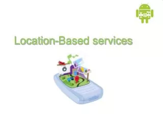
Location Based Services • What is a Location Based Service? • How is a LBS useful? • Components • What’s special about it? • Context • Adoption • Privacy • How does it work? • Services request processing • Mobile positioning • Architectural requirements
Introduction to LBS • A certain service that is offered to the users based on their location • An information service provided by a device that knows where it is and modifies the information it provides accordingly • Mobile services that utilise user location information to add value to the service • Usually require modifications in either the networks or the mobile device or both • It was first developed for the military and emergency services
LBS: Then For how many years have we used these signs as the ONLY source for LBS?
LBS: Now • Location-based traffic reports: • Range query: How many cars on the motorway? • Shortest path query: What is the estimated time travel to reach my destination? • Location-based store finder: • Range query: What are the restaurants within five miles of my location? • Nearest-neighbor query: Where is my nearest fast food restaurant? • Location-based advertisement: • Range query: Send E-coupons to all customers within five miles of my store
inTouch checks her calendar and sees she’s supposed to pick up Cindy from ballet It’s 4:30pm and Mum is stuck in traffic
Mum’s phone senses that she is in a traffic jam, and automatically prepares a status message Mum hits “send”, and Cindy sees that Mum is running late. Cindy decides to wait inside.
GIS/ Spatial Database Mobile Devices Internet LBS: Why Now ? Mobile GIS Web GIS LBS Mobile Internet LBS is a Convergence of Technologies
LBS Components (1) • Mobile Devices • A tool for the user to request the needed information • The results can be given by speech, using pictures, text... • PDAs, Mobile Phones, Laptops, a car navigation unit, a toll box for road pricing in a truck • Communication Network • The mobile network • Transfers the user data and service request from the mobile terminal to the service provider • Transfers the requested information back to the user
LBS Components (2) • Positioning Component • For the processing of a service usually the user position has to be determined • The user position can be obtained either by using the mobile communication network or by using the Global Positioning System (GPS) • Further possibilities to determine the position are WLAN stations, active badges or radio beacons (indoor navigation) • If the position is not determined automatically it can be also specified manually by the user • Service and Application Provider • Responsible for the service request processing • Calculation of the position, finding a route, searching yellow pages with respect to position or searching specific information on objects of user interest
LBS Components (3) • Data and Content Provider • Service providers will usually not store and maintain all the information which can be requested by users • Geographic base data and location information is requested from the maintaining authority (e.g. mapping agencies) or business and industry partners (e.g. yellow pages, traffic companies)
LBS- Context (1) • Mobile user identity • Age and gender - children are unlikely to be interested in knowing about bars and pubs • Personal preferences – Language, style, imagery, colours • Location - the most commonly considered element of context • It allows information and services to be localized • Time - An entertainment’s active time might be used to determine if an event was still valid, for example a concert or a venue is open • Orientation - the direction a user is heading in and thus what is in front, behind and to either side of them • In a tourist guide this might be used to determine what historical building the user is facing • In a navigation service it is important to check the user is heading in the right direction
LBS- Context (2) • Navigation history • allows the users to see where they have been and what they have seen and done • orientate a user while they're are moving and allow them to backtrack if they get lost • help to build up a profile of the what the user is interested in, enhancing the provision of relevant information • Purpose of use • Defined by the activities, goals, tasks and roles of users. Different types of usage require different • Types of information • Types of presentation, for example maps, text or speech, and • Modes of interaction
LBS- Context (3) • Social and cultural situation • proximity to others • social relationships • collaborative tasks • Physical Surroundings • lighting level or how much ambient noise there • For example direct sunlight will make screens more difficult to read requiring the contrast to be adjusted • System Properties • to the computer infrastructure the user is employing • What type of device they are using and what are its capabilities • a continuous internet connection or it is only intermittent, bandwidth, the quality of the positioning information, e.g. the GPS coverage.
LBS- Context • How do services respond to context? • Information level • Technology level • User interface level • Presentation level
LBS- Privacy • Like many technologies, LBS have an enormous potential for good but they can also be misused. • The potential for misuse doesn’t invalidate the technology, but it does mean that we must be thoughtful about how we apply it, especially during its developmental stages.
Major Privacy Threats YOU ARE TRACKED…!!!! “New technologies can pinpoint your location at any time and place. They promise safety and convenience but threaten privacy and security” Cover story, IEEE Spectrum, July 2003
http://technology.guardian.co.uk/news/story/0,,1699156,00.htmlhttp://technology.guardian.co.uk/news/story/0,,1699156,00.html Major Privacy Threats http://wifi.weblogsinc.com/2004/09/24/companies-increasingly-use-gps-enabled-cell-phones-to-track/
Location Technologies • GPS - Global Positioning System • AGPS - Assisted GPS • Cell ID • Cell ID + Timing Advance • Signal Strength Based • AOA - Angle Of Arrival • TOA - Time Of Arrival • TDOA - Time Difference of Arrival • EOTD - Enhanced Observed Time Difference • Keypad based (click the address yourself) • Hybrid solutions • RF Fingerprinting (on phones that will support WLAN)
GPS • With the launch of Sputnik in 1957, radio-based global positioning became a (theoretical) possibility • TRANSIT • This was a very crude form of GPSusing only one satellite (1960s) • Submarines used it • Could only be used every 35-45 minutes • Submarine had to be still
Components of GPS and how it works • Space (e.g. satellites) • Control (i.e. a ground station at a known geographic location) • User • The GPS receiver precisely measures the time it takes a signal to travel from a satellite to the receiver • There are lots of satellites
Details • 6 orbital planes, included at 55 degrees to the equator, each with 4 satellites • 21 active satellites, 3 backups • Orbit the earth at 12,541 miles and have an orbital period of 11 hrs. 56 min.
Satellite Triangulation • GPS receiver links to the handset • As reference to the nearest 3 satellites the receiver calculates the exact position
Selective Acquisition • The US military was concerned about the possibility of terrorists or other unfriendly people using GPS to precisely guide a missile (or other unfriendly device) • The deliberately introduced errors in the time embedded in the signal • This caused locations to be up to 100m off • Turned off on 2 May 2000 • GPS III system will launch in 2014 • http://scpnt.stanford.edu/pnt/PNT09/presentation_slides/2_Podlesney_GPSIII.pdf • Should be even more accurate than the 8m accuracy limit currently in place • Galileo is a European Union Equivalent • http://ec.europa.eu/transport/galileo/index_en.htm
Assisted GPS • Conventional GPS has difficulty providing reliable positions in poor signal conditions • When first turned on in these conditions, some non-assisted GPS units may not be able to download the information from the GPS satellites • GPS has a slow time to fix unless it is permanently tracking satellites • To solve the inherent restrictions with GPS, Assisted GPS was proposed • Assisted GPS is based upon providing GPS satellite information to the handset, via the cellular network
A-GPS • Assisted GPS gives improvements in • Time to First Fix • Battery Life • Sensitivity • Cost • Assistance Data • Satellite Position • Time information • Visible GPS List • Sensitivity
Cell ID (Cell of Origin) • Cell based positioning • No calculation • Least accurate than others • Accuracy is dependent on cell density • Compatible with all handset and GSM network
Power level or time taken at phone logged at Base Station Calculation based on signal loss or time taken for signal travel Compatible with all handset and GSM network Resolution is 500 meters Timing Advance (TA)
Signal Strength Based • Measure signal strength from the control channels of several Base Stations • If signal levels from 3 different BSs are known, it’s possible to calculate the location
Time of Arrival (TOA) • Location Measurement Units (LMU) at Base Station • Measure access requests from handset • Triangulation calculated from combined information • Compatible with all handset and GSM network
AOA - Angle Of Arrival • Measure the angle of arrived signal between base station and mobile station • Location error increases as mobile is far from BSs
Time Difference Of Arrival • Measure the time difference of arrived signal between base station and mobile station : Minimum three base stations • Mobile station locates at the intersection point which will be made by more than 3 hyperbolas
Enhanced Observed Time Difference • Added device, LMU (Location Measurement Unit), whose location is known • LMU and mobile station measure the time difference of arrived signal from base station at the same time • Mobile station locates at the intersection point which will be made by more than 3 hyperbolas
Keyboard Based • You set your location! • Example: Navigation Software: • Manually set origin • Manually set destination • Approve when each step is completed to get the next step instructions
Lampposts Based • Last Mile company plans to offer Internet & LBS using street lampposts • A flash memory will be installed inside the lampposts and store info about local pubs, shops. • Cost: about £500 per lamppost
Hybrid Solutions Based • Improve effectiveness • Extends the coverage of a solution e.g. AGPS • Common Hybrids • EOTD / AGPS • Cell ID / AGPS • Benefits of both systems realized increasing the accuracy and availability of any single method
RF Fingerprint Based • Pinpointing wireless clients makes it easier to secure and manage wireless LANs • WLANs typically have used closest access point (closest AP) or triangulation technologies to track location • RF fingerprinting improves by taking into account the effects that a building or people will have on an RF signal - characteristics such as reflection, attenuation and multi-path
Range Of Coverage AGPS,GPS, GPS Hybrids 5 m 100 m EOTD 300 m TDOA, AOA 500 m Cell ID + TA Cell ID 1000+m
Code of practice • Regulation play a major role in the shape and success LBS. • Regulation is likely to have an impact on the accuracy operators will provide and the use of handling user information • This will affect both technology choice and the availability and usability of user location information for different players • Location based service providers that use location data as part of their services must comply with the Industry Code of Practice For the Use of Mobile Phone Technology to Provide Passive Services in the UK • http://online.vodafone.co.uk/dispatch/Portal/appmanager/vodafone/wrp;wrpsessionid=FvsQQS4S5qMn4RJ02nwbkJLkwpxTbMt59HTgV57QJytW2BygpZJ6!71690501?_nfpb=true&_pageLabel=template12&pageID=PRPP_0011 • http://www.imcb.org.uk/assets/documents/SummaryofLBSCodeofPractice.pdf