Download
1 / 13
130 likes | 138 Views
This study explores the use of unmanned aerial vehicles (UAVs) for collecting water level observations, and how these observations can improve estimates of river-groundwater interaction. The study focuses on the Mølleåen river in Denmark, and uses a truly integrated groundwater-surface water model for calibration. The results show that when calibrated against UAV water level measurements, the estimations of surface water-groundwater interaction significantly improve.

E N D
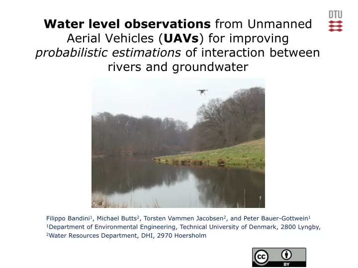
Water level observations from Unmanned Aerial Vehicles (UAVs) for improving probabilistic estimations of interaction between rivers and groundwater Filippo Bandini1, Michael Butts2, Torsten Vammen Jacobsen2, and Peter Bauer-Gottwein1 1Department of Environmental Engineering, Technical University of Denmark, 2800 Lyngby, 2Water Resources Department, DHI, 2970 Hoersholm
Water level measurements:Ground-based VS Satellite VS Airborne Pros: • Accurate • High temporal resolution Cons: • Expensive • Need maintenance • Non uniform spatial distribution Pros: • Very good spatial coverage (polar orbit satellites) • Often open source data • Measurements available for some years Cons: • Temporal resolution depending on orbit configuration • Low spatial resolution • Influenced by atmosphere Pros: • Low Cost and Flexibility of the payload • High Spatial Resolution • Flexible timing of the sampling Cons: • Legislation • Repeatability
Water level measurements:Applications in hydrology A variety of hydrological models could benefit from spatially distributed water level measurements, including: • Flood Propagation Mapping • Hydrologic monitoring of sinkholes, ephemeral lakes and other unconventional targets • Remote sensing of ice and snow depth Sacred Blue Cenote, Mexico. Arctic region Urban flood in Copenhagen All of these applications require cm accuracy of the orthometric water height
Application: calibration of a river model • Only few measurement stations record water level along river courses • Obtaining water level measurements with very high spatial resolution can help in retrieving accurate longitudinal water profiles. An accurate estimation of the river water level is essential for improving estimation of groundwater-surface water interaction. Horizontal profile of profile of Mølleåen river (Denmark): in the shown branch there are 8 weirs which play an important role in regulating water level
Aim: improvement of groundwater surface water interaction estimation Topic & aim: • Estimation of surface water-groundwater interaction in Mølleåen river (Denmark) by model calibration against both water level and discharge using DiffeRentialEvolution Adaptive Metropolis (DREAM) algorithm. • Model: Truly integrated model of groundwater, surface water, recharge and evapotranspiration (MIKE SHE-MIKE 11 model).
Flowchart of the river model calibration • Only discharge observations were available. Synthetic UAV water level observations have been extracted. • Two calibrations have been performed : • Against discharge only • Against both discharge and water level observations • Calibration parameters were river structures head loss coefficients and datum of some of the river cross sections • Probabilistic predictions of surface water–groundwater interaction have been produced to compare the two calibration methodologies.
Calibration against discharge Calibration against discharge observations for a specific cross section: Red dots are the discharge observations, dark grey regionis the 95% confidence intervals of the output prediction due to parameter uncertainty, light grey region represents the remaining 95% prediction uncertainty due to uncertainty in forcing conditions and model structural errors
Calibration against water levels Calibration against spatially distributed water level observations for a specific time step: Water level is plotted as relative to datum. Green dots are water level observations, dark grey region is the 95% confidence intervals of the output prediction due to parameter uncertainty, light grey regionrepresents the remaining 95% prediction uncertainty due to uncertainty in forcing conditions and model structural errors
Groundwater-SurfaceWater interaction (I),water level calibration Plot of the 95% posterior uncertainty ranges for time-averaged baseflow over the entire branch: Baseflow after discharge calibration Green dots are baseflow observations, grey color region is the uncertainty due to parameter uncertainty Baseflow after water level calibration
Groundwater-SurfaceWater interaction (II),Discharge vs Water level calibration 95% uncertainty ranges for the baseflow time series for a specific cross section: Baseflow after discharge calibration Green dots are baseflow observations, grey color region is the uncertainty due to parameter uncertainty Baseflow after water level calibration
Groundwater-SurfaceWater interaction (III),Discharge vs Water level calibration 95% uncertainty ranges for the baseflow time series for a specific cross section: Baseflow after discharge calibration Green dots are baseflow observations, grey color region is the uncertainty due to parameter uncertainty Baseflow after water level calibration
Conclusions • When the model was calibrated against UAV spatially distributed water level measurements, estimations of surface water groundwater interaction drastically improved. In particular: • Sharpness of the predictions is approximately halved • RMSE (Root Mean Square Error) of the maximum a posteriori probability is reduced (approximately by two-thirds) • Interval Skill Score (ISS) is significantly decreased • Brier score of the binary outcome, either gaining or loosing river, has shown a slight decrease
Thanks for your attention Poster board A.117