Download

1 / 15
150 likes | 293 Views
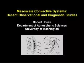
Use of observational information for convective-scale predictions. w ith contributions from: Ross Bannister, Mark Dixon, Stephen English, Graeme Kelly, Cristina Prates, Randhir Singh and Robert Tubbs. Stefano Migliorini University of Reading s.migliorini@reading.ac.uk. Contents.

E N D
Use of observational information for convective-scale predictions with contributions from: Ross Bannister, Mark Dixon, Stephen English, Graeme Kelly, Cristina Prates, Randhir Singh and Robert Tubbs Stefano Migliorini University of Reading s.migliorini@reading.ac.uk
Contents • Probabilistic forecasting at convective-scale • Operational radiative transfer modelling for NWP • Assimilation of cloudy radiances • Advanced wind measurements from space
High-resolution numerical weather predictions • Increase of computer power allows met agencies to run NWP forecasts at increasing resolution: deep-convection permitting models (~1 km res) • Less need for parameterizations (e.g. convection) and better topography and surface fields • Better use of high-res observation • Aim is to improve forecasts of small-scale processes, storms, hazardous weather
Predictability limits • Error growth timescales decrease with horizontal scale. It is estimated that a 20-km wavelength (e.g. thunderstorm) has a predictability horizon of ~1-2h • Errors are always present: initial and boundary conditions, model errors (e.g. approximations, resolution, parameterizations)
Ensemble prediction at convective scale • Error growth at convective scale stronger in the presence of convective instability: need for accurate representation of ongoing convection at initial time (e.g., from radar), particularly for nowcasting (0-6 hours). • Large sensitivity to initial conditions and to model error motivates the need for probabilistic forecasts at convective scale. • Initial-condition uncertainty for nowcasting should depend on available observational information content: ensemble filtering • We also obtain flow-dependent (but low-rank) description of forecast uncertainty that can be used for high resolution data assimilation
The Met Office EPS • Met Office Global and Regional Ensemble Prediction System (MOGREPS) • BC from the global ensemble • IC calculated using an ETKF • to generate 23 increments 6
Ensembles at convective scale 7 1.5 km resolution over 70 vertical levels over southern UK Ensemble of 23 forecast members + control Initial 1.5 km perts interpolated from NAE EPS fields at 24 km and 1.5 km operational analysis
Case study: 26 July 2007 • active front, line convection, strong dynamical forcing
Case study: forecasts of precipitation • T+1 forecast valid at 12 UTC, with LH nudging acting between 10.30 and 11.30. • Substantial variability that “compensate” shortcomings in deterministic forecast (member 0): heavy rainfall over the north coast of South West England captured by members 2, 3, 4, 6 and 18; light precip in the East by several member (e.g., 11)
Sensing the Earth from space • Line-by-line models calculates absorption coefficients for each spectral line for all relevant molecules over layers • Radiative transfer equation solved; top-of-atmosphere monochromatic radiance convolved with instrument response; computationally expensive • “fast” RT codes (e.g. RTTOV) determine transmittance from optical depth calculated as regression of set of predictors (T, WV)
Operational radiative transfer codes • A fast radiative transfer model (RTM) to compute emitted infrared radiances for a very high resolution radiometer (VHRR), onboard the operational Indian geostationary satellite Kalpana has been developed and verified (Singh et al., 2009) . This work is a step towards the assimilation of Kalpana water vapor (WV) radiances into numerical weather prediction models. Singh, Rayer, Saunders, Migliorini, Brugge, O’Neill, 2009
Assimilation of cloudy radiances (1/2) • Satellite observations regarding clouds can be assimilated as either raw radiances or as retrieved parameters. • RTMs used in assimilation assume a simple cloud model: a single layer of geometric thin grey cloud Cloud-free radiance Radiance for 100% opaque cloud cover Cloud Parameters: Effective Cloud Fraction (ECF) and Cloud Top pressure (CTP)
Assimilation of cloudy radiances (2/2) • Statistics of 1D-Var retrieval obtained from a set of 200 pseudo IASI observations where a layer of cirrus cloud type is placed above a layer of cumulus cloud. The true cloud top is represented in orange and the retrieved in blue. • New two-layer cloud model to increase the number of assimilated cloud-affected radiances Thanks to Cristina Prates
Atmospheric motion vectors for NWP • Suitable features will be identified on forecasts at different lead times to determine a set of simulated AMVs. • The relationship between estimated AMVs from simulated SEVIRI data and “true” atmospheric winds will be investigated, to improve the expression of the observation operator used for data assimilation. • Experiments will be performed with model data at different horizontal resolutions, ranging from 1.5 km to 500 m. Courtesy Met Office
Conclusions • Accurate weather prediction relies on accurate observations and reliable models • Uncertainty is inevitable (finite predictability) and needs to be quantified for meaningful predictions • Satellite information is essential to guarantee global coverage • Still a lot of research needs to be done to improve predictions at high-resolution (clouds, storms, high-impact weather)