Download
1 / 21
210 likes | 343 Views
Gistutorial for Health Lecture 2 Visualizing Health Data. Lecture 2 Outline. Tools for a GIS GIS Data Visualizing Data GIS Data Sources Review Assignment 1 Results. Tools for a GIS. Hardware Computer Printer / Plotter Digitizer Scanner GIS Desktop Software (ESRI, Inc. – ArcView)

E N D
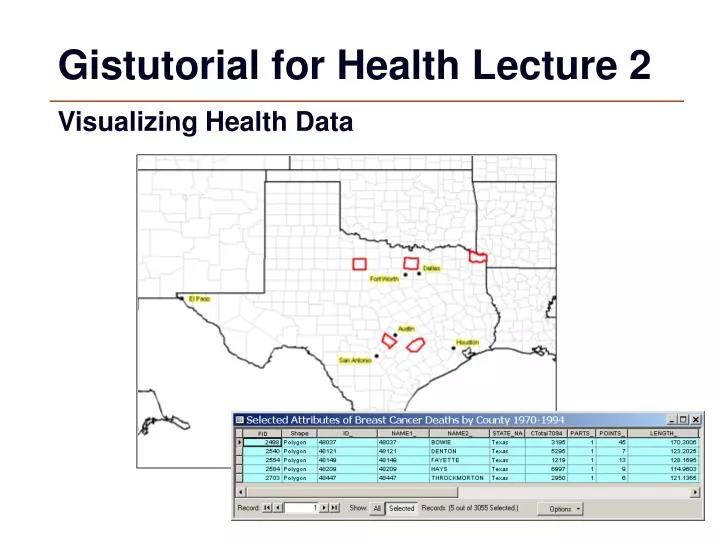
Gistutorial for Health Lecture 2 Visualizing Health Data
Lecture 2 Outline • Tools for a GIS • GIS Data • Visualizing Data • GIS Data Sources • Review Assignment 1 Results
Tools for a GIS • Hardware • Computer • Printer / Plotter • Digitizer • Scanner • GIS Desktop Software (ESRI, Inc. – ArcView) • CAD Software (AutoDesk - AutoCAD) • Multimedia (Photos, Video, 3D Models) • World Wide Web (ESRI, Inc. – ARCIMS)
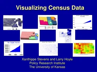
GIS Data • Location DataHow Many? – What Kind? – Where? • Scale of DataGlobal to Local • Data Presentation Words, Charts, Graphs, Tables, Maps, Photos
GIS Data • Raster Images - grids • “pixels” • satellite images • aerial photos • Vector - grids • features: points, lines & polygons • attributes: size, type, length, etc.
Databases • Not easy to interpret
Visualizing Data A picture is worth a thousand words
“Layers” of GIS Information Municipalities
“Layers” of GIS Information Census Tracts
“Layers” of GIS Information Lakes and Rivers
“Layers” of GIS Information Polluting Companies
“Layers” of GIS Information Schools
GIS Data Sources • Digitized and Scanned Maps • purchased, donated, free (Internet) • created by user • Data Bases – Tables of data • GPS (Global Positioning Systems) • Field Sampling of Attributes • Remote Sensing & Aerial Photography
Review Assignment 1 Results • Student Health GIS Web sites (replace with your student’s examples) • Georgia’s Public Health Division • http://health.state.ga.us/ • South Carolina Department of Health and Environmental Control • http://www.scdhec.net/ • Kaiser Family FoundationState Health Facts • http://www.statehealthfacts.org • American Hospital Association • http://www.hospitalconnect.com/ahapolicyforum/trendwatch
Review Assignment 1 Results • The Environmental Protection Agency (EPA): Envirofacts Data Warehouse • http://www.epa.gov/enviro/ • Global Health Council • http://www.globalhealth.org • http://atlas.globalhealth.org • California Nutrition Network • http://www.calnutritionnetworkgis.org • New Zealand’s Ministry of Health • http://www.phionline.moh.govt.nz • South Carolina Division of Health and Environmental Control (SC DHEC) • http://web05.dhec.sc.gov/gis
Review Assignment 1 Results • Medical Research Council of South Africa • http://www.mrc.ac.za/services/giscentre.htm • USAID(U.S. Agency for International Development) • http://www.usaid.gov/gn/infotechnology/gis/index.htm • Tracking the spread of the West Nile virus in Illinois • http://www.idph.state.il.us/envhealth/wnv.htm • Colorado Department Public Health and the Environment - Public Health GIS Group • http://emaps.dphe.state.co.us/website/cheis_gis/maps.html
Lecture 2 Summary • Tools for a GIS • GIS Data • Visualizing Data • GIS Data Sources • Review Assignment 1 Results