Download
1 / 25
260 likes | 428 Views
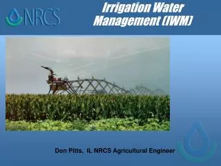
Water Management Planning for Agricultural Irrigation. Water Laws and Policy Geospatial Applications. Donn Rodekohr James Hairston Auburn University. Facets of Irrigation in Alabama. Alabama has “abundant water resources” More navigable river miles than any other state

E N D
Water Management Planning for Agricultural Irrigation Water Laws and Policy Geospatial Applications Donn Rodekohr James Hairston Auburn University
Facets of Irrigation in Alabama • Alabama has “abundant water resources” • More navigable river miles than any other state • Averages 22” of runoff each year • Tallapoosa River has richest biodiversity of any stream in the US • Alabama has a long agricultural tradition • But… • Alabama ranks near the bottom in terms of irrigable acres that are irrigated • Mississippi is ranked higher
Aspects of Irrigation in Alabama • Why hasn’t irrigation development occurred? • No perceived need • 55-60” average annual rainfall • But… • The rain doesn’t always fall when or where it is needed
Aspects of Irrigation in Alabama • Why hasn’t irrigation development occurred? • No perceived need • No perceived ROI • Curtis and Tyson both showed profitability • But … • Infrastructure and initiation dues are high • But … • Georgia irrigation developed contradicting UGA economic analysis
Aspects of Irrigation in Alabama • Why hasn’t irrigation development occurred? • No perceived need • No perceived ROI • Limited or No access to water • Physical constraints • Economic constraints • Political constraints
Constraints on Access to Water • Physical • Most, nearly all, small scale irrigation development in the West used Groundwater as the source – Land owner projects. • Alabama abundance is surface water supplies • Most, nearly all, large scale irrigation development in the West used Surface water as the source – Government projects. • Much of Alabama’s prime farm land is not riparian
Constraints on Access to Water • Physical • Economic • Groundwater in Alabama is usually deep • Groundwater in Alabama is sometimes poor quality • Drilling costs are high • Pumping costs are high
Constraints on Access to Water • Physical • Economic • Political • Alabama is a Riparian Doctrine state
100th Meridian Surface Water Management Policy • Overview of Two Doctrines • Riparian • Prior Appropriation
Riparian Doctrine • Eastern or English Doctrine • Based upon Land ownership • Predicated upon water abundance • Regulation initiated by complaint • Monitoring and measurement of water is post-adjudication
No harm No Foul Harm Foul! Riparian Doctrine Watershed specific Case Law
Western Doctrine • Colorado or Prior Appropriation Doctrine • Based upon the State owning the water regardless of who owns the land • Predicated upon water scarcity • Regulation initiated by administration • “First in time is first in right” • Monitoring and measurement is apriori
No harm No Foul No harm Foul! Harm No Foul Harm Foul! Western Doctrine Proactive Arbitration
West Conservation: “Highest and best” use Maintain or improve efficiency East Conservation: Preservation Maintain or improve quality 100th Meridian Geographic Division - Definitions
West Conversion of marginal land to production Surface Erosion Groundwater degradation East Conversion of prime farm land to other uses Forest Urban 100th Meridian Geographic Division – Soil Resources
West Designated for economic development Power Agriculture East Designated as transportation vectors Move goods upstream Move wastes downstream 100th Meridian Geographic Division – Surface Water Resources
West Inter-basin transfer It is a way of life Can’t live without it Move the commodity to where it can be used East Inter-basin transfer It is illegal Can’t think of a good reason to allow it 100th Meridian Geographic Division – Water Legal Code
Feasibility of Irrigation in Alabama • Assume the legal constraints of the Riparian Doctrine • Identify areas most suitable for irrigation
Mapping Physical Constraints • Topography • Soils
Mapping Physical Constraints • Water availability • Soils interface • Moisture holding capacity • “In Alabama, we are only a week away from drought.” Dr. Charles Mitchell
Geospatial Analysis for Planning • Identify prime farm land adjacent to a stream • Current Doctrine • Land ownership • Limit by topography • Identify prime farm land and access to water. • PFL isolated from water
Geospatial Analysis for Planning • Identify prime farm land and access to water
Synopsis of National Feasibility • Water is THE ingredient constraining development • Soils are the wild-card for agricultural production • Water policy has enabled economic returns for agriculture • Scale of irrigation development is dependent upon source • Individual scale – groundwater • Regional scale – surface water • Map of groundwater contamination = Map of irrigation development
Synopsis of Feasibility in Alabama • Physical constraints • 1998 NRI data ~ 176,000 acres irrigated • ~ 6 million acres potentially suitable for irrigation • Water availability • Doctrine constrains access • Volume of water that is “available” is unclear • Water wars are possible • Economic viability • ROI is proven -- $200 / ac • Scale of development is driven by the source
Direction for Future Analysis • Policy Analysis • Governor’s Comprehensive Water Plan – Policy alternatives • Riparian Doctrine – Disbenefits of small scale • Economic feasibility – Infrequently used infrastructure bothers bureaucrats • Key Questions to be answered • Is there water available? • Where are the areas in Alabama where irrigation is most feasible? • What is the possible ROI in these areas? • Landowner investments (small scale) • Governmental investments (large(r) scale) • Is irrigation on Black Belt soils possible? • How can we manage irrigation to avoid environmental degradation?