Download
1 / 16
170 likes | 325 Views
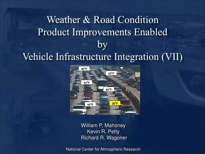
45 o F. 43 o F. 44 o F. 45 o F. 38 o F. 44 o F. Weather & Road Condition Product Improvements Enabled by Vehicle Infrastructure Integration (VII). William P, Mahoney Kevin R. Petty Richard R. Wagoner National Center for Atmospheric Research. Vehicle Infrastructure Integration (VII).

E N D
45oF 43oF 44oF 45oF 38oF 44oF Weather & Road ConditionProduct Improvements Enabled byVehicle Infrastructure Integration (VII) William P, Mahoney Kevin R. Petty Richard R. Wagoner National Center for Atmospheric Research
Vehicle Infrastructure Integration(VII) DEFINITION:Vehicle to Infrastructure (V-I) and Vehicle to Vehicle (V-V) communication through Dedicated Short Range Communications (DSRC-wireless radio comm. 5.9 GHz) Received: Low Friction Ahead! Sent: Low Friction Indicator Vehicle 1 Vehicle 2 RSU RSU
Data Fusion – Road Weather Impact Products • New weather and road condition data (incl. VII and Clarus data) should be integrated into a seamless information database(s) to support: • 511 • In-vehicle information • Traveler information • Highway operations • Control systems • Weather Prediction • Road Condition Prediction • Etc.
Weather Improvements Enabled by VII(some examples) • Reducing radar anomalous propagation • Reducing false radar returns (e.g., virga) • Identification of precipitation type • Improved delineation of freezing temperatures • Improved localization of air temperature • Improved identification of foggy regions • Improved data for high-resolution weather models • Improved boundary characterization for hazardous plume emergency (evacuation response)
Radar Based Precipitation Identification • False precipitation echoes are caused by temperature inversions (index of refraction gradients) • Vehicle data (e.g., wiper settings) could be used to declare “yes or no” and be used to clean up the radar product. Anomalous Propagation – False Echoes
Wipers Off Wipers Off Wipers Off Wipers Off Wipers Off Wipers Off Des Moines, Iowa Wipers Off Wipers Off Wipers Off Wipers Off Wipers Off Wipers Off Radar Based Precipitation Identification • Virga (precipitation that does not reach the ground) fools DOT personnel who must make tactical decisions related to winter maintenance and traffic management. • Vehicle observations (e.g., wiper settings) could verify the occurrence of precipitation which would be used to clean up the data. Virga – Precipitation not hitting the ground
Rain Rain Rain Mixed Rain Snow Rain Snow Snow Snow Snow Snow Snow Diagnosis of Precipitation Type • Currently, precipitation type is determined by airport observations (METARS) which are few and far between! • Vehicle data (air temperature, and data from maintenance or patrol vehicles) would greatly improve product accuracy. Typical precipitation type products
RH: 98% Lights: On Brakes: Yes Speed: 40 mph RH: 45% Lights: Off Brakes: No Speed: 65 mph RH: 100% Lights: On Brakes: Yes Speed: 30 mph RH: 98% Lights: On Brakes: No Speed: 35 mph RH: 50% Lights: Off Brakes: No Speed: 65 mph Identification of Foggy Regions • The use of vehicle data (relative humidity, fog and head lamp settings, speed, and brake data) coupled with other data sets (e.g., satellite, surface analysis data) could be used to diagnose areas where fog is likely. • This product concept is challenging!
Improved High-Resolution Modeling • As weather models increase in resolution, observations will need to increase as well to better define the regional/local state of the atmosphere. • Vehicle observations can fill-in the gaps in the fixed observation network. • Surface temperature, pressure, and water vapor are critical state variables Data sparse regions Weather occurs on very fine scales
Temperature Water vapor +7 Nocturnal Inversion Defining Atmospheric Vertical Profiles • Vehicle observations in complex terrain can provide important vertical information such as: • Freezing level (air temp) • Cloud top • Air temperature profiles • RH profiles • Road temperature profiles • Vehicle data are like mini-soundings that could be used by models and to support tactical operations.
Boundary Layer Characterization • Vehicle data can be used to improve the characterization of the atmospheric boundary layer. • This will improve the accuracy of plume dispersion products and hence emergency operations – such as evacuation.
Road Condition Improvements Enabled by VII(some examples) • Improved identification of treated roads (anti-icing) • Improved identification of road conditions • Improve knowledge of road and rail temperatures
Winter Maintenance Operations • Vehicle data can be used to diagnose weather and road conditions and actual treatments. • The resultant data could then be automatically used in decision support systems such as the winter Maintenance Decision Support System (MDSS) Actual winter maintenance treatments automatically entered into systems such as the MDSS Material Black Ice Road Condition Snow on Road Weather Winter maintenance vehicle data entry interface and MDSS treatment screen.
Road Condition Reporting • Vehicle data can be used to diagnose road conditions and supplement call-in observations. • The resultant improved products would serve operational systems such as: • 511 • HARS • MDSS • Traffic management • Incident management • Traveler web sites • Traveler kiosks Iowa State Patrol calls-in road conditions in Iowa.
Surface Temperature Gradients Rail & Transit Hazards • Knowledge of very near surface (<2 meter) temperatures can be used to predict potential for rail separation and buckling • This is critical for rail and transit operations. Rail Temperature & Weather DSS - Jim Bertrand, Calgary, Canada
Summary At this time, we can only begin to imagine the improved weather and road condition safety and consumer applications that will be enabled through VII. • Weather Hazard Products - High winds • Tornado • Fog - Heavy snow, rain, hail, etc. • Road Hazard Products - Black ice - Snow drifting - Flooding Real-time Graphical Weather Information Here