Download
1 / 45
580 likes | 1.07k Views
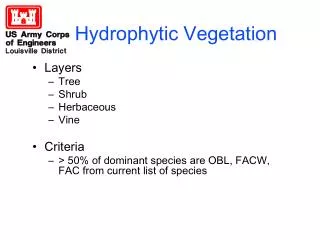
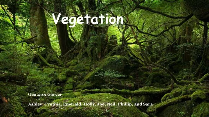
Vegetation. Geo 410: Garver Ashley, Cynthia, Emerald, Holly, Joe, Neil, Phillip, and Sara. Plant Related Remote Sensing Applications. Ecological Uses Predicting Migratory Bird Prevalence Invasive species Rainforest Management Agriculture Albedo & Climate Change NDVI Vegetation Indices

E N D
Vegetation Geo 410: Garver Ashley, Cynthia, Emerald, Holly, Joe, Neil, Phillip, and Sara
Plant Related Remote Sensing Applications • Ecological Uses • Predicting Migratory Bird Prevalence • Invasive species • Rainforest Management • Agriculture • Albedo & Climate Change • NDVI • Vegetation Indices • Google Earth Engine (future applications)
Ecological Uses of Remote Sensing • Cost Benefits • Time • Money • Manpower
Predicting Migratory Bird Prevalence Based on Vegetation •LiDAR - Light detection and ranging •Multispectral Data - Landsat ETM+ •Radar Data- Uninhabited Aerial Vehicle Synthetic Aperture Radar
Bird Observation Data 1998-2008
Remote Sensing of Invasive Species • Advanced Very High Resolution Radiometer (AVHRR) • 1,100m spatial resolution, geostationary • Daily data from morning and afternoon available for free on https://lta.cr.usgs.gov/AVHRR • LiDAR, remote sensing with a laser
Applications • Fire prevention and control • Agriculture (ie: pasture management) • Ecotourism • Early detection
Fire Control • Invasive grasses alter the ecosystem dynamic. • Often create and intensify fire cycles that would not naturally occur. .
Vegetation: Albedo • 20% Earth covered • 30% solar radiation reflected back • Increases/decreases • Boreal/deciduous forests • Heat Island effect • reflective/absorptive
Vegetation: Climate Alterations • Climate (micro/macro) • Evapotranspiration • Clouds • Trees vs Grasses • Hydrological cycle • flora affected • soils • Anthropogenic • 30% Industrial • 80% End of 21st
Analyzing Deforestation of the Amazon Rainforest Using Remote Sensing
The Amazon is the largest intact Tropical Rainforest in the world
Deforestation in the Amazon • Two main aspects measured using Remote Sensing in the Amazon forest. • Activity data - measures the forest changes over time • Emissions data - changes in carbon pools over time
Analysing Activity Data • Two main problems • The govt. is clearcutting to grow agg. with higher profits • The govt. is sending the poor from heavily populated cities out into the forest.
Analyzing Emissions Data • 5 Types of carbon pools in the rainforest • Above ground biomass • Below ground biomass • Dead wood • Litter • Soil organic matter
Analyzing Emissions Data cont... • Two ways to measure carbon cycles in the Amazon • Carbon stock difference method • Carbon gain loss method
Analyzing Emissions data cont... • Troubles gathering this data • RS is great for above ground biomass but may run into errors when categorizing the diameter, height, and crown parameter of the trees.
Spectral Signatures Recap
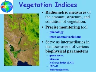
Dark Light Vegetation Indices What are Vegetation Indices? • Feature extraction operations designed to yield estimates of vegetative cover in an image. • Indices are based on the fact that vegetation absorbs well in the red (visible) and reflects efficiently in the near infrared. Why are vegetation indices(VIs) used? can reduce sensitivity to: • topographic effects • soil background • view/sun angle (?) • atmosphere
Vegetation Indices Vegetation is divided into 3 general categories: • Plant Foliage Pigments, Water, Carbon, Nitrogen • Canopies • Non-Photosynthetic Vegetation
Vegetation Indices Plant Foliage Pigment absorptions Carbon
Vegetation Indices Canopies
Vegetation Indices Non-Photosynthetic Vegetation Change in canopy reflectance due to increasing amounts of NPV
VIs continued • There are more than 150 VIs • The Environment for Visualizing Images (ENVI) - software system used for advanced image processing of satellite data ENVI exposes 27 of these indices which were selected based upon their robustness, scientific basis, and applicability. These 27 indices are divided into seven categories. • Broadband Greenness • Narrowband Greenness • Light Use Efficiency • Canopy Nitrogen • Dry or Senescent Carbon • Leaf Pigment • Canopy Water Content
What is NDVI • Normalized Difference Vegetation Index • NDVI is an equation that takes into account the amount of infrared reflected by plants. • NDVI relation to vegetation
NDVI Range • NDVI values range from +1.0 to -1.0. • low NDVI values (for example, 0.1 or less). • Areas of barren rock, sand, or snow. • Moderate NDVI values (approximately 0.2 to 0.5). • Sparse vegetation such as shrubs and grasslands or senescing crops. • High NDVI values (approximately 0.6 to 0.9) • Dense vegetation such as that found in temperate and tropical forests or crops at their peak growth stage.
Measuring Vegetation • In visible light vegetated areas are very dark, almost black, while desert regions are light. • At near-infrared wavelengths the vegetation is brighter, and deserts are about the same.
NDVI at work • NDVI has been used predominantly in studies focusing on the effects of environmental change on plants • Recently, studies have coupled vegetation dynamics, as assessed by the NVDI, with biodiversity, animal species distribution, the movement patterns of animals and the performance of animal populations.
Normalized Difference Vegetation Index • Transforming raw satellite data into NDVI values give rough measures • Vegetation types • Amount of vegetation • Conditions on land surfaces around the world • Change in vegetation over time • NDVI is useful for continental- to global-scale vegetation monitoring because it can compensate for • Changing illumination conditions • Surface slope • Viewing angle. • most well-known and used index to detect live green plant canopies in multispectral remote sensing data.
Agriculture Management with Remote Sensing Agriculture plays an important role in the economies of countries. With growing population, there is a demand to produce more food. The goal is to produce food in the most cost-effective manner, while protecting the environment.
Benefits of Precision Farming Satellite imagery can show: Crop health re: nutrient deficiencies, diseases, water deficiency and surplus, weed infestations and insect damage. Predict crop yield. Landsat provides free data! Helps the environment by lowering pollution.
Why It’s Cost-effective • Treat only affected areas • Minimize cost on: • Water • Fertilizer • Herbicides • Pesticides Since Landsat has repeated coverage every 16 days it is easy to visualize the effectiveness of corrective actions.
Crop Insurance Fraud Satellite imagery can be used to prove or disprove claims Keeps insurance premiums at a lower rate
EarthNow! Landsat Image Viewer Live Feed of Landsat 7 Passes
Google Geo For Good You want to change the world. We want to help.
Google Earth Engine Saudi Arabia Irrigation (~30 years)
Supervised Classification Using Google Earth Engine Earth Engine Workspace Northern California Southern California
Google Earth Engine - the future! Become a trusted tester by emailing earthengine-beta@google.com
Citations by Section EarthNow! Landsat Image Viewer, USGShttp://earthnow.usgs.gov/earthnow_app.html?sessionId=3d66638c0d504ac9d834dca61ada2df629400 Google Geo For Good, Earth Outreach Teamhttp://www.google.com/earth/outreach/index.html Google Earth Engine, Saudi Arabia Irrigationhttps://earthengine.google.org/#intro/SaudiArabiaIrrigation Supervised Classification Using Google Earth Enginehttps://earthengine.google.org/#workspace/qEx4aDk3zGC Google Earth Engine Overview Videohttps://www.youtube.com/watch?v=MnCf9Gjz720&feature=youtu.be 6 Invasive Species. 7. http://www.sciencedaily.com/releases/2012/12/121205132357.htm 8. http://www.fire.ca.gov/fire_protection/downloads/SuppressionCostsOnepage.pdf 9. http://www.cal-ipc.org/ip/definitions/impact.php 10. https://www.dfg.ca.gov/invasives/ 11. http://www.sciencedaily.com/releases/2012/12/121205132357.htm 12. http://www.werc.usgs.gov/OLDsitedata/fire/lv/fireandinvasives/research_summary.htm 13.http://0-download.springer.com.opac.library.csupomona.edu/static/pdf/226/art%253A10.1007 Vegetation Indicies http://www.seos-project.eu/modules/remotesensing/images/Reflexionskurven.jpg http://ceeserver.cee.cornell.edu/wdp2/cee6150/Lectures/DIP09C_VI_PCA_Sp11.pdf http://www.exelisvis.com/docs/understandingvegetation.html http://www.exelisvis.com/docs/plantfoliage.html http://www.exelisvis.com/docs/canopies.html http://saigonocean.com/trangAlbertDong/Info/InfoSceneAR_files/image028.jpg http://www.exelisvis.com/docs/nonphotosyntheticvegetation.html http://www.yale.edu/ceo/Documentation/rsvegfaq.html
Continued Climate Change Picture: http://www.nc-climate.ncsu.edu/edu/k12/.vegetation https://www.google.com/search?q=surmount&source=lnms&tbm=isch&sa=X&ei=gVMMU_y5MoPuoASN2IDIAQ&ved=0CAcQ_AUoAQ&biw=1366&bih=572#q=albedo+grass+vs+tree&tbm=isch&facrc=_&imgdii=_&imgrc=vhQuXxE13Kdc2M%253A%3BGmIEePr87FQJsM%3Bhttp%253A%252F%252Fej.iop.org%252Fimages%252F1748-9326%252F3%252F4%252F044006%252FFull%252F9157401.jpg%3Bhttp%253A%252F%252Fiopscience.iop.org%252F1748-9326%252F3%252F4%252F044006%252Ffulltext%3B729%3B746 https://www.google.com/search?q=surmount&source=lnms&tbm=isch&sa=X&ei=gVMMU_y5MoPuoASN2IDIAQ&ved=0CAcQ_AUoAQ&biw=1366&bih=572#q=heat+island+effect&tbm=isch&facrc=_&imgdii=_&imgrc=yHT3TV0o4TeCJM%253A%3BCza70y9YvxYhqM%3Bhttp%253A%252F%252Fupload.wikimedia.org%252Fwikipedia%252Fcommons%252F0%252F0a%252FAtlanta_thermal.jpg%3Bhttp%253A%252F%252Fen.wikipedia.org%252Fwiki%252FUrban_heat_island%3B540%3B379 Text: http://www.nc-climate.ncsu.edu/edu/k12/.vegetation http://www.botany.wisc.edu/courses/botany_422/Lecture/pdf/Climate.pdf http://www.pik-potsdam.de/~luedeke/brovkin_erca5.pdf http://journals.ametsoc.org/doi/pdf/10.1175/JCLI3989.1 http://www.sciencedirect.com/science/article/pii/016041209190166N http://journals.ametsoc.org/doi/pdf/10.1175/JCLI3989.1 http://www.sciencedirect.com/science/article/pii/016041209190166
continued Agriculture: http://en.wikipedia.org/wiki/Central_Valley_(California) http://www.netstate.com/economy/ca_economy.htm http://www.cuesa.org/article/california-farming-regions-great-central-valley http://grist.org/climate-energy/nitrogen-fertilizer-is-bad-stuff-and-not-just-because-it-could-blow-up-your-town/ http://www.house-garden.us/articles/the-role-of-nitrogen-in-plants/ http://urbanext.illinois.edu/gpe/case2/c2facts3.html http://www.hrlimited.com/land-surveyor-services/precision-farming/benefits-of-precision-farming/ http://www.growingproduce.com/uncategorized/advantages-of-precision-agriculture/ http://www.rma.usda.gov/news/2011/07/torlai.pdf http://landsat.gsfc.nasa.gov/?p=6375