Download
1 / 62
620 likes | 739 Views
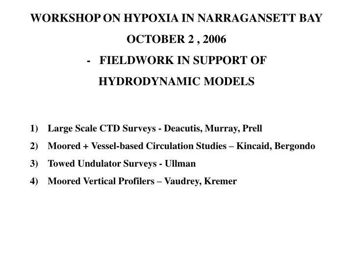
WORKSHOP ON HYPOXIA IN NARRAGANSETT BAY OCTOBER 2 , 2006 - FIELDWORK IN SUPPORT OF HYDRODYNAMIC MODELS. Large Scale CTD Surveys - Deacutis, Murray, Prell Moored + Vessel-based Circulation Studies – Kincaid, Bergondo Towed Undulator Surveys - Ullman

E N D
WORKSHOP ON HYPOXIA IN NARRAGANSETT BAY OCTOBER 2 , 2006 - FIELDWORK IN SUPPORT OF HYDRODYNAMIC MODELS • Large Scale CTD Surveys - Deacutis, Murray, Prell • Moored + Vessel-based Circulation Studies – Kincaid, Bergondo • Towed Undulator Surveys - Ullman • Moored Vertical Profilers – Vaudrey, Kremer
“The Day Trippers” – Large Scale CTD Surveys 2006 Survey Dates : Neap Tide Surveys : 6/6/06, 7/6/06, 8/3/06,8/31/06 Spring Survey : 8/11/06
PRN 1 PRS 07 http://www.geo.brown.edu/georesearch/insomniacs/
Providence River Bottom Mounted ADCPs Influenced by wind
Providence River Bottom Mounted ADCPs Outflow Inflow
Providence River Bottom Mounted ADCPs Outflow Inflow
Summary Bottom Mounted Results • EYC shallows – average surface flow to North • Influenced by prevailing winds • Two layer flow in EYC and Conimicut channels • Southward winds enhance return flow • Northward winds stall return flow
Physics: Observations & Modeling Acoustic Doppler Current Profilers - C Kincaid Bottom mounted Ship mounted Data coverage: Excellent temporal Poor Spatial Data coverage: Good spatial Poor Temporal
Results: Providence River Prevailing outflow - shallow, western side shipping channel Prevailing inflow - deep, eastern side shipping channel Series of weak, recirculation eddies in shallow edges Strong wind-induced water column response/reorientation Physics: Goal to characterize circulation, mixing, flushing, transport, etc Methods are Observations & Modeling
Bay Circulation Data Summary: Model boundary conditions 18 underway surveys: summer vs winter
Bay Circulation Data Summary: Model boundary conditions 18 underway surveys: summer vs winter 1.5 years of BM-ADCP data
Bay Circulation Data Summary: Model boundary conditions Summer: strong long-shore flow bottom surface
Bay Circulation Data Summary: Model boundary conditions Summer: prevailing (depth-averaged) counter-clockwise flow Summer: strong long-shore flow
Bay Circulation Data Summary: Model boundary conditions Summer: prevailing (depth-averaged) counter-clockwise flow (CCF) Dominant exchange through mouth Summer: strong long-shore flow
Bay Circulation Data Summary: Model boundary conditions Strong wind-induced exchanges
Bay Circulation Data Summary: Model boundary conditions Extent of counter Wind Strong wind-induced exchanges SE winds enhance CCF, trigger RIS intrusion
Bay Circulation Data Summary: Model boundary conditions Extent of counter Spatial extend of CCF ? ? Wind Strong wind-induced exchanges SE winds enhance CCF, trigger RIS intrusion
Bay Circulation Data Summary: Model boundary conditions Extent of counter Winter: Strong 2-layer flow RIS water from southwest
Bay Circulation Data Summary: Model boundary conditions Mt. Hope Bay circulation/exchange /mixing study. ADCP, tide gauges (Deleo, 2001) Extent of counter Bay-RIS exchange study (98-02)
Bay Circulation Data Summary: Model boundary conditions Narragansett Bay Commission: Providence & Seekonk Rivers Mt. Hope Bay circulation/exchange /mixing study. ADCP, tide gauges (Deleo, 2001) Extent of counter Bay-RIS exchange study (98-02)
This project: Mid-Bay focus Narragansett Bay Commission: Providence & Seekonk Rivers Mt. Hope Bay circulation/exchange /mixing study. ADCP, tide gauges (Deleo, 2001) Extent of counter Summer, 07: 4 month deployment (Outflow pathways) Bay-RIS exchange study (98-02)
This project: Mid-Bay focus Outflow, inflow, exchange between Bay sub-regions Narragansett Bay Commission: Providence & Seekonk Rivers Mt. Hope Bay circulation/exchange /mixing study. ADCP, tide gauges (Deleo, 2001) Extent of counter Summer, 08: Deep return flow processes Bay-RIS exchange study (98-02)
High-Resolution Surveys of Hydrography, Currents, and Vertical Mixing Dave Ullman (GSO) • Objectives: • Provide high resolution sections of physical • and biological parameters for assessment and • calibration of hydrodynamic and ecological models. • Estimate vertical turbulent mixing rates. • Methodology: • Towed undulating vehicle measuring hydrographic • parameters and turbulent microstructure. • Shipboard ADCP measuring currents.
Acrobat Microstructure Sensors. Towed Undulating Vehicle • Towed vehicle sensors: • Temperature • Conductivity • Pressure • Oxygen concentration • Chlorophyll fluorescence • Nitrate concentration • Microscale conductivity • (turbulent mixing) • Ship-mounted ADCP: • Velocity profiles
Along-channel sections suggest dynamical importance of the “narrows” at Conimicut Rapid variability in depth of thermocline, halocline over short distances. Conimicut
Coordinate origin Conimicut Pt. Intensive Sampling, Conimicut Region • Carried out repeated tows over approximately a full tidal cycle • along black line shown on bathymetry map: • August 11, 2005 (Neap): 18 lines • August 18, 2005 (Spring): 20 lines
Flood Tide Eddies • Commonly observed just south of narrows at Conimicut on flood tide. • Cause as yet unknown. • Potential to be an important horizontal dispersal mechanism. Aug. 11, 2005 early flood Clockwise eddy in near-surface current (blue vectors) Extends down to ~7 m depth. East Component (m/s) North Component (m/s) Conimicut south
Acrobat Signature of Eddies in Hydrographic Fields? T Doming of isolines in upper water column in eddy region. S ADCP Eddy East Component (m/s) O2 Chl-a North Component (m/s) NO3
Vertical Mixing Estimates • Methodology: • Compute variance of conductivity gradient. • Apply corrections for salinity contributions • and sensor response to get temperature • gradient variance. • Dissipation rate of temperature gradient • fluctuations (T) is proportional to variance. • Estimate vertical temperature gradient ( ) • from CTD sensors on acrobat. • Turbulent thermal eddy diffusivity • computed from T and gradient: • Micro-conductivity Sensor on Acrobat: • Measures conductivity at scales of O(1cm). • Sampled at 1024 Hz.
Example Vertical Diffusivity Section From a single tow on Aug. 18, 2005. Spring tide conditions, ebb flow. Colors: log10(KT) (m2/s) Lines: t (kg/m3) • Conimicut narrows: • KT~10-4 - 10-3 m2/s • (strong vertical mixing) south
Tidally Averaged Vertical Turbulent Diffusivity Colors: log10(KT) (m2/s) Lines: t (kg/m3) Aug. 11 (neap) Aug. 18 (spring) • Turbulent mixing appears to be enhanced in the Conimicut area. • Slightly stronger mixing on spring tides: • Neap average = 2.9x10⁻⁵ m2/s. • Spring average = 3.5x10⁻⁵ m2/s.
Future Interaction with Modelers • Compare observations to ROMS model output: • Tidal eddies • Present in model? • If so, what is the mechanism by which they form? (Examine model momentum balance) • How do they affect horizontal property transport? • Vertical mixing • How does magnitude of model vertical mixing (computed by turbulence closure submodel) compare with observed mixing rates? • Can observations be used to tune model turbulence parameterizations? • Stratification • Is model vertical stratification of similar magnitude as observed?
J. Kremer & J. Vaudrey Profiling Units 4 Locations Field’s Point Bullocks Reach Buoy east of Conimicut Point Light Warwick Neck Sampling Set-Up sample every 15cm in the vertical 1 profile every 3 hours deployed for ~ 2 weeks 3 Deployments June, July, September
Temperature oC depth off the bottom (m) Salinity ppt Dissolved Oxygen mg/L day of deployment (day 1 = 8/31/06) east of Conimicut Light
Warwick Neck Temperature oC depth off the bottom (m) Salinity ppt Dissolved Oxygen mg/L day of deployment (day 1 = 6/27/06; day 16 = 7/13/06)
Hydrodynamic Model Grid Resolution: 100 m Grid Size: 1024 x 512 Vertical Layers: 20 River Flow: USGS Winds: NCDC Tidal Forcing: ADCIRC Open Boundary