Download
1 / 26
260 likes | 354 Views
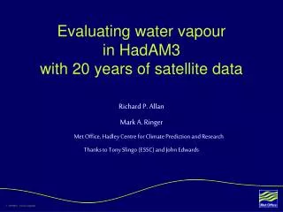
Use of satellite water vapour data sets for climate model evaluation & development. Mark Ringer & Viju John, Met Office Hadley Centre, Exeter, UK GEWEX/ESA DUE GlobVapour Workshop, Frascati, 8-10 March 2011. Contents. Background & motivation

E N D
Use of satellite water vapour data sets for climate model evaluation & development Mark Ringer & Viju John, Met Office Hadley Centre, Exeter, UK GEWEX/ESA DUE GlobVapour Workshop, Frascati, 8-10 March 2011
Contents • Background & motivation • “Traditional” evaluation studies – total column moisture in the new Hadley Centre climate model, HadGEM2 • The forward modelling approach – simulation of HIRS/AMSU radiances • Climate model development & improvement • Summary & conclusions
Why do we use satellite data? • Evaluate the physical processes most relevant to reducing uncertainty in climate predictions • Inform & prioritise key areas for developing and improving climate models • Constrain climate change predictions – or at least try and determine if this is possible • Detection & attribution of observed variations to natural and anthropogenic forcings • Initialisation of models used for seasonal-to-decadal prediction
Three key questions • Can we use present-day observations to constrain climate feedbacks? • Can we use observations to improve the processes which contribute most to the range of uncertainty in climate projections? • Will future observations be suitable for evaluating our climate projections for the coming decades?
How do we use satellite data? • “Traditional” method – compare high-level products (e.g. radiative fluxes, total column moisture) with their model equivalents • “Model-to-satellite” approach – simulate what is actually measured (e.g. IR or microwave radiances, radar reflectivities, etc) • Development of new, process-based, evaluation techniques for using the data and combining with other information such as reanalyses – e.g. compositing in terms of dynamics, clustering • Apply similar techniques to analysis of climate change simulations and feedbacks • For “fast” processes such as clouds & precipitation we also use comparisons with the global NWP model (e.g. CloudSat) • In combination with in situ data from the global observation network, data from aircraft and other field campaigns
Radiative feedbacks in the IPCC AR4 models Water Vapour Clouds Albedo Lapse Rate WV + LR ALL (Bony et al. 2006)
Title We clearly need to remember the bigger picture… …and our desire to improve these processes in climate models. Images courtesy of the USGS (John M. Evans, USGS, Colorado District) and lasp.colorado.edu
Allows direct comparison with measured radiances, etc • Avoids ambiguities associated with comparing to retrieved quantities • Example shows HIRS Channel 12 in previous version of Hadley Centre model • RTTOV is now part of the COSP simulator • For further details see: • http://cfmip.metoffice.com/COSP.html
Evaluation of HadGEM2 using AMSU-B January July Model OBS • Direct simulation of AMSU-B Channel 3 • Converted to UTH in model and observations • Further sub-sampled into times of large-scale descent
Long-term variability: Tropical mean anomalies in large-scale descending regions • Model reproduces observed variability very well • Indicates no significant trend in UTH
Evaluation of the global forecast model IR WV Model OBS
Development of HadGEM3: Relative Humidity New New-Old Old-Obs New-Obs
Development of HadGEM3: UTH New New-Old Old-Obs New-Obs
Development of HadGEM3: Clear-sky OLR New New-Old Old-Obs New-Obs
Summary – 1 • TCWV data sets need to demonstrate superiority compared to re-analyses, which are continually improving • Requirement for reliable vertical profiles of moisture to assess model biases • Increasing move towards forward modelling and away from retrieved quantities • Value of data is greatly enhanced in combination with other information such as radiative fluxes
Summary – 2 • Model resolutions – horizontal and vertical – are continually increasing • Increasing focus on seasonal-to-decadal prediction • Continued interest in understanding and trying to place observational constraints on feedbacks • Work on water vapour needs to be placed within the wider context of interest in the hydrological cycle: rainfall, clouds, etc.