Download
1 / 24
240 likes | 411 Views
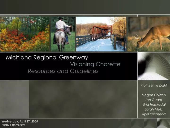
Michiana Regional Greenway Visioning Charette Resources and Guidelines. Wednesday, April 27, 2005 Purdue University. Prof. Bernie Dahl Megan Dryden Jon Guard Nina Herskedal Sarah Metz April Townsend. Greenways: the what and how. What is a greenway?

E N D
Michiana Regional GreenwayVisioning CharetteResources and Guidelines Wednesday, April 27, 2005 Purdue University Prof. Bernie Dahl Megan Dryden Jon Guard Nina Herskedal Sarah Metz April Townsend
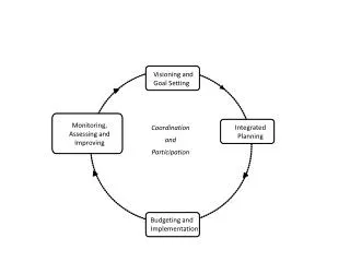
Greenways: the what and how • What is a greenway? • Corridors of open space managed for conservation and recreational purposes • The linking network between regionally significant community assets • Steps to be taken • Inventory existing natural features, parks, trails and infrastructure • Inventory and map destination points to serve as nodes • Get citizens involved in the process so they support the plan through the project • Follow hierarchy of trail preferences when choosing greenway routes
Greenways: the benefits • Economic Benefits • Newly created trail related jobs and expansion of existing businesses along trails • Property values along trails increase • Many corporations seek corporate headquarter with access to trails. • Homebuyers ranked trails as an important community amenity. • Conservation and Ecological Benefits • Greenways serve as habitat and a corridor for animals to migrate • Greenways serve as a buffer or barrier for ecological sensitive areas • Greenways reduce pollution by filtering runoff and by reducing vehicular travel.
Greenways: the benefits • Educational and Cultural Benefits • Rail-trails and canal paths along historic corridors provide a glance at historic travel • Draw public to culturally historic sites giving a sense of historically significant sites like battlefields and native settlements. • Transportation Benefits • Provide corridors for non-motorized travel between home, work, school, businesses, and community attractions. • Safe alternative to travel along busy roadways • Reduce pollution and congestion related to short errands to local destinations. • Recreation and Health Benefits • Safe, inexpensive avenue for regular exercise • Offer opportunities for wide variety of recreation close to home
Greenways: the benefits • Trail and Corridor types: • Water Trails • Multi-Use Trails • Wildlife Corridors • Utility Corridors • Rails-to-Trails program
Water Trails • What are water trails? • Navigable passageways that mainly consist of water – such as: • Streams • Rivers • Lakes/lakeshore • Ocean coastline • Non-navigable waterways: • Canals • Seasonal creeks, streams (those which are often dry) • Privately-owned waterways • Polluted waters
Water Trails • Ecological significance • Riparian zones are a crucial part of the landscape by: • Moderating the flow of water • Filtering nutrients and sediment from runoff • Helping to regulate the water temperature • Stabilizing banks • Providing food and habitat for aquatic communities
Water Trails • How can we use them? • Navigable waterways are those which may be utilized for many different types of recreation • Canoes • Kayaks • Inner-tubes • Man-powered boats • Motorized boats • Water recreational vehicles (Jet Ski/Wave Runner)
Water Trails • Community questions… • Where are waterways located? • Who owns the waterway as well as the bordering land? • Is the water easily accessible? • What signage and/or orientation devices exist in waterways currently used for recreational purposes? • What accommodating facilities currently exist for water trail users?
Multi-use Trails • What are multi-use trails? • Trails which can accommodate for multiple or mixed uses, such as: • Hiking • Bicycling • Walking • Jogging • Horseback riding • Winter sports • Cross country skiing • Snow-shoeing • All-terrain vehicles/Off-highway vehicles (ATV/OHV) • Four-wheelers • Snowmobiles
Multi-use Trails • What do they connect and link? • Cities and towns • Historic sites and museums • Schools • Parks • Shopping areas • Fairgrounds • Waterways
Multi-use Trails • Linking can be achieved by • Bridges • Parks • Standard/unified paving materials, signage, lighting, trailheads • Information kiosks • Picnic shelters • Bicycle and pedestrian • Interpretive trails and explanatory signage • Parking hubs • Rental facilities for bicycles, ATVs • Water bodies (lakes, rivers, streams) • Views
Multi-use Trails • Community questions • Where are existing/proposed trails? • Where are logical connecting points? • Schools • Town centers • Parks
Utility Corridors • What are utility corridors? • Land that has been allocated for utility lines • Utility corridors may consist of aboveground or underground utilities lines such as: • Pipelines • Electrical Lines • Gas and Oil Transmission Pipelines • Fiber Optic Cable Lines
Utility Corridors • Potential Uses • Utility line property can be converted into multi-use corridors available for both public and private use • Utility corridors provide a linear, fairly unobstructed and undeveloped corridor that is very useful for incorporating future trail development
Utility Corridors • Issues and Concerns • Many companies have come to the realization that the public will in one way or another use their corridors, whether they are managed or not • This is an incentive to make these right-of-ways available for public recreation by managing the properties surrounding the utilities • Additional Concerns • Public safety • Increased crime • Increased vandalism • Lack of a defined management entity • Lack of funding sources
Utility Corridors • NIPSCO • The Northern Indiana Public Service Company (NIPSCO) is one of Northern Indiana’s leading utility companies • As of 2004, NIPSCO had developed more miles of off-road trails than any other utility company in Indiana • NIPSCO has modified and redefined its criteria for trail development within its utility corridors, giving potential planners consistent guidelines for the use of these corridors
Utility Corridors • Funding • Developing public trails along utility corridors requires ongoing cooperation and planning between the trail or city agency and the utility company in order to minimize operation and maintenance impacts • The key to receiving grant money for utility corridors and other trail systems is defining the trail as a “transportation trail”
Wildlife Corridors • What are wildlife corridors? • Corridors are segments of land which link critical wildlife habitats • The pathways which animals take to migrate from one island of habitat to the next • Why are wildlife corridors important? • They allow species to migrate and intermingle so that survival of the species can continue • Development is increasing the loss of natural spaces – fragmenting these spaces – leading to the degradation of water resources and the ability for nature to respond to change
Wildlife Corridors • How to identify existing and potential wildlife corridors • It is important to design greenways so that they can stand as effective wildlife conduits and corridors • Some important factors to determine are: • width • continual links • outside disturbance • riparian proximity • quality
Wildlife Corridors • Guidelines for designing greenways to provide for habitat • Habitat: • Identify the needs of the most sensitive species • Conduits: • Concentrate on matching natural characteristics of the landscape • For the most part, greenways will not, by themselves, provide good habitat. Therefore, do not allow greenways projects to proceed at the expense of other initiatives, which will provide habitat, such as large reserves.
Rails-to-Trails program “Creating a nationwide network of trails from former rail lines and connecting corridors to build healthier places for healthier people.” - Motto of Rails-to-Trails Conservancy • The Rails-to-Trails Conservancy has successfully been able to organize and implement hundreds of trails across the United States • RTC has the ability to acquire and own corridors or acquire corridors on behalf of third parties
Rails-to-Trails program • Rail-trails boast unique features which contribute to the wide variety of users who use them for their individual activities and interests: • Accessibility • People with physical disabilities have an opportunity to safely exercise and enjoy these unique natural settings due to the standard, flat grade of rail-trails • Bird-watching • Cross country skiing • Cycling • Fishing • Rail-trails frequently provide the quickest and easiest access to some of the premier fishing spots across the country • Horseback riding • Inline skating • Running • Snowmobiles • Walking