Download
1 / 26
260 likes | 391 Views
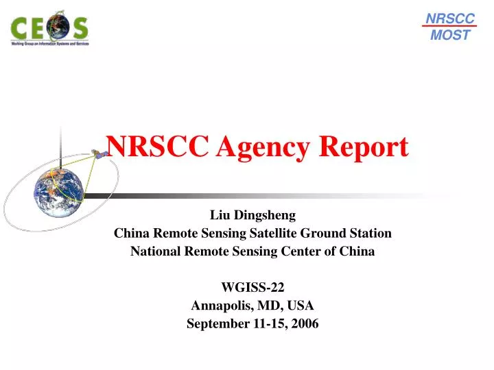
NRSCC MOST. NRSCC Agency Report. Liu Dingsheng China Remote Sensing Satellite Ground Station National Remote Sensing Center of China WGISS-22 Annapolis , MD, USA September 1 1 - 1 5 , 2006. Agency report - NRSCC. Topic New Structure of the National Remote Sensing Center of China

E N D
NRSCC MOST NRSCC Agency Report Liu Dingsheng China Remote Sensing Satellite Ground Station National Remote Sensing Center of China WGISS-22 Annapolis, MD, USA September 11-15, 2006
Agency report - NRSCC • Topic • New Structure of the National Remote Sensing Center of China • Beijing-1 Micro-Small Satellite put into operational • New Progress of Dragon Programme • Some activities in the next year • Brief introduction of FY3 2
Ministry of Science and Technology Advisor committee expert committee NRSCC Office Joint administrative meeting Departments Engineering Centers R&D Bases NRSCC Structure • New Structure of the National Remote Sensing Center of China 3
Ministry of Science and Technology Advisor committee expert committee NRSCC Office Joint administrative meeting Departments Engineering Centers R&D Bases NRSCC Structure • New Structure of the National Remote Sensing Center of China Earth Observation Division and Satellite Navigation and Positioning Division 4
Ministry of Science and Technology Advisor committee expert committee NRSCC Office Joint administrative meeting Departments Engineering Centers R&D Bases NRSCC Structure • New Structure of the National Remote Sensing Center of China • Total 19 departments connected with other ministries • R & D Dept. (IRSA, CAS) • Training Dept. (PKU, MOE) • Remote sensing satellite Dept. (RSGS, CAS) • Information Services Dept. (CISM, MLR) • GIS Dept. (IGSNRR, CAS) • Land resources Dept. (AGRS, MLR) • Meteorological Satellite Dept. (NSMC, CMA) • …… • …… • Beijing Dept. (IRMC, Beijing) • …… • Divided into Three Types • Research and Development • Services and Applications • Local Provinces 5
Ministry of Science and Technology Advisor committee expert committee NRSCC Office Joint administrative meeting Departments Engineering Centers R&D Bases NRSCC Structure • New Structure of the National Remote Sensing Center of China • Responsible to develop suitable products for application within related field • National engineering research center for geoinformatics • National Engineering Research Center for Satellite Positioning System • National engineering research center for satellite communication 6
Beijing-1 Small Satellite • Oct. 27, 2005,Beijing-1 small-satellite launched successful • From October 2005 to March 2006, commissioning and orbit testing successful completed and all main functionality was proven • Started at June 6, 2006, Beijing-1 was put into normal operation • Many demonstrations for the application of Beijing-1 data have been started and some preliminary results were archived 7
Beijing-1 Small Satellite Beijing-1 Summary • Mass: 166.4 kg • Optical imagery (at Nadir) with Ground Sampling Distance of • 4m pan (24 km swath) • 32m multi-spectral (600 km swath) • Sun-synchronous orbit (686km) • On Board Storage: HDDR (240Giga Bytes) + SSDR (4 Giga Bytes) 8
Beijing-1 Small Satellite • Data Collection: Dec. 2005 to May, 2006 9
Beijing-1 Small Satellite • Tianjin Harbour (MS Data) 10
Beijing-1 Small Satellite • Tehran Airport, Iran (Pan) 11
Beijing-1 Small Satellite Hanoi, Vietnam 12
Beijing-1 Small Satellite • Demonstration Applications • Landuse 13
Beijing-1 Small Satellite • Demonstration Applications • Flood Monitoring 10 June, 2006 2 Mar. 2006 24 May, 2006 14
新火场 新过火区 2006年5月20日 2006年5月27日 Beijing-1 Small Satellite • Fire Monitoring 15
Beijing-1 Small Satellite • Environmental Monitoring 森林 Forestry 湿地 Wetland 沙尘源 Sandstorm 16
3rd annual Dragon Symposium • From 10 to 14 July 2006, the 3rd annual Dragon Symposium successful held in beautiful Lijiang city, China 17
3rd annual Dragon Symposium • Lijiang city, a world famous cultural heritage site in China. 18
3rd annual Dragon Symposium • Dragon Programme is the joint Sino-European project sponsored by NRSCC and ESA • Started fromApril 2004, the Dragon Programme is a dedicated three-year Earth Observation exploitation programme which focuses on science and applications development in China using mainly data from the ERS and Envisat missions • Nearly 170 scientists attended the meeting and the 16 project teams Reported their progress and latest results • The total progress and results are satisfied by both side and it is decided the Dragon-II shall be started at 2008 • During the meeting, we have discussed with the programme co-coordinators how to make use Grid TT results to serve the data exchange and application-oriented processing. It is expected to join Dragon programme during second period 20
Some activities in the next year • New national 5 years plan Started from 2006 • Research and development shall be concentrated on the operational application of earth observation in the field agriculture, forest, disaster and environment monitoring, etc. • More detail plans are planed to finish at the end of this year or the beginning of next year • Three satellites are expected to launch next year • First one of China Small Satellite Constellation for Environment and Disaster Monitoring • Cbers-02B (similar with Cbers-01 but added a 2.34m pan. imager) • FY-3A, the first one of the Second Generation of Polar-Orbiting Meteorological Satellites 21
Brief Introduction of FY3 • The main mission objectives for FY-3: • To provide global sounding of 3-dimensional thermal and moisture structures of the atmosphere, cloud and precipitation parameters to support global and regional numerical weather prediction • To provide global imaging to support short range weather forecasting and real time monitoring of meteorological/hydrological disasters and surface environment anomaly • To provide necessary data for deriving important geophysical parameters to support researches on global change and climate change • To collect and relay important data • FY-3 Constellation will be consisted of two experience satellites and 6 operational satellites 22
Brief Introduction of FY3 FY-3A satellite specifications and major parameters 23
Brief Introduction of FY3 Payloads onboard FY-3A • Infrared Atmospheric Sounder (IRAS) • MicroWave atmospheric Temperature Sounder (MWTS) • MicroWave atmospheric Humidity Sounder (MWHS, similar to AMSU-B) • Multichannel Atmospheric Infrared Sounder (MAIRS) • Solar Backscatter Ultraviolet and Total Ozone Sounder (SBUV/TOS) • Visible and Infrared Radiometer (VIRR, 10 channels, similar to radiometer aboard FY-1C) • Medium Resolution Spectral Imager (MERSI) • MicroWave Radiation Imager (MWRI) • Earth Radiation Budget Unit (ERBU) • Space Environment Monitor (SEM) 24
Brief Introduction of FY3 FY-3A in Flying Mode 25
Agency report - NRSCC Thanks! 26