Download
1 / 15
150 likes | 258 Views
From Design to Implementation: the National System of Marine Protected Areas. Presentation to Caribbean Fisheries Management Council Samuel D. Rauch III Deputy Assistant Administrator for NMFS March 2009. WWW.MPA.gov. Presentation Outline. Definition of MPAs

E N D
From Design to Implementation:the National System of Marine Protected Areas Presentation to Caribbean Fisheries Management Council Samuel D. Rauch III Deputy Assistant Administrator for NMFS March 2009 WWW.MPA.gov
Presentation Outline • Definition of MPAs • Background on National System • Nomination Process
What is an MPA? Marine Protected Area (MPA) – any area of the marine environment that has been reserved by Federal, state, territorial, tribal or local laws or regulations to provide lasting protection to part or all of the natural and cultural resources therein. (Executive Order 13158 of May 26, 2000) Marine Reserve – “no take” area – one type of MPA where extractive uses are prohibited MPA
National Picture of MPAs • ~ 1,700 MPAs in U.S. waters • Hundreds of federal, state and local MPA authorities • About 1/3 of US EEZ in some form of MPA, but purposes narrow • Majority allow multiple uses (>99% of MPA area) • Few prohibit all extractive activities (<1% of MPA area); no • take MPAs are typically very small • Federal programs manage most area; states manage most sites
Why A National System of MPAs? • Confusion over MPA types, purposes, and terms • About 200 independent legal authorities • Lack of coordination among MPA designations and operations • No existing forum for comprehensive planning for place-based management • Lack of consideration of connectivity among different MPA types • Missed opportunities to address multiple management objectives in one MPA
The Driving Force: MPA Executive Order 13158 • Signed by President William J. Clinton in May 2000 • Endorsed by President George W. Bush in July 2001 • DOC/NOAA and Interior are co-Leads • Develop and implement a scientifically based, comprehensive national system of MPAs representing diverse U.S. marine ecosystems, and the Nation’s natural and cultural resources • Improve MPA coordination, stewardship and effectiveness
Benefits of a National System of MPAs • To Participating MPAs • Enhancing stewardship through regional coordination • Building partnerships • Building public & international awareness and support • To the Nation: • Protecting representative ecosystems and resources • Enhancing connectivity • Identifying conservation gaps • To ocean stakeholders: • Transparent process for MPA planning • Better planning for diverse ocean uses • Better information on MPA resources, uses and fishing opportunities
What will the National System do? • Establish national goals and objectives • natural heritage, cultural heritage and sustainable production • 21 Priority Conservation Objectives • Ensure a comparable set of information about MPAs across the nation • Provide regional coordination of existing MPAs • Identifies common science and stewardship priorities • Provide tools and technical assistance to enhance stewardship • Conduct regional gap analyses to identify priority areas for potential new or enhanced MPAs • No new regulatory authority
Criteria for Entry to the National System • Meets the definition of an MPA • Key terms: area, marine, reserved, lasting, protection • Has a management plan • Includes site specific information; can be part of a broader fisheries management plan • Contributes to a priority conservation objective of the nation system • Additional criteria for cultural resources
Priority Conservation Objectives:Sustainable Production Goal
Nomination Process: Coordination with Councils Regional Administrators consult with Councils regarding final nominations Council votes on which sites to recommend (2nd Council Meeting if Necessary) NMFS nominates potential sites MPA Center identifies potentially eligible sites and invites entities to nominate Accepted MPAs placed on official National System List Managing entities nominate potential sites Public notice and comment Entities review comments Submit final nominations NOAA Fisheries and Councils consultation process NMFS request recommendations and Council takes public comment at meeting (1st Council Meeting) NOAA Fisheries Sends Letter to Council with List Attached NOAA Regions review for corrections
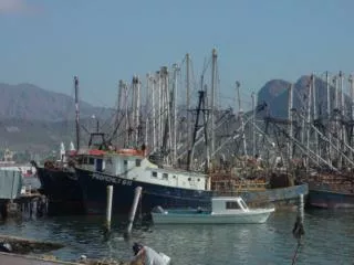
Examples of NOAA Fisheries MPAs North Pacific: Bering Sea Habitat Conservation Areas = 130,000 nm2 Steller Sea Lion Protection Areas, Gulf of Alaska - Groundfish, Pollock, and Pacific Cod Closures = 83,725 km New England: Closed Area I = 3,940.44 km & Closed Area II = 6,734 km Stellwagen Bank/Jeffreys Ledge Restricted Area = 5,271 km Pacific: Klamath River Salmon Conservation Zone = 394.02 km Big Sur/Port San Luis Bottom Trawl Closed Area = 10,390 km Mid-Atlantic: Mid-Atlantic (Elephant Trunk) Closed Area = 5,387 km Southern Mid-Atlantic Waters Closure Area = 113,534 km South Atlantic: Charleston Bump Closed Area = 125,494 km East Florida Coast Closed Area = 103,448 km Gulf of Mexico: Tortugas Marine Reserves = 348.86 km Reef Fish Stressed Area = 99,478 km Western Pacific WestPac Bed = 39.47 km Hancock Seamount = 61,481 km Caribbean: Red Hind Spawning Aggregation Areas = 104.01 km Mutton Snapper Spawning Aggregation Area = 8.72 km
National System Milestones for FY09 • Initial Nomination Process (Nov-Feb 2009) • Currently out for public comment – 225 sites responded (www.mpa.gov) • Aiming for initial membership representing diverse levels of government and types of MPAs • NOAA Fisheries Service will consult with Councils and be represented in future nominations • Announcement first National System MPAs: April 2009 • 2nd Round of Nominations – late 2009 • Annual nomination process cycle in future years • Begin coordination with other federal and state MPA sites in the system • Develop methodology for first regional gap analysis – West Coast (CA, WA, OR)
MPA Federal Advisory Committee • Diverse, stakeholder committee • Advises NOAA and DOI on implementation of national system • 30 members • commercial and recreational fishing • industry • natural and social science • environmental organizations • states and tribes • Caribbean Members • Eugenio!
Questions? A National System of MPAs, collaboratively conserving the nation’s… Natural Heritage, Sustainable Production, and Cultural Heritage.