Download
1 / 18
180 likes | 404 Views
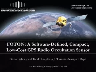
FOTON: A Software-Defined, Compact, Low-Cost GPS Radio Occultation Sensor. Glenn Lightsey and Todd Humphreys, UT Austin Aerospace Dept. GEOScan Planning Workshop | March 27-30, 2011. FOTON Sensor Overview. Grand Challenges

E N D
FOTON: A Software-Defined, Compact, Low-Cost GPS Radio Occultation Sensor Glenn Lightsey and Todd Humphreys, UT Austin Aerospace Dept. GEOScan Planning Workshop | March 27-30, 2011
FOTON Sensor Overview • Grand Challenges • Responsive, flexible occultation science via software-defined GPSRO sensor • Exploit emerging technology to maximize science return from GPSRO sensors • Signals: GPS L1CA and L2C • GPS radio occultation sensors are strongly synergistic with in-situ electron density sensors, electric field sensors, etc. • Instrument/Sensor Specifications • Mass: 350 g • Power: 4.8 W • Volume: < 1 U • Data rate: 64 kbps (occulation mode), 2.6 kbps (standard) • Flight heritage or stage of development: Under development • Number of satellites required: at least 1 • Accommodation requirements: antenna on anti-ram (possibly also ram) facing surfaces • Expected data products: 100-Hz phase, TEC, S4, sigmaPhi, tau0 • Data delivery and distribution: Data posted to central server • Expected results, contribution, broader impact: Prove the promise of swarms of low-cost GPS occultation sensors for ionospheric and tropospheric science • Cost: $10k - $50k per unit, depending on number of units • Instrument/Science Team • Main contact: Todd Humphreys, University of Texas at Austin (todd.humphreys@mail.utexas.edu) • Collaborators: • Glenn Lightsey, University of Texas at Austin • Mark Psiaki, Cornell • Steve Powell, Cornell • Chuck Swenson, USU • Chad Fish, SDL • Sponsors/institutions/individuals with potential interest in funding development of FOTON • US Air Force under existing SBIR contract • NASA Ames for constellation of cubesats • Conceptual Design • FOTON • Software-defined space weather sensor • High-sensitivity occultation returns • Scintillation triggering • Data-bit wipeoff • Open-loop tracking • Recording of raw IF data
Q: What emerging technologies can be exploited to maximize the science impact of GNSS-based radio occultation over the next decade?
Miniaturization Proliferation Modernization Estimation • Smaller, less power-hungry GPSRO devices enable deployment: • As hosted payload on larger SVs (e.g., IridiumNext) • On CubeSats • Shrinking Sensor envelope and cost allows ubiquitous space based sensor networks
Miniaturization Proliferation Modernization Estimation • Low cost enables larger constellations (10-100) of GPSRO-bearing SVs • Redundancy shifts from sensor to swarm • Challenges posed by large numbers of low-cost GPSRO sensors: • Data rate (~300 kB per occulation) may be too high for practical downlink sensors should be smart, do some preliminary processing onboard • Occultation capture cannot be orchestrated from the ground sensors must be autonomous • Low cost implies some radiation hardness sacrifice • Low cost implies less rigorous pre-flight qualification testing of each unit Like COSMIC but at a fraction of the cost per GPSRO sensor
Miniaturization Proliferation Modernization Estimation • GPS L2C offers a crucial unencrypted second civil signal • Allows tracking of occultations deeper into troposphere • 9 L2C-capable SVs now in orbit • 20 L2C-capable SVs by 2015 • GPS L1 C/A + L2C most promising signal combination for occultations over next decade • GPS L5 and Galileo signals • Also promising after ~2018 • P(Y) code may be discontinued after 2021 • Software-defined GNSSRO receivers offer complete on-orbit reprogrammability • Reduces operational risk • Enables on-orbit innovation • Allows adaptation to science needs/events (Fig. 1 of Wallner et al., "Interference Computations Between GPS and Galileo," Proc. ION GNSS 2005)
Miniaturization Proliferation Modernization Estimation • Challenge: Need good measurement quality despite low-cost and small size of GNSSRO sensors • Climate science requires accurate, consistent measurements • If large, high-gain antennas can’t be accommodated, must make up sensitivity in signal processing • Specialized open-loop tracking required to push deep into troposphere • Phasemeasurementsmustbe CDGPS-ready to enable precise orbit determination (Topstar receiver by Alcatel fails this req’t) • Challenge: Atmospheric assimilative models should be modified to ingest raw carrier phase and TEC measurements from occultations • Abel transform appears to be an unnecessary step: does not fully summarize the information in the data • Challenge: Toease data downlinkburden, ionospheric scienceparameters such as TEC, S4, tau0, sigmaPhi should be estimated on-orbit
Survey of GPSRO Receivers(Flight Qualified orConsidered) COTS receivers Chart adapted from Oliver Montenbruck, 2008; Pictures from Gupta, 2009.
Since 2008, The University of Texas, Cornell, and ASTRA LLC have been developing a dual-frequency, software-defined, embeddable GPS-based space-weather sensor.
Antarctic Version of CASES • Deployed late 2010 • Remotely reprogrammable via Iridium • Automatically triggers and buffers high-rate data output during intervals of scintillation • Calculates S4, tau0, sigmaPhi, SPR, TEC
CASES Follow-On: FOTON GPSRO • Size: 8.3 x 9.6 x 3.8 cm • Mass: 350 g • Power: 4.8 W • Reprogrammable from ground • Dual frequency (L1CA, L2C) • Software can be tailored for occultation and space weather sensing: • Scintillation triggering • Open-loop tracking • Recording of raw IF data • Data bit wipeoff Prototype FOTON receiver Now undergoing testing Goal: Deliver high-end GPSRO benefits at low-end Size/Weight/Power and Cost
Commercialization Path for FOTON • Startup Company Created in Austin for licensing and commercialization of university space technology • Air Force SBIR Phase 1 Awarded (2/11-11/11) • SBIR Phase 2 (if awarded) 2012-2014 • FOTON GPSRO CubeSat on-orbit demonstration planned in 2013-2014 FOTON will be ready for selection as a GEOScan payload on IridiumNext
Concern: Our experience with Iridum interference at two Antarctic stations indicates that this may be a more serious problem for Iridium-hosted GPSRO than earlier studies suggest.
More Information http://radionavlab.ae.utexas.edu
A Closer Look: NovAtel OEMV-3 • High-quality device, proven manufacturer • OEM4-G2L flew on CanX-2 • CanX-2 adaptations: • Disable altitude and velocity restrictions • Upload startup scripts to speed acquisition • Set sampling rate to 100 Hz • Set elevation mask to -45 deg • Reduce carrier phase smoothing of code measurements