Download
1 / 57
570 likes | 637 Views
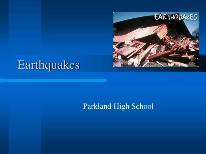
Earthquakes. Parkland High School. What is an Earthquake?. Vibration of the Earth produced by the rapid release of energy or movement of the fractures in the crust Focus---the place within the Earth where the rock breaks, energy is released and radiates in the form of seismic waves

E N D
Earthquakes Parkland High School
What is an Earthquake? • Vibration of the Earth produced by the rapid release of energy or movement of the fractures in the crust • Focus---the place within the Earth where the rock breaks, energy is released and radiates in the form of seismic waves • Epicenter---the point on the ground's surface directly above the focus
Earthquakes and Faults • Vertical and horizontal movements are associated with large fractures in Earth’s crust called faults • Movement along these faults is explained by plate tectonics (faults associated with plate boundaries which strain rocks) • Three types of faults
Reverse Fault • Caused by compression • Stress that decreases the volume of material • Shortens the crust • http://www.calstatela.edu/faculty/acolvil/struct/blind_animation.gif
Normal Fault • Caused by tension • Stress that pulls a material apart • Extends the crust • http://www.calstatela.edu/faculty/acolvil/struct/normal_animation.gif
Strike-Slip Fault • Caused by shear • Stress that causes a material to twist • Ex-San Andreas Fault • http://www.calstatela.edu/faculty/acolvil/struct/rightlateral_animation.gif
Cause of Earthquakes • Stress • Force per unit area or pressure acting on a rock • When force exceeds strength of rock it fractures • Three types (compression, tension, and shear) • Strain • Deformation of materials in response to stress; the result of the stress
Strain/Deformation • Elastic rebound or deformation - when stresses are removed, rock returns to original shape (think of a rubber band) • Ductile or Plastic deformation - permanent deformation; when stresses are removed, rock stays bent (results in increase in size) • Rupture or Failure - breakage and fracturing of the rock, causing an earthquake
Cause Continued… • Can also be looked at as in Figure 6.5 on pg 167 and compared to a limber stick • Original position • Buildup of strain • Slippage (earthquake) • Strain released
Stress-Strain Curve • Has two segments: straight and curved • Low stress Straight segment Elastic deformation • High stress Curved segment Ductile deformation • Most brittle materials (glass, wood) fail before much ductile deformation occurs, while most ductile materials (rubber, metals) can undergo a great deal of deformation before failure begins or they never fail at all • Most rocks are brittle under low temps in Earth's crust and ductile under high temps at greater depths
Foreshocks and Aftershocks • Foreshocks • Small earthquakes that precede a major earthquake by days or possibly years • Can be used in prediction • Aftershocks • Smaller earthquakes that occur after a major earthquake as the fault adjusts and moves • Weaker but can still cause damage
Seismology • The study of earthquake waves • Began with the Chinese about 2000 years ago • A seismograph or seismometer detects/records seismic waves
Seismograph • How it works: • Suspended mass hanging from a support that is attached to (and moves with) the ground. • Inertia keeps the suspended mass stationary while the ground moves below it. • The movement is recorded on a rotating drum or magnetic tape. • Prints seismogram (shows that waves are elastic energy)
Seismic Waves • Types of waves • Body • Travel through Earth’s interior • Primary or P waves • Secondary or S waves • Surface • Travel along Earth’s outer layer
P Waves • Also called compressional waves • Push and pull waves (compress and expand the rocks in the same direction the wave is traveling) • Fastest of the seismic waves • Travel through solids, liquids, and gases (temporarily change the volume of the material by compressing and expanding) • http://www.eserc.stonybrook.edu/wise/WSE187spr2002/PrimaryWaves.html • http://www-rohan.sdsu.edu/~rmellors/lab8/l8pwav2.htm
S Waves • Move rocks from side to side or at right angles to the direction the wave is traveling • Travel through solids only (temporarily change the shape of the material) • http://www.eserc.stonybrook.edu/wise/WSE187spr2002/SecondaryWaves.html • http://www-rohan.sdsu.edu/~rmellors/lab8/l8swav2.htm • http://www.classzone.com/books/earth_science/terc/content/visualizations/es1002/es1002page01.cfm?chapter_no=visualization
Surface Waves • Complex motion: up-and-down and side-to-side (two directions) • Slowest • Causes damage to structures during an earthquake • http://www-rohan.sdsu.edu/~rmellors/lab8/l8rwav2.htm • http://www-rohan.sdsu.edu/~rmellors/lab8/l8awav2.htm
Seismic Record • P waves arrive first, followed by S waves, and then surface waves • Results from their speeds • Velocity of P waves through granite is 6 km/s • Velocity of S waves through granite is 3.5 km/s • On average, P waves travel about 1.7 times faster than S waves • Surface waves travel at 90% of the velocity of S waves
Earth’s Interior • Please read this section in text on pg. 182-187 and take notes/outline • Layers defined by composition: crust, mantle, core • Layers defined by physical properties: lithosphere, asthenosphere, mesosphere, inner and outer core • Moho • Shadow zone • Discovering Earth’s composition • See figure 6.25 and 6.26
Locating an Earthquake • The greater the interval measured on a seismogram between the arrival of the first P wave and the first S wave, the greater the distance to the earthquake source • So, first examine the seismograph and determine the elapsed time between the arrival of the first P-wave and the first S-wave
Locating an Earthquake Continued… • Next, use a time-distance graph: Knowing the S - P time, you can determine the distance to the epicenter from the seismic station • See figure 6.9 on pg. 172 • Then, on a map, draw a circle around the seismic station(Radius of circle = distance to epicenter) • Repeat this for two other seismic stations (Triangulation) • The three circles will meet at a point; that point is the epicenter.
Locations of Earthquakes • Most occur along tectonic plate boundaries: • Around Pacific Ocean (Circum-Pacific Belt) • Mediterranean-Asia Belt (Indonesia, Himalayan region) • Mid-ocean ridges • Some occur far from plate boundaries
Measuring Earthquakes • Two different types to describe the size • Intensity • Measure of the degree of the shaking based on amount of damage • Modified Mercalli Scale • Magnitude • Measure of the amount of energy released at the source • Relies on seismic records • Richter and Moment Magnitude Scales
Modified Mercalli Scale • Developed in 1902 by Guiseppe Mercalli • Intensity scale • Describes damage to structures. • Ranges from I (felt by only a few) to XII (total destruction) • Modified using California buildings as its standard so usable throughout US and Canada • Disadvantages: based on effects, so not only ground shaking, but also population density, building design, and the nature of surface materials
Richter Scale • Developed by Charles Richter in 1935 at CIT • Based on amplitude of largest seismic wave (P, S, or surface) recorded on the seismogram---measures magnitude • Logarithmic scale: each number on the Richter Scale is ten times greater in wave amplitude (an 8 on scale is 10 times larger than a 7 and 100 times larger than a 6) and each number on the Richter Scale involves an energy release about 32 times as great
Richter Continued… • Wood-Anderson seismograph is the standard recording device • Largest magnitude ever recorded was 8.9 • Saturated for large earthquakes because they cannot distinguish between the size of the events • See Table 6.2 on pg. 175
Moment Magnitude Scale • Also measures magnitude of earthquakes • Takes into account the size of the fault rupture (area), the amount of movement/ displacement along the fault, and the rocks’ stiffness/strength • Estimated from size of several types of waves • Better to describe very large earthquakes • Strongest on record---moment magnitude of 9.6 (1960 Chile)
Destruction • Seismic Vibrations • Tsunamis • Landslides and Ground Subsidence • Fire
Seismic Vibrations • Structural damage from earthquake waves depends on: • Intensity • Duration • Nature of material upon which structure sits • Design of structure
Structural Damage • Most damage occurs to unreinforced building made of stone, concrete, etc. • Wooden structures are resilient and sustain less damage • High-rise, steel-frame buildings are often reinforced and sustain less damage • Buildings may rest on rubber structures to absorb vibrations • Soft sediments amplify vibrations more than solid bedrock • Liquefaction: soil turns into a fluid (saturated with water)
Tsunamis • Earthquakes under the ocean caused by seismic sea waves (caused by displacement of sea floor along a fault) • Waves travel at 500 - 950 km/hr • Fast, high energy waves, but not tall (less than 1 m) in deep sea • Not distinguishable in open ocean (height less than 1 m) • When they enter shallow water, they slow down, the water stacks up (30 m)
Tsunamis Continued… • First sign = withdrawal of water from coast • 5 - 30 min later, a BIG wall of water arrives (100 ft)…can extend hundreds of meters inland • Each surge is followed by a retreat of water • Waves are separated by intervals of 10-60 minutes
Tsunami Warning System • Put in place by the U.S. Coast and Geodetic Survey for coastal areas of the Pacific after 1946 tsunami struck Hawaii • Large earthquakes reported to the Tsunami Warning Center in Honolulu and scientists use tidal gauges to determine if tsunami has formed • Within an hour a warning is issued