Download
1 / 35

E N D
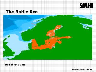
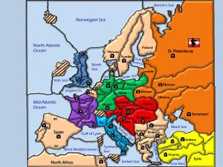
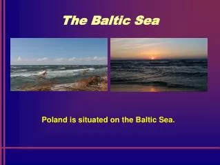
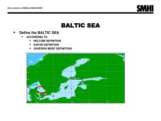
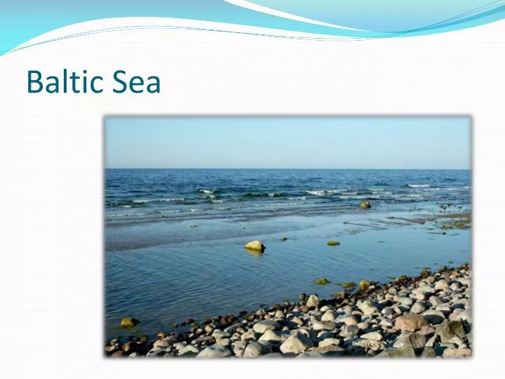
Location • The Baltic Sea is a brackish mediterranean sea located in Northern Europe, from 53°N to 66°N latitude and from 20°E to 26°E longitude. It is bounded by the Scandinavian Peninsula, the mainland of Europe, and the Danish islands. It drains into the Kattegat by way of the Øresund, the Great Belt and the Little Belt. The Kattegat continues through Skagerrak into the North Sea
Dimensions • The Baltic sea is about 1600 km long, an average of 193 km wide, and an average of 55 m deep. The maximum depth is 459 m, on the Swedish side of the center. The surface area is about 377,000 km² and the volume is about 20,000 km³. The periphery amounts to about 8000 km of coastline.
Hydrography • The Baltic Sea flows out through the Danish straits; however, the flow is complex. A surface layer of brackish water discharges 940 km³ per year into the North Sea. Due to the difference in salinity, a sub-surface layer of more saline water moving in the opposite direction brings in 475 km³ per year. It mixes very slowly with the upper waters, resulting in a salinity gradient from top to bottom, with most of the salt water remaining below 40 to 70 m deep.
Hydrography • The general circulation is counter-clockwise: northwards along its eastern boundary, and south along the western one.The difference between the outflow and the inflow comes entirely from fresh water. More than 250 streams drain a basin of about 1.6 million km², contributing a volume of 660 km³ per year to the Baltic. They include the major rivers of north Europe, such as the Oder, the Vistula, the Neman, the Daugava and the Neva. Additional fresh water comes from the difference of precipitation less evaporation, which is positive.
Demographics About 85 million people live in the Baltic drainage basin, 15 million within 10 km of the coast and 29 million within 50 km of the coast. Around 22 million live in population centers of over 250,000. 90% of these are concentrated in the 10 km band around the coast. Of the nations containing all or part of the basin, Poland includes 45% of the 85 million, Russia 12%, Sweden 10% and the others (see below) less than 6% each
Salinity • The Baltic Sea's salinity is much lower than that of ocean water (which averages 35‰), as a result of abundant freshwater runoff from the surrounding land, combined with the shallowness of the sea itself; indeed, runoff contributes roughly one-fortieth its total volume per year, as the volume of the basin is about 21,000 km³ and yearly runoff is about 500 km³.
Salinity • The open surface waters of the central basin have salinity of 6 to 8 ‰. At the semi-enclosed bays with major freshwater inflows, such as head of Finnish Gulf with Neva mouth and head of Bothnian gulf with close mouths of Lule, Tornio and Kemi, the salinity is considerably lower. Below 40 to 70 m, the salinity is between 10 and 15 ‰ in the open Baltic Sea, and more than this near Danish Straits.
Types of glaciers • Ice folded bay: Bothnia, Finland and Riga, and lagoons and small bays. Ice thickness reaches 70 cm in the northern part of the Gulf of Bothnia. Ice formed there in the coastal narrow belt, but in the central areas of each of these pools already in arrears only variety of so-called dense floes. pack ice. The sea begins to freeze first at the bank, in mid-November, and thawing in May, which was also observed in recent years. Islands, northern Baltic Sea, as Hiiumaa, Saaremaa and the archipelago at the entrance to the Gulf of Bothnia in winter acquire a connection to the mainland, such as at the beginning of 2009.
Land cover • BalticSeacoastaremostlycovered by forests and openlands. Surrounded by greenery, theBalticSeais an interestingtouristdestination. To a smallextentarewetlands and glaciers. Ports and smallresortsaretheonlyaspect of urbanization.
Biology Approximately a quarter of Baltic’stotal area is a variable dead zone. The more saline water remains on the bottom, isolating it from surface waters and the atmosphere. This leads to decreased oxygen concentrations within the zone. It is mainly bacteria that grow in it, digesting organic material and releasing hydrogen sulfide. Because of this large anaerobic zone, the seafloor ecology differs from that of the neighbouring Atlantic.
Biology • Plans to artificially oxygenate areas of the Baltic that have experienced eutrophication have been proposed by the University of Gothenburg and Inocean AB. The proposal intends to use wind-driven pumps to inject oxygen (air) into waters at, or around, 130m below sea level.
Pollutions • The biggest problem with the protection of the Baltic Sea is eutrophication. Its main causes are excessive loads of nitrogen and phosphorus that come from land in the catchment of the Baltic Sea, and areas outside it.
Pollutions The Baltic is one of the most polluted seas in the world. In 1973, the Gdansk Convention on Fishing and Conservation of living resources in the Baltic Sea and the Belts was signed. In 1974, seven countries bordering the Baltic Sea (out of 9) signedsecond International Convention in Helsinki on the Baltic. Nevertheless, the Baltic Seastill remains one of the most polluted seas in the world.
Portsin Poland • Port of Gdynia - a commercial seaport on the Gulf of Gdansk, in the provinc of Pomerania and Gdynia located atKashubianCoastland.
Portsin Poland • Port of Gdańsk – a portwhichfulfills the function of commercial fishing, yachting, and which constitutes a large share of handling bulk cargo, mostly oil and petroleum products
Portsin Poland • Port of Police – a commercial port specializing in handling of bulk commodities (phosphates, ammonia and other chemicals). In additional to beingthe port of Police,the port alsoplaysthe role of the fishing base.
Portsin Poland • Port of Kołobrzeg – a seaport on the Baltic Sea, situatedat the Parsętariverestuary. Commercial and fishing port whichhasa yachtharbour, fishingharbor and a ferryharbour. The port is a well-developedpassenger port.
Portsin Poland • Port of Władysławowo – a seaport on the Baltic Sea, in the northern part of thePomeranian province, in the district of Puck, in Wladyslawowo. It is a typical fishing port with a marina and passengerharbour. Cargo facilitiesarealsoavailableatthe port of Władysławowo. The port specializesinhanding a widerange of maritime cargo and transporting a wideselection of goods.
Portsin Poland • Port of Puck – a sea port on the Gulf of Puck, in the Pomeranianprovince, in Puck. It is a fishing port with itsown independent marina. Thereis a fishingfleetbasedinthe port. The port isalsofamous for expandinginlandtourism and housing a watersports center.