Download

1 / 14
140 likes | 268 Views
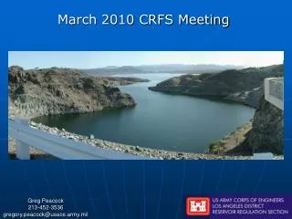
CRFS Technical Meeting LC Operations Update March 29, 2011. Topics. Operations Update Research Efforts Real Time Evaporation Development of streamflow projections Comparison of streamflow projections and operational impacts Probabilistic Mid-Term Operations Model.

E N D
Topics • Operations Update • Research Efforts • Real Time Evaporation • Development of streamflow projections • Comparison of streamflow projections and operational impacts • Probabilistic Mid-Term Operations Model
Summary of Lake Powell and Lake Mead OperationsReview of 24-Month Study 2011 Water Year Projections In 2011, the Equalization Elevation is 3643 ft.
11.63 MAF Published March 2011 Projection for September 30, 2011 Apr-Jul Forecast = 9.2 MAF (116% Average) Lake Mead Lake Powell 25.877 maf 24.322 maf 1,220 3,700 Equalization Elevation 3,643 3632.49 Feet 1,105 11.9 maf 9.5 maf 3,575 1105.00 Feet 0.0 maf 0.0 maf 3,370 895 1.9 maf 2.0 maf Dead Storage Dead Storage Not to Scale
End of Water Year 2011 Lake Mead elevation end of WY 2011: 1105.00 feet • Downstream water use during CY2011 has been lower than expected • January storms and flooding along the Virgin River resulted in an initial increase to Lake Mead’s elevation of approximately 1.5 – 2.0 feet • Since January, dry conditions have persisted in the Southwest
Lower Basin Side InflowsGlen Canyon to Hoover in WY/CY 20111,2 1Values were computed with the LC’s gain-loss model for the 24-month study2Percent of average are based on the 5-year mean from 2005-2009 in CY 2010 and the 5-year mean from 2006-2010 in CY 2011.
Water Year 2011 Projected Operations • August 2010 Most Probable 24-Month Study projected Lake Mead elevation on Jan 1, 2010 to be 1086.38 feet • ICS Surplus Condition to govern Lake Mead operations • Mexico deliveries may be reduced • Minute 318 signed to allow Mexico to store up to 260 KAF through 2013
Real Time Evaporation At Lake Mead • 5-Year cooperative project with the USGS • Measure and obtain hourly evaporation rates (and other parameters) from Lake Mead • Develop new monthly coefficients for use in long-term modeling efforts • Maintain program into the future
Comparison to Evaporation Rates in 24 Month Study *provisional
Impacts • Will reduce error associated with 24-Month Study side inflow to Lake Mead term • Since February 2010, side inflows would have been lower than previously calculated, most of the time • Lower Basin is actively working with CBRFC to forecast side inflows as well • Would like to keep project going, perhaps investigate bank storage
Recent Research Efforts • Forced CBRFC RFS model with BCSD climate dataset through 2099 • 10-15% decrease in flows over Gunnison and San Juan River Basins • 8% increase in flows over Green River Basin • Compared impacts of streamflow projections derived using VIC and RFS to operations over the San Juan • RFS flows generally lower over water year • Seasonal RFS flows above Navajo are higher
Development of New Probabilistic Mid-Term Operations Model Motivation is to better quantify range of uncertainty associated with mid-term operations forecasts Being developed by CADSWES graduate student in collaboration with Reclamation’s Modeling Work Group Developed in parallel with the 24-Month Study model Simulation horizon of 2-10 years Input is range of probable inflows First and part of second year based on CBRFC’s ESP forecasts On-going research to develop forecasting techniques beyond 2 years (being done by student developing model) Results expressed in probabilistic terms Target end of2011 for first version of completed model
Lower Colorado River Operations For further information: http://www.usbr.gov/lc/region