Download
1 / 28
280 likes | 285 Views
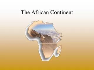
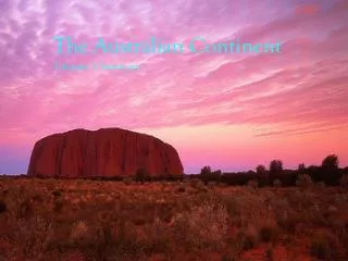
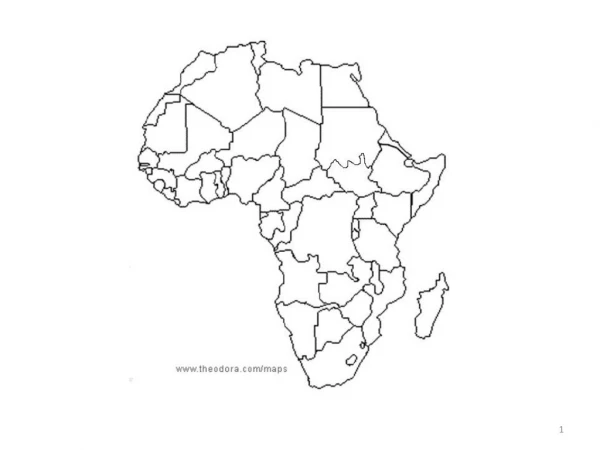
Physical Geography of Africa:. The Plateau Continent. A continent of plateaus, basins, and rift valleys, Africa features dense rain forests, vast grasslands, and the world’s largest desert. Physical Geography of Africa:. The Plateau Continent. SECTION 1. Landforms and Resources.

E N D
Physical Geography of Africa: The Plateau Continent A continent of plateaus, basins, and rift valleys, Africa features dense rain forests, vast grasslands, and the world’s largest desert.
Physical Geography of Africa: The Plateau Continent SECTION 1 Landforms and Resources Climate and Vegetation SECTION 2 Human-Environment Interactions SECTION 3
Section-1 Landforms and Resources • A large plateau covers most of Africa. • Africa’s natural resources made it appealing to European colonizers.
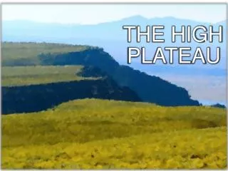
Section-1 Landforms and Resources A Vast Plateau After Pangaea • Pangaea supercontinent broke up 200 million years ago • − Africa moved very little, unlike Americas, Antarctica, Australia, India • − Africa is second largest continent • Africa’s Plateau • Huge plateau covers most of Africa, rising inland from coasts • − most of Africa is at least 1,000 feet above sea level • − known as the “plateau continent” Continued…
A Vast Plateau {continued} Basins and Rivers • Basins—huge depressions on plateau • − each is more than 625 miles across, up to 5,000 feet deep • NileRiver—world’s longest: 4,000 miles though Uganda, Sudan, Egypt • − waters used for irrigation; 95% of Egyptians get water from Nile • Egypt’s population density near Nile is 3,320 people per square mile • − only 177 per square mile overall
1 Distinctive African Landforms Basins and Rivers • Waterfalls, rapids, gorges make rivers less useful for transportation • − 2,900-mile Congo is largest river network • − 32 cataracts (waterfalls) make much of Congo impassable • Rivers’ meandering courses also make them less useful Continued…
Distinctive African Landforms{continued} Rift Valleys and Lakes • East Africa: continental shift created huge cracks in East Africa • − land sank, formed long, thin riftvalleys • − stretch 4,000 miles from Jordan to Mozambique • − eastern part is still slowly pulling away from Africa • Long, deep lakes form at bottoms of rift valleys • − Lake Tanganyika is longest freshwater lake in world • Lake Victoria is Africa’s largest; sits in basin between rift valleys Continued…
Distinctive African Landforms{continued} Mountains • Africa mainly has volcanic mountains: Mount Kenya, Mount Kilimanjaro • − MountKilimanjaro is Africa’s highest mountain • − volcanoes created Ethiopian Highlands • − also Tibesti Mountains (Sahara), Mount Cameroon (West Africa) • Volcanic rock covers Great Escarpment in Southern Africa • − escarpment—steep slope with flat plateau on top
Africa’s Wealth of Resources A Wealth of Minerals • Africa’s minerals make it one of world’s richest continents • − copper, phosphates, diamonds; 42% of world’s cobalt • South Africa is largest producer of chromium, for stainless steel • − produces 80% of world’s platinum, 30% of gold • Mineral wealth has not created general African prosperity • − colonial rulers sent natural resources to Europe • − nations are slow to develop infrastructure, industries Continued…
Africa’s Wealth of Resources {continued} Oil Resources • Libya, Nigeria, Algeria among world’s leading petroleum producers • − Angola, Gabon have untapped oil reserves • Angola is example of resources not benefiting Africans • − oil deposits will make it Africa’s most oil-rich country • − American companies will pay Angola to drill oil • − money will be spent on ongoing ethnic civil war • − little will be invested in schools, hospitals, other infrastructure
Diversity of Resources Major Commodities • Coffee is Africa’s second most profitable commodity • − few Africans drink coffee, but 20% of world’s supply is grown there • Nigeria leads in lumber exports, but logging is depleting forests • − each year an area twice the size of New Jersey is cleared • Other commodities include sugar, palm oil, cocoa • Agriculture is Africa’s single most important economic activity • − 66% of Africans earn a living farming; accounts for 1/3 of exports
Section-2 Climate and Vegetation • Africa contains dry and hot deserts, warm tropics, and permanently snow-capped mountains. • Africa’s vegetation includes thick rain forests, tall grasslands, and desert areas.
Section-2 Climate and Vegetation A Warm Continent The Deserts • Saharais largest desert in world; name means “desert” in Arabic • − 3,000 miles from Atlantic to Red Sea; 1,200 miles north to south • − temperatures as high as 136 degrees in summer, freezing at night • − fewer than 2 million of Africa’s 800 million people live in Sahara • Only 20% is sand; rest is mountains, rocks, gravelly plains • − Tibesti Mountains in northwestern Chad rise 11,000 feet Continued…
A Warm Continent {continued} The Deserts • Saharan travelers rely on camels that can go 17 days without water • 6,000 feet under Sahara are aquifers—stores of underground water • − when this water comes to the surface it creates an oasis • Other African deserts include Kalahari, Namib Continued…
A Warm Continent {continued} The Tropics • Africa has largest tropical area of any continent • − 90% of Africa lies between tropics of Cancer, Capricorn • − high temperatures year around, especially in Somalian Sahara • − Africans say nighttime is the “winter” of the tropics
Sunshine and Rainfall Rainfall Patterns • Rains all year in rain forests; most of Africa has rainy seasons • Tropical savanna covers half of Africa; six-month rainy season • Longer rainy seasons near equator; longer dry seasons near desert • West coast gets heavy rain; Monrovia, Liberia, has 120 inches yearly • Sahara, other deserts may go years without rain Continued…
Sunshine and Rainfall {continued} Africa’s Moderate Areas • Mediterranean climate on northern, southern tips of Africa • − clear blue skies, moderate summers, rain in winter
A Grassy Continent Tropical Grassland • Tropical grassland covers most of Africa • SerengetiPlain—northern Tanzania grassland • − dry climate, hard soil prevent growth of trees, crops • Serengeti National Park has best grasslands in the world • − some grasses grow taller than a person • − ideal for grazing animals like wildebeests, gazelles, zebras • − site of largest numbers of migrating land mammals
Africa’s Extremes Rain Forest • Major tropical rain forests are on equator in Congo Basin • A square acre can have hundreds of different types of trees, birds • − plants, trees, leaves block out most sunlight; air is hot, moist • − plants, vegetation decay 8 times faster than in Europe • Most animals live in canopy—uppermost branches, 150 feet off ground • − birds, monkeys, flying foxes, snakes Continued…
Africa’s Extremes {continued} Rain Forest • Farmers’ slash-and-burn methods endanger rain forest • − Madagascar’s rain forest is almost completely gone • − some estimate over half of Africa’s original rain forests are gone Continued…
Africa’s Extremes {continued} Varieties of Plantlife • Oak, pine forests in Atlas Mountains of North Africa • Mangrove trees grow along West African river banks • − roots are breeding grounds for fish • − roots help build dry land by holding silt
Section-3 Human-Environment Interaction • The Sahara’s expansion is causing problems of Africa’s farmers. • The Nigerian oil industry has caused serious environmental damage in the Niger delta.
Section-3 Human-Environment Interaction Desertification of the Sahel The Spreading Sahara • Sahelmeans “shore of the desert” • − narrow band of grassland runs east-west along southern Sahara edge • − used for farming, herding • Since 1960s, desert has spread into Sahel • − desertification—expansion of dry conditions into nearby moist areas • − natural, long-term desertification cycles sped up by human activity Continued…
Desertification of the Sahel {continued} Human Causes of Desertification • Livestock overgrazing exposes and tramples soil, increases erosion • Clearing land for farming increases erosion • Water drilling, irrigation increase soil’s salt levels • − vegetation growth is stunted • Population levels require more crop land, more fuel (wood) to burn Results of Desertification • Forests around Khartoum (Sudan), Lake Chad are vanishing • − some countries are planting trees to slow desertification
Harming the Environment in Nigeria A Major Oil Producer • Oil discovered in Nigeria in 1956 in Niger delta • Nigeria is world’s 6th leading oil exporter • − 2 million barrels extracted each day, most shipped to U.S. • − oil provides up to 90% of national income • In 1970s, high oil prices made Nigeria one of African’s richest nations • − when prices fell, Nigeria owed millions to other nations, U.S. • − poor planning, corruption helped leave Nigeria poorer than ever Continued…
Harming the Environment in Nigeria {continued} Destroying the Land and People • Over 4,000 oil spills in four decades with slow or no cleanup • − acid rain and soot from oil fires lead to respiratory diseases • Pipeline explosions kill 2,000 between 1998 and 2000 • − bandits work with corrupt officials, drain pipeline fuel, sell it A New Start • Olusegun Obasanjo becomes new Nigerian president in 1999 • − fires corrupt officials, begins economic reform
Controlling the Nile The Aswan High Dam • Egyptians have always tried to control the Nile’s flood, droughts • − built first Aswan Dam in 1902; quickly obsolete • AswanHighDam completed in 1970, creates 300-mile Lake Nasser • Dam provides regular supply of water for farmers • − holds back Nile floodwaters for irrigation • − farmers now have two, three harvests a year • − Egypt’s farmable land increased by 50% Continued…
Controlling the Nile {continued} Problems with the Dam • Construction meant relocating people, changing Nubian’s way of life • Abu Simbel temples moved, but other treasures lost at bottom of lake • River no longer deposits rich silt—sediment—on farmland • Irrigation raises water table • − river doesn’t flush out salts that decrease soil fertility • Mosquitoes thrive in Lake Nasser, spread malaria, other diseases • Millions of gallons of fresh water lost yearly to lake evaporation