Download
1 / 26
270 likes | 532 Views
Upper ocean currents, Coriolis force, and Ekman Transport. In the open ocean mixed layer: vertical structure was the key to biological productivity mixing, light, stratification, critical depth

E N D
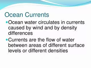
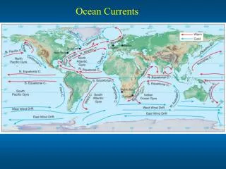
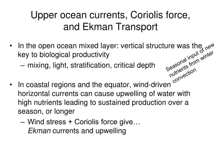
Upper ocean currents, Coriolis force, and Ekman Transport • In the open ocean mixed layer: vertical structure was the key to biological productivity • mixing, light, stratification, critical depth • In coastal regions and the equator, wind-driven horizontal currents can cause upwelling of water with high nutrients leading to sustained production over a season, or longer • Wind stress + Coriolis force give…Ekman currents and upwelling Seasonal input of new nutrients from winter convection
Time scales greater than a day introduce earth’s rotation in the dynamics – Coriolis force
Coriolis force: In a fixed frame of reference the ball travels in a straight line (Newton’s laws) In a rotating frame of reference (on the table, or Earth), the ball appears to turn. In the example, the merry-go-round is turning clockwise and the ball turns toward the left. This is the Southern Hemisphere effect. In the Northern Hemisphere the local rotation is counter-clockwise, and Coriolis force deflects motion to the right. N S http://marine.rutgers.edu/dmcs/ms320/coriolis.mov
Figure 9.1 Inertial currents in the North Pacific in October 1987 (days 275-300) measured by holey-sock drifting buoys drogued at a depth of 15 meters. Positions were observed 10-12 times per day by the Argos system on NOAA polar-orbiting weather satellites and interpolated to positions every three hours. The largest currents were generated by a storm on day 277. Note: these are not individual eddies. The entire surface is rotating. A drogue placed anywhere in the region would have the same circular motion. From van Meurs (1998).
DE • V0 is 45° to the right of the wind (in the northern hemisphere) • V0 decreases exponentially with depth as it turns clockwise (NH) • At depth z = -DE the flow speed falls to e-π = 0.04 times the surface current and is in the opposite direction (typical DEis 20 to 40 m)
Eastern Boundary Current program Progressive vector diagram. Apr-Oct 1993 water wind Progressive vector diagram, using daily averaged currents relative to the flow at 48 m, at a subset of depths from a moored ADCP at 37.1°N, 127.6°W in the California Current, deployed as part of the Eastern Boundary Currents experiment. Daily averaged wind vectors are plotted at midnight UT along the 8-m relative to 48-m displacement curve. Wind velocity scale is shown at bottom left. (From: Chereskin, T. K., 1995: Evidence for an Ekman balance in the California Current. J. Geophys. Res., 100, 12727-12748.)
Equator-ward winds on ocean eastern boundaries Pole-ward wind on ocean western boundaries Pole-ward winds on ocean eastern boundaries Equator-ward wind on oceanwestern boundaries
Wind speed and along-shelf currents at various depths along the continental shelf off northwest Africa
Wind-driven currents and upwelling On timescales longer than a few days: Earth’s rotation introduces Coriolis force • flow turns to the right (northern hemisphere) or left (southern hemisphere) • wind stressbalances Coriolis force = Ekman transportOceanographer’s rule: Ekman transport is toward the right of the wind stress(in northern hemisphere) Adjacent to a coast… Alongshore wind produces Ekman transport across-shore … causes upwelling or downwelling of a few meters per day
The magnitude of the Ekman transport is m2 s-1 τ = wind stress (Pascals or N m-2)ρ = water density (1027 kg m-3) f = Coriolis parameter = 2 Ω sin φΩ = 2π/(24 hours) = 2 x Earth rotation rate x sin(latitude)
Estimating the upwelling velocity from NJ coast data Wind data show southerly of 6 m s-1 over a few days To balance mass transport in a 2-dimensional (across-shelf/vertical) process, the average upwelling velocity (w) times the width of the upwelling zone must balance the Ekman transport. Over 1 day (86400 sec) this is 4.32 m day-1
uE Depth (z) Typical τ = 0.1 Pa f = 5x10⁻⁵ at 20N typical DE ~ 30 m uE ~ 0.1 / 1000 / 5x10⁻⁵ / 30 = 6.7 cm s-1
typical τ = 0.1 Pa f = 5x10⁻⁵ at 20N, DE ~ 30 m 50/8 = 6.25 km day-1 = 5.6 km/day
Alongshore flowshaded into page i.e. poleward Upwelling favorable wind is out of the page Across-shore flowshaded to left (offshore) 6 cm/s Density(kg m-3)
Wind-driven currents and upwelling On timescales longer than a few days: Earth’s rotation introduces Coriolis force • flow turns to the right (northern hemisphere) or left (southern hemisphere) • wind stressbalances Coriolis force = Ekman transportOceanographer’s rule: Ekman transport is toward the right of the wind stress(in northern hemisphere) Adjacent to a coast… Alongshore wind produces Ekman transport across-shore … causes upwelling or downwelling of a few meters per day