Download
1 / 8
80 likes | 227 Views
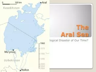
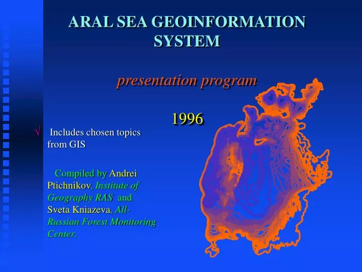
ARAL SEA GEOINFORMATION SYSTEM presentation program 1996. Includes chosen topics from GIS Compiled by Andrei Ptichnikov , Institute of Geography RAS and Sveta Kniazeva , All-Russian Forest Monitoring Center. Aral sea GIS features. 3 main themes , including :

E N D
ARAL SEA GEOINFORMATION SYSTEMpresentation program1996 Includes chosen topics from GIS Compiled by Andrei Ptichnikov, Institute of Geography RAS and Sveta Kniazeva, All-Russian Forest Monitoring Center.
Aral sea GIS features • 3 main themes, including: • - Physical geography and topography; • - Socio-economic development and resources use; • - Environmental problems and ways of their solution. • 49 thematic layers in English and Russian • Republican, regional and local levels of presentation • Detailed studies of AmuDarya and SyrDarya deltas • Remote Sensing layers from Landsat TM and MSS, Resource MSU-SK, MSU-E satellite platforms for 1973-1996 • Compatibility with GRID/GEMS specifications • Compiled using PC ARC-INFO and IDRISI software in UTM projection • Scales from 1:4 000 000 to 1:25 000. • Visualization of maps - using ArcView 2 software
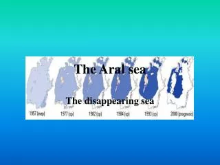
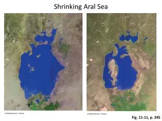
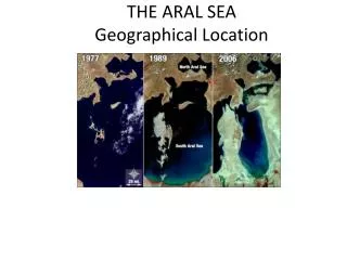
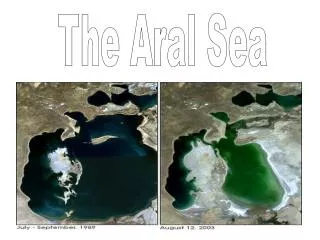
Physical geography and topography Isobates (m) • Batimetry • Fall of the Aral Sea level since 1960 to 2000 yy 0 1 1975 2 3 4 5 6 7 8 9 1960 10 12 14 16 18 20 22 2000 24 25 26 28 30 35 40 45 1990 50 55 60 65
ECOLOGICAL ISSUES • Environment pollution Amount of salt-dust deposits from dry bottom of the Aral sea Fall of salt and dust > 20 tons/sq.km Fall of salt and dust > 80 tons/sq.km Fall of salt and dust > 200 tons/sq.km Fall of salt and dust > 600 tons/sq.km Center of salt and dust transfer Aral sea Administrative boundaries Rivers Lakes
Rehabilitation measures ECOLOGICAL ISSUES Forecasted ecosystems in the AmuDarya delta in 2000 - 2005 years Halophyte shrubs and reeds Desertic hemihalophyte No data Takyr without vegetation Desertified halophyte shrubs Xerohalophyte shrubs Desiccated tugay complexes Salinized tugay shrub complexes Desiccating and salinizing tugay complex Semidesertic hemihalophyte Halophyte shrubs Landriv
Background (<0.5) Verylow (0.5-06) Low (06-12) Moderate (12-18) High (18-24) Very high (24-30>) Dynamics of maligant diseases in Karakalpakia ( % ) 1990 7,8 9,9 1989 7,5 1988 9,5 1987 8,7 1986 1985 7,4 1984 7,1 7,2 1983 7,1 1982 5,8 1981 4,5 1980 4 0 2 6 8 10 • Public health Socio-Economic development Aral sea Medical anomalies, cases per 10000 Muinak Kungrad Tachtakupyr Bozatau Kanlikuly Chimbay Chumanay Kegeily Berouny Nukus Karauziak Ellikala Turtkul Irgizsky Chelkarsky Bayganinsky Aralsky Suzaksky Aral sea Kazalinsky Kungradsky Kzylkumsky Tamdynsky Peshkunsky
Socio-economic development • Data by Rainer Ressl, Germany • Water management and irrigation Irrigation and drainage channel network
Zones of ecological disaster ECOLOGICAL ISSUES Zones with different criticalitiy of ecological situation In AmuDarya delta Aral Sea Muinak • Type of cituation: • Catastrophic • Disaster • Critical • Strained • Lakes • Irrigated fields Usturt plateau Nukus