Download
1 / 6

E N D
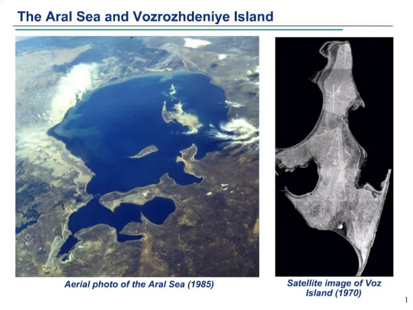
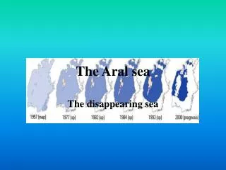
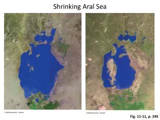
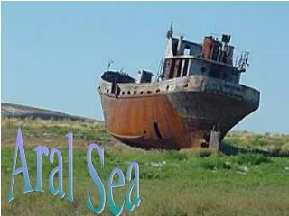
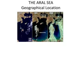
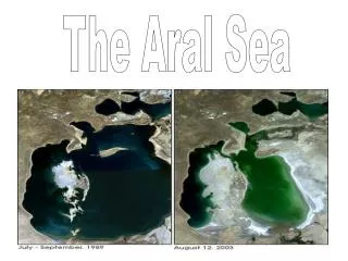
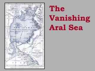
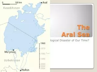
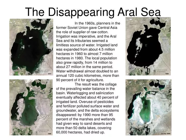
The Disappearing Aral Sea In the 1960s, planners in the former Soviet Union gave Central Asia the role of supplier of raw cotton. Irrigation was imperative, and the Aral Sea and its tributaries seemed a limitless source of water. Irrigated land was expanded from about 4.5 million hectares in 1960 to almost 7 million hectares in 1980. The local population also grew rapidly, from 14 million to about 27 million in the same period. Water withdrawal almost doubled to an annual 120 cubic kilometres, more than 90 percent of it for agriculture. The result was the collage of the prevailing water balance in the basin. Waterlogging and salinization eventually affected about 40 percent of irrigated land. Overuse of pesticides and fertilizer polluted surface water and groundwater, and the delta ecosystems disappeared: by 1990 more than 95 percent of the marshes and wetlands had given way to sand deserts and more than 50 delta lakes, covering 60,000 hectares, had dried up.
Satellite Images The brightness of a cloud in the visible image is determined by its height, thickness, and amount of water droplets. High clouds that drape over the Earth like blankets have lots of particles and scatter a lot of sun light. They appear white in a visible image. Fog is also very easy to see on visible satellite images. In water vapor images, black indicates low amounts of water vapor and milky white indicates high concentrations. Bright white corresponds to high clouds. Water vapor images provide information in all regions, even those that lack clouds. IR imagery can be used to distinguish low clouds from high clouds. Low clouds are relatively warm and appear gray in satellite IR images. Thick cold clouds, like the tops of thunderstorms, appear bright white. An of IR satellite images over visible images is that IR images are available day and night. Color composite images are made from the combination of visible, IR, and water vapor satellites. The green colors are seen in warm dry areas, while the blues are in warm humid areas.
Land Use/Land Cover Change By using the LANDSAT satellite we can see the change in the land cover between 1988 (top) and 1996 (bottom) in Shenzhen, China. On the right are the true color images and on the left are the false color composites. In the false color composites the red represents vegetation while the white represents developed areas.
Yellow River Change Looking at the satellite images of the Yellow River in China, we can see how the development along the coast has changed the river delta. The light white colors seen in the water are sediment and pollution.
Typhoon Fitow Typhoon Fitow as a tropical depression in the western Pacific on August 28th. After just two days, it intensified into a typhoon. The storm struck Japan near Tokyo on September 6th and killed two people. These are two different images of the typhoon taken on the morning on September 4th. The water vapor image (above) shows lots of moisture around the storm, while the colorized infrared images shows cold high cloud tops.
Shiveluch Volcano On March 29, 2007, the Shiveluch Volcano on the Russian Federation's Kamchatka Peninsula erupted, sending an ash cloud skyward roughly 32,000 feet. The image on the right taken by NASA’s MODIS satellite captured the eruption and the ash plume.