Download
1 / 20
200 likes | 318 Views
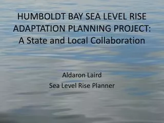
HUMBOLDT BAY SEA LEVEL RISE ADAPTATION PLANNING PROJECT: A State and Local Collaboration. Aldaron Laird Sea Level Rise Planner. HUMBOLDT BAY Shoreline Inventory, Mapping, and Sea Level Rise Vulnerability Assessment. Tuluwat Wiyot World Renewal Site, 2010, 1’ sea level rise.

E N D
HUMBOLDT BAY SEA LEVEL RISEADAPTATION PLANNING PROJECT:A State and Local Collaboration Aldaron Laird Sea Level Rise Planner
HUMBOLDT BAYShoreline Inventory, Mapping, and Sea Level Rise Vulnerability Assessment Tuluwat Wiyot World Renewal Site, 2010, 1’ sea level rise
Shoreline Type Artificial=75%, 77 miles Natural=25%, 26 miles
Shoreline Structure • Dike = 53%, 41 miles • Railroad = 14 %, 11 miles
Shoreline Cover • Exposed = 9 miles • Vegetated = 65 miles • Fortified = 27 miles
King High Tide and Storm SurgeNew Years Eve 2005 Arcata Bay 1.7’ sea level rise, 2005
Diked Shoreline Overtopping(miles) Sea Level Rise 0’, 1’, 2’, 3’, & 6’
HUMBOLDT BAY SEA LEVEL RISE ADAPTATION PLANNING PROJECT Purpose:Support informed decision-making and encourage a unified, consistent regional adaptation strategy to address the hazards associated with sea level rise in the Humboldt Bay region. Partners: • Humboldt County • Cities of Eureka and Arcata • Humboldt Bay Harbor District • North District Coastal Commission
WHY COLLABORATE Coastal Hazards and Sea Level Rise Do Not Recognize Political Boundaries
Basic Adaptation Planning Strategy We Cannot Manage or Protect the ShorelineParcel by Parcel,We Need to Address EntireHydrologic Units
WHY COLLABORATE • Sea Level Rise Adaption Planning Will Require Integration of Coastal Commission Development Permit and Local Coastal Program: Policies and Standards. • Complimentary and Overlapping Jurisdictions.
Mosaic of Permitting and Planning Jurisdictions • Coastal Commission: Retained and Federal • Humboldt County • City of Eureka • City of Arcata
Affected Planning AreasCoastal Hazards vs. Sea Level Rise Tsunami & Flood Zones 6 foot Inundation 3.0 meters 6.0 meters 2.0 meters
Coastal Commission Strategic Plan Climate Change Goal & Objective • Address Climate Change through LCP Planning, Coastal Permitting, Inter-Agency Collaboration, and Public Education • Develop Planning and Permitting Policy Guidance [Document] for Addressing the Effects of Climate Change on Coastal Resources
Coastal Planning & Permitting • Planning: Land Use Policies & Standards • Local Coastal Programs : County & Cities • Permitting: Regulatory Policies & Standards • Retained Jurisdiction Areas: Commission-Chapter 3 Policies; Coastal Development Permit • Federal Lands/Actions: Commission-Chapter 3 Policies; Consistency Determination • Local Coastal Programs: County & Cities-LCP Policies; Coastal Development Permit