Download
1 / 70
700 likes | 1.15k Views
WEATHER AWARENESS Joe Sienkiewicz Science and Operations Officer NOAA Ocean Prediction Center www.opc.ncep.noaa.gov NOAA Forecast Responsibility High Seas Warning Categories GALE – 34-47 knots Force 8/9 STORM – 48-63 knots Force 10/11

E N D
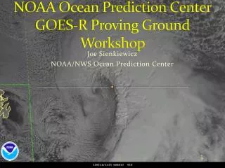
WEATHER AWARENESS Joe Sienkiewicz Science and Operations Officer NOAA Ocean Prediction Center www.opc.ncep.noaa.gov
NOAA Forecast Responsibility High Seas Warning Categories GALE – 34-47 knots Force 8/9 STORM – 48-63 knots Force 10/11 HURRICANE FORCE - >64 knots Force 12
NOAA Forecast Responsibility Wind Warning Categories GALE – 34-47 knots Force 8/9 STORM – 48-63 knots Force 10/11 HURRICANE FORCE - 64 knots and greater Force 12 Tropical Cylone Warning Categories TROPICAL STORM – 34-63 knots Force 8-11 HURRICANE - >64 knots Force 12
NWS Ocean Prediction Center Responsibilities High Seas Text • North Pacific and North Atlantic Offshore Waters Forecasts • New England Waters Mid - Atlantic Waters to 250 nm Washington and Oregon Waters California and Northern Mexican Waters Weather Fax Graphic Products • North Pacific and North Atlantic Surface, 500 mb, Sea State analyses Surface and 500 mb Forecasts to 5 days • WARNINGS GALE STORM HURRICANE FORCE
NOAA/NWS Ocean Prediction Center Offshore Zones
Offshore Waters Forecast ANZ089-182030- 1030 AM EDT SUN MAR 18 2007 .SYNOPSIS FOR MID ATLC WATERS... HIGH PRES WILL BUILD E INTO THE WATERS THIS AFTERNOON INTO TONIGHT...THEN PASS E OF THE AREA LATE MON. THE HIGH WILL MAINTAIN A RIDGE OVER THE SRN WATERS MON NIGHT AND TUE MORNING. A COLD FRONT WILL MOVE SE OVER THE AREA TUE... WEAKEN AND BECOME STATIONARY ACROSS THE SRN WATERS LATE TUE...THEN DISSIPATE WED MORNING. HIGH PRES WILL BUILD SE INTO THE WATERS N OF THE FRONT ON WED...THEN SPREAD OVER THE ENTIRE AREA THU.
Offshore Waters Forecast BALTIMORE CANYON TO HATTERAS CANYON OUT TO 36N 70W TO 34N 71W 1030 AM EDT SUN MAR 18 2007 . .THIS AFTERNOON...W TO NW WINDS 20 TO 30 KT. SEAS 4 TO 7 FT...EXCEPT 7 TO 13 FT E OF 1000 FMS...HIGHEST NE. .TONIGHT...NW WINDS DIMINISHING TO 10 TO 20 KT. SEAS SUBSIDING TO 3 TO 5 FT...EXCEPT TO 5 TO 10 FT E OF 1000 FMS...HIGHEST E. .MON...WINDS BECOMING VARIABLE 5 TO 10 KT BY AFTERNOON...THEN INCREASING TO S TO SW 15 TO 25 KT LATE. SEAS BECOMING 4 TO 7 FT THROUGHOUT. HIGHEST WINDS AND SEAS NW. .MON NIGHT...SW WINDS INCREASING TO 20 TO 30 KT. SEAS BUILDING TO 5 TO 10 FT. HIGHEST WINDS AND SEAS NW. .TUE...SW WINDS 20 TO 30 KT EARLY...THEN BECOMING N TO NE 15 TO 20 KT LATE. SEAS BUILDING TO 7 TO 11 FT...THEN SUBSIDING TO 4 TO 8 FT LATE...HIGHEST NE. .WED...E TO NE WINDS 15 TO 20 KT BECOMING E TO SE 10 TO 15 KT LATE. SEAS 3 TO 7 FT...BECOMING HIGHEST SE. .THU...S TO SE WINDS 10 TO 15 KT. SEAS BECOMING 3 TO 5 FT . $$
Communications How can you receive weather warnings and forecasts? INMARSAT NAVTEX NOAA Weather Radio E-mail Single Side - Band Weatherfax SAT phone
Surface Charts Analysis, 24, 48, 96 HR Forecasts Fronts Isobars Pressure Centers 24 hour forecast of motion / intensity WARNINGS
Microwave SEA SURFACE TEMPERATURE Cyclone Formation Areas Tropical Cyclone Formation Areas Bermuda
SPAWNING GROUND FOR T-STORMS THE GULF STREAM
Surface Analysis 1200 UTC 17 Mar
NCEP GFS PMSL 2m Temp
Sea Surface Temp Deg C
OPC Gridded Wave Heights 1200 UTC 17 Mar
Norwegian Dawn Jan 2005
MATURE GROWING
MAMMATUS GREEN TINGE
SQUALL LINES MAMMATUS MAMMATUS MAMMATUS
CELL MOVEMENT X LINE MOVEMENT
CELL MOVEMENT LINE MOVEMENT NOAA WEATHER RADIO IS YOUR CONNECTION TO THE NWS DOPPLER RADAR NETWORK
Thunderstorms Squall drill Down and stowed Anchor Tether in - ahead of time Assigned tasks
THUNDERSTORM TIPS Know the forecast! NOAA WX Radio Fronts, troughs, boundaries Watch the sky!!! Gulf Stream Flow parallel to the Stream Max activity at night AM Radio Radar (rain clutter/sea clutter) Act early!