Download
1 / 34
340 likes | 460 Views
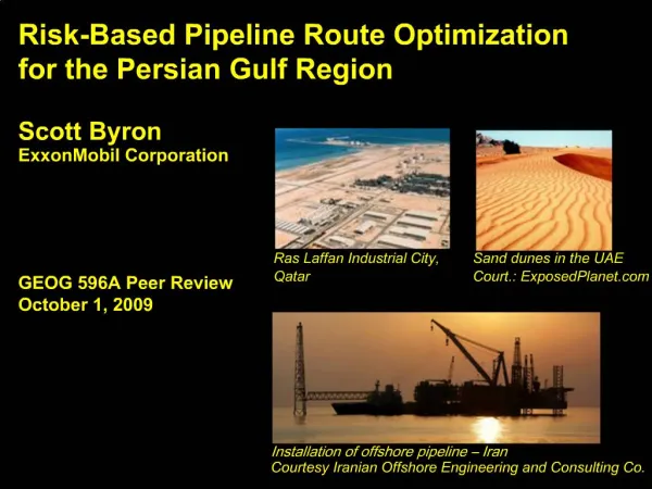
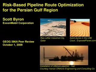
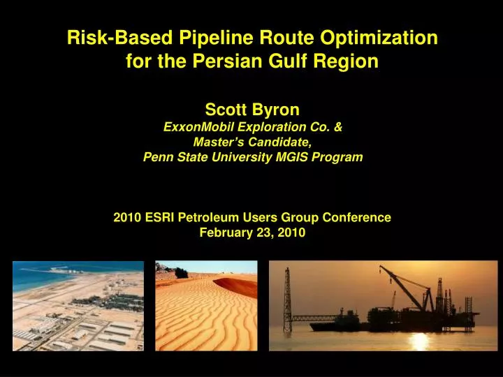
Risk-Based Pipeline Route Optimization for the Persian Gulf Region Scott Byron ExxonMobil Exploration Co. & Master’s Candidate, Penn State University MGIS Program 2010 ESRI Petroleum Users Group Conference February 23, 2010. Presentation Overview. Project overview Analysis methodology

E N D
Risk-Based Pipeline Route Optimization for the Persian Gulf Region Scott Byron ExxonMobil Exploration Co. & Master’s Candidate, Penn State University MGIS Program 2010 ESRI Petroleum Users Group Conference February 23, 2010
Presentation Overview • Project overview • Analysis methodology • Results & Conclusion Courtesy: NASA 2010 ESRI PUG Conference
Project Overview 2010 ESRI PUG Conference
Project Objectives • Proof of concept • Create risk maps by Identifying & weighting analysis risk factors • Test system against existing pipelines Qatar – Abu Dhabi – Oman Pipeline Courtesy: Oil & Gas Journal 2010 ESRI PUG Conference
The Persian Gulf region topography & bathymetry Why Focus on Risk? • New pipelines will encounter high-risk environments • People can easily perceive risks • Risk management improves project performance • Must apply internal safety & risk management policies Key Map ~90m (Approx. depth of Persian Gulf) -1,788m 0m 2,863m 2010 ESRI PUG Conference
The Persian Gulf region topography & bathymetry Constraints • Availability of experts • No marine examples • Reliance on public data • Expectation that low risk path will equate to shortest, lowest cost path Key Map ~90m (Approx. depth of Persian Gulf) -1,788m 0m 2,863m 2010 ESRI PUG Conference
Analysis Methodology 2010 ESRI PUG Conference
Construction 10 risks Operation 13 risks Socio-Economic 7 risks Environmental 6 risks Risk Categories Risk Factor Identification • 36 risk factors identified • 19 – terrestrial, 11 – marine, 6 - both • Divided into 4 categories 2010 ESRI PUG Conference
Risk Scores Formal Risk Analysis • Probability of Occurrence & Potential Impact scores combined for Risk Score • High priority risks have Risk Score >= 3.0 • High priority risks used in weighting methods Risk Count = High Priority Risks 2010 ESRI PUG Conference
Weighting Methodology Simple Weighted Index • Factors evaluated independently • Evaluated 21 risks Increasing risk 2010 ESRI PUG Conference
Factor A Factor B > Weighting Methodology Pair-Based Comparison Overview • Evaluating Brown & Peterson method, Analytical Hierarchy Process • Factors compared to each other • Data collected via survey • Fewer risks evaluated Factor C Factor A < Factor C Factor B < Factor C Factor A Factor B > > 2010 ESRI PUG Conference
Frequency matrix for 10 respondents Weighting Methodology Brown & Peterson Method • Captures selection frequency • Is row factor riskier than column factor? • No factor categories • Simple calculation of weights Factor ‘s column sum Maximum selection # = Weight 2010 ESRI PUG Conference
Analysis Problem Category 1 Category 2 Factor A Factor C Factor D Factor B Weighting Methodology Analytical Hierarchy Process • Captures Degree of importance (How much riskier?) on scale of 1 – 7 (similar – significantly riskier) • Weights categories • Uses matrix similar to BP method • Weights categories • Complex weight calculation 2010 ESRI PUG Conference
Analysis Problem Category 1 Weight = 1.00 Category 2 Weight = 1.5 Factor A Weight = 4.28 Factor C Weight = 6.1 Factor B Weight = 1.00 Factor D Weight = 4.52 Weighting Weighting Methodology Analytical Hierarchy Process Steps • Sum each column • Divide all cell values by column sum • Sun each row • Divide all row sums by smallest row sum • Divide by combined row sums • Multiply by Category weights, repeat steps 4 & 5 2010 ESRI PUG Conference
Results 2010 ESRI PUG Conference
Low High Low High Low High Top High Priority Risks Seismic Steep Slope (>5%) Commercial Shipping Landslide Crossings Reefs & Spill Windows High risk areas River, road, rail or pipe Spill response window (2 day) Coral reefs 2010 ESRI PUG Conference
Final Risk Surfaces Simple Weighted Index Brown & Peterson Analytical Hierarchy Process 0 0.424 0 0.466 0 0.514 • Land riskier than ocean due to higher number of land risks • Zagros has highest risk • Less ocean – land distinction • Zagros is riskiest • Further loss of ocean – land distinction • Exaggerated risk variation 2010 ESRI PUG Conference
The IGAT 4 pipeline, Iran Validation IGAT 4 Pipeline • Land oil pipeline • Crosses mountains, active earthquake area • ~$1 billion Key Map 2010 ESRI PUG Conference
Alignments on BP Risk Map Validation IGAT 4 Pipeline • SWI shortest, has greater slope variability • BP, AHP have best match • Key risks: seismic, slope, landslide, crossings Key Map 2010 ESRI PUG Conference
Validation IGAT 4 Pipeline 2010 ESRI PUG Conference
The Dolphin Pipeline, Qatar - UAE Validation Dolphin Pipeline • Marine gas pipeline • Crosses highly developed area • $3.5 billion Key Map 2010 ESRI PUG Conference
Alignments on SWI Risk Map Validation Dolphin Pipeline • SWI has best match • BP, AHP similar, but route southward • Key risks: commercial shipping, pipeline crossings, coral reefs & spill windows Key Map 2010 ESRI PUG Conference
Validation Dolphin Pipeline 2010 ESRI PUG Conference
Conclusion 2010 ESRI PUG Conference
Learnings • Risk approach is valid • Lowest risk path: pair-based • Shortest path: SWI • Data quality impacts results • Finer resolution needed • Reevaluate some factors for coverage and weight 2010 ESRI PUG Conference
Questions? Dubai, UAE 2010 ESRI PUG Conference
Appendix 2010 ESRI PUG Conference
List of Risk Factors 2010 ESRI PUG Conference
List of Risk Factors (Con’t) 2010 ESRI PUG Conference
Resources Applying AHP in Weighting GIS Model Criteria. Retrieved from http://www.innovativegis.com/basis/Supplements/BM_Sep_03/T39_3_AHPsupplement.htm Brown T.C., & Peterson G.L. (2009). An enquiry into the method of paired comparison: Reliability; scaling; and thurstone's law of comparative judgment. USDA Forest Service - General Technical Report RMRS-GTR. (216 RMRS-GTR), 1-98. http://www.fs.fed.us/rm/pubs/rmrs_gtr216.pdf Longley, P. A., Goodchild, M. F., MaGuire, D. J. & Rhind, D. W. (2005). Geographic Information Systems and Science, 2nd Ed.. London: John Wiley& Sons, Ltd.. 2010 ESRI PUG Conference
Resources (Con’t) Montemurro D., Barnett S., & Gale T. (1998). GIS-based process helps TransCanada select best route for expansion line. Oil and Gas Journal. 96(25), 63-71. Saaty T.L., Vargas L.G., and Dellmann K. 2003. The allocation of intangible resources: The analytic hierarchy process and linear programming. Socio-Economic Planning Sciences. 37 (3):169-184. Pipelines Braestrup, Mikael W. Design and Installation of Marine Pipelines.. Blackwell Publishing. Online version available at: http://knovel.com.ezaccess.libraries.psu.edu/web/portal/browse/display?_EXT_KNOVEL_DISPLAY_bookid=1384&VerticalID=0 2010 ESRI PUG Conference
Resources (Con’t) Guo, Boyun; Song, Shanhong; Chacko, Jacob; Ghalambor, Ali Offshore Pipelines. Elsevier. Online version available at: http://knovel.com.ezaccess.libraries.psu.edu/web/portal/browse/display?_EXT_KNOVEL_DISPLAY_bookid=1258&VerticalID=0 Data Global Seismic Hazard Program. (2009 August 27). Middle East Hazard Map. Retrieved from: http://www.seismo.ethz.ch/GSHAP/ National Center for Ecological Analysis and Synthesis. (2009, August 2). Commercial Activity (Shipping) Dataset. Retrieved from: http://www.nceas.ucsb.edu/GlobalMarine/impacts 2010 ESRI PUG Conference
Resources (Con’t) NationMaster.com. (2009, September 22). Oil Consumption (per Capita) (Most Recent) by Country. Retrieved from: http://www.nationmaster.com/graph/ene_oil_con_percap-energy-oil-consumption-per-capita Tupper, M., Tewfik, A., Tan, M.K., Tan, S.L., The, L.H., Radius, N.J., & Abdullah, S. (2009, September 2) ReefBase: A Global Information System on Coral Reefs [Online]. Retrieved from: http://www.reefbase.org United Nations Environmental Program. (2009, August 18). Global Environment Outlook (GEO) Data Portal. Retrieved from: http://geodata.grid.unep.ch/ United States Geological Survey. (2009, September 2). Earthquake Hazards Program: Epicenters Database. Retrieved from: http://neic.usgs.gov/neis/epic/epic_rect.html 2010 ESRI PUG Conference
Resources (Con’t) World Database on Protected Areas. (2009, August 5). Annual Release 2009 Dataset. Retrieved from: http://www.wdpa.org/Default.aspx 2010 ESRI PUG Conference