Download
1 / 12
130 likes | 268 Views
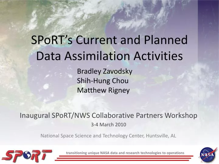
SPoRT’s Current and Planned Data Assimilation Activities. Bradley Zavodsky Shih-Hung Chou Matthew Rigney. Inaugural SPoRT/NWS Collaborative Partners Workshop 3-4 March 2010. National Space Science and Technology Center, Huntsville, AL.

E N D
SPoRT’s Current and Planned Data Assimilation Activities Bradley Zavodsky Shih-Hung Chou Matthew Rigney Inaugural SPoRT/NWS Collaborative Partners Workshop 3-4 March 2010 National Space Science and Technology Center, Huntsville, AL transitioning unique NASA data and research technologies to operations
Relevance to NWS WFOs • SPoRT focuses on improvements to short-term, regional weather forecasts using unique satellite products and capabilities • One method to improve forecasts is through assimilation of satellite observations • Blend observations with model first-guess to provide updated analysis of the atmosphere • Analyses are then used to initialize model runs • Large data voids over Pacific Ocean, Gulf of Mexico, and Mexico • Atmospheric rivers and moisture return • Convective potential • Improvements to precipitation forecasts with assimilation of AIRS profile data • SPoRT can support WFOs by: • Sharing expertise with assimilating satellite data sets • Providing satellite-enhanced 3D analyses for nowcasting purposes • Providing satellite-enhanced initial conditions for local model runs • Lessons learned can be applied to current and future hyperspectral sounders such as IASI (EUMETSAT) or CrIS (NOAA/NASA) transitioning unique NASA data and research technologies to operations
AIRS 101 • Aboard Aqua Polar Orbiter • Early afternoon equatorial crossing • Twice-daily data over SEUS at ≈0700 and ≈1800 UTC (±1 hr) • Radiances: 15-km spatial resolution at nadir • 2378 spectral channels • 3.7 – 15.4 μm • Profiles: 50-km spatial resolution at nadir • 3x3 radiance footprints (golfball) • 54 levels below 100 hPa (100 total) • Coupling with AMSU allows for retrievals in clear and partly cloudy scenes • Accuracy of 1K in 1-km layer; 10-15% RH in 2-km layer in troposphere transitioning unique NASA data and research technologies to operations
Methodology for Profile Assimilation AIRS QI’s for 17 Jan 2007 • L2 Version 5 temperature and moisture profiles • 28-level standard product • Land and water soundings w/ separate errors • Quality control using Pbest value in each profile • Sensitivity study assimilating only AIRS profiles Current Analysis Error Characteristics BKGD AIRS water AIRS land • B-matrix from “gen_be” • WRF initialized with 40-km NAM at 0000 UTC (cold start) • 12-km analysis and model grid • Short WRF forecast used as background for analysis transitioning unique NASA data and research technologies to operations
Profile Precipitation Verification • Combined forecast results for 12-48 hr forecasts of precipitation for 37-days from winter 2007 • Equitable Threat Score shows forecasted and observed precipitation matches • Improvement at all thresholds except lightest • Best results for moderate thresholds (28% at 12.7 mm/6h, 14% at 19.05 mm/6h, 90% at 25.40) • Bias score shows F/O • Improved (closer to 1) for all thresholds transitioning unique NASA data and research technologies to operations
12-13 February 2007 Case 2/12/07 1200Z Surface Analysis 2/13/07 1200Z Surface Analysis Developing front draped across Texas 2/12/07 0742-0800Z AIRS 2/12/07 0800Z GOES IR Image High-quality AIRS profiles in clear skies ahead of front Pressure (hPa)
A Sample Analysis Impact Gulf of Mexico soundings at ≈08 UTC on 12 February 2007 • Figure at right shows how assimilation of AIRS temperature and moisture profile impacts a sample Skew-T • Warms near-surface; cools upper levels • Result is a more unstable sounding • Entire column is moistened Mid-level cooling Low-level warming BKGD AIRS ALYS Pressure (hPa) transitioning unique NASA data and research technologies to operations
Improved Moisture Forecasts • 1000 hPa dew point forecasts • Representative of boundary layer levels • NAM analysis shows large pool of 20-22oC dew points migrating from Yucatan to Gulf Coast • Control gives no hint of these warmer dew points • AIRS forecast favorably compares to NAM transitioning unique NASA data and research technologies to operations
Improved Precipitation Forecasts Control Control + AIRS Analysis “Truth” 24-h forecast valid 00Z 2/13/07 • Convective precipitation in Eastern Texas • Control (upper left) produces some rain but does not capture significant precipitation • AIRS (upper middle) reproduces convective precipitation line • Better representation of lower level moisture • CAPE values above 1800 J/kg in NAM analysis (lower right) • AIRS (lower middle) nicely represents CAPE • Control run (lower left) gives no hint of higher CAPE values 50.80 38.10 25.40 19.05 6-hr precip. 12.70 6.35 2.54 0.25 1000 hPa Td CAPE transitioning unique NASA data and research technologies to operations
Scatterometer Wind Assimilation • Planned to use QuikSCAT; now focusing on EUMETSAT’s ASCAT (METOP) • Scatterometer uses wave characteristics to calculate wind speeds at ocean surface (10m) • Assimilation of scatterometer winds should produce a better analysis of low-level winds • Improve marine forecasts • Possibly improve moisture return forecasts over Gulf • Combine with AIRS profile assimilation to create an integrated “Moisture Return Analysis” product? From Paul Chang: NOAA/NESDIS transitioning unique NASA data and research technologies to operations
Summary/Conclusions • SPoRT seeks to improve short-term, regional weather forecasts using satellite products and capabilities • Assimilation of profiles into WRF-Var produced overall improvements in precipitation forecasts • Improved CAPE and lower-level moisture for extreme precipitation event • Assimilation of scatterometer winds may give improved lower-level wind forecasts • Improved wind analyses and forecasts • Improved moisture return forecasts • SPoRT plans to begin generating a real-time 3D analysis product incorporating AIRS profile data • May be easier for forecasters to use the data in an integrated manner than from raw data alone • Nowcasting; Initializing WFO model runs • SPoRT is committed to working with WFO partners on projects to investigate the impact of assimilating satellite data into regional models to address unique forecast problems transitioning unique NASA data and research technologies to operations
Future Work • Produce a real-time 3D analysis product incorporating AIRS and (and eventually IASI) profile data over data void regions for nowcasting or for initializing local forecast runs to improve stability and moisture return forecasts • Study assimilation of scatterometer winds to better diagnose low-level wind patterns over Pacific and Gulf of Mexico • Pursue creation of an integrated “moisture return” product combining satellite profiles and satellite winds • Work closely with our WFO partners on case studies that have impacted their region with the end goal of conference or journal publications transitioning unique NASA data and research technologies to operations