Download
1 / 13
130 likes | 232 Views
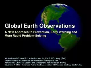
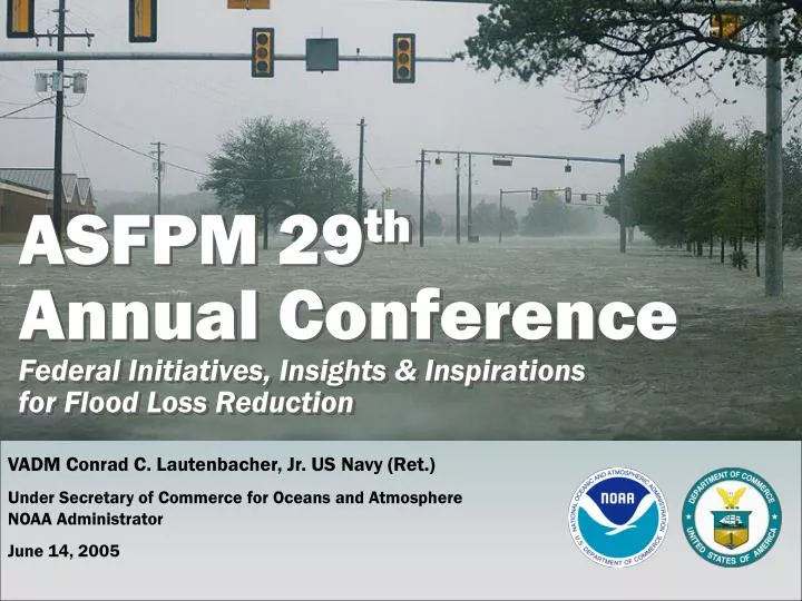
ASFPM 29 th Annual Conference Federal Initiatives, Insights & Inspirations for Flood Loss Reduction. VADM Conrad C. Lautenbacher, Jr. US Navy (Ret.) Under Secretary of Commerce for Oceans and Atmosphere NOAA Administrator June 14, 2005.

E N D
ASFPM 29thAnnual ConferenceFederal Initiatives, Insights & Inspirations for Flood Loss Reduction VADM Conrad C. Lautenbacher, Jr. US Navy (Ret.) Under Secretary of Commerce for Oceans and AtmosphereNOAA Administrator June 14, 2005
Federal Initiatives, Insights & Inspirations for Flood Loss Reduction • Initiatives: NOAA Products and Services • NOAA’s Water Forecasts • Flood Inundation Display • Height Modernization • NOAA Research Supporting Hydrometeorological Applications • NOAA All Hazards • Insights: Partnerships/Common Goals • Inspirations: Education
Initiatives: NOAA Products & ServicesNOAA’s Water Forecasts Snowpack Precipitation Soil moisture River flow Surface storage Ground water WaterPredictions for LifeDecisions Rio Grande Developed Shrubs/Grass Agriculture Wetlands Forecast Basin Forecast Point Urban Area • Flood warnings for local communities • Critical information for neighborhoods and watersheds • Water volume and soil condition forecasts Working Together: Federal Agencies, Tribal Agencies, State Agencies, Local Agencies, Private Sector, Academia
Initiatives: NOAA Products & ServicesFlood Inundation Display
Initiatives: NOAA Products & ServicesHeight Modernization • …the establishment of accurate, reliable heights using GPS technology in conjunction with traditional leveling, gravity, and modern remote sensing information. Measuring heights along evacuation routes
Initiatives: NOAA Products & ServicesTsunami Warning System • Expand existing network from 6 deep-sea buoys to 39 for enhanced tsunami detection along the U.S. coast (Pacific, Atlantic, and Caribbean) • In partnership with the USGS, improve seismic sensor data and infrastructure for better earthquake detection and warning • Expand research on forecasting impacts of tsunamis • Improve response capacity with enhanced emergency warning systems, community response plans, and public education • Work internationally to support building a global warning system
Initiatives: NOAA Products & ServicesNOAA Research Supporting Hydrometeorological Applications • Support to the National Weather Service Flood Forecast Programs • Next-generation precipitation algorithms for radar data • Systems support for multi data analysis for flood forecasts National Mosaic and QPE infrastructure will be part of a complete system to evaluate the data from multiple sources to support flood forecasting Q2 Workshop (short range QPF) Norman, OK, June 28-29th, 2005
Initiatives: NOAA Products & ServicesNOAA ALL HAZARDS NOAA Partners With State of Wisconsin Educational Communications Board (WECB) on NWR Project Training & New Purchases
InsightsPartnerships/Common Goals • NOAA, USGS, FEMA and ASFPM programs share common goals and objectives: • Minimize losses of life and property due to floods, droughts, coastal storms and other natural disasters • Provide reliable scientific information, expertise and emergency management for managing natural resources (water, biological, energy, mineral) and natural disasters • Enhance/protect natural features (beaches, dunes, wetlands & floodplains) and other coastal assets
InspirationsEducation • Risk and Vulnerability Assessment Training: • Helps coastal resource and emergency managers use the Community Vulnerability Assessment Methodology to assess a community's risk and vulnerability to hazards • Community Vulnerability Assessment Methodology Workshops • Vulnerability Assessment Techniques Workshops • Risk and Assessment Vulnerability Tool Training
InspirationsEducation • HURREVAC Inland Flood Module • Inland Flood Planning and Response Tool • Covers coastal states (Texas to Maine), Puerto Rico and U.S. Virgin Islands • Coastal No Adverse Impact Toolkit • Help manage development to decrease future flood damages • Provide long term floodplain protection • Available in 2007 (English and Spanish)
ASFPM 29thAnnual ConferenceFederal Initiatives, Insights & Inspirations for Flood Loss Reduction VADM Conrad C. Lautenbacher, Jr. US Navy (Ret.) Under Secretary of Commerce for Oceans and AtmosphereNOAA Administrator June 14, 2005