Download
1 / 28
280 likes | 284 Views
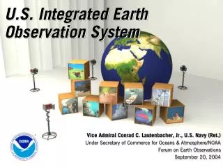
Earth Observations: A Global, National and NOAA Perspective A Presentation to the NOAA Science Advisory Board. VADM Conrad C. Lautenbacher, Jr., U.S. Navy (Ret.) Under Secretary of Commerce for Oceans & Atmosphere/NOAA March 22, 2005. MENU. Global Earth Observation System of Systems (GEOSS)

E N D
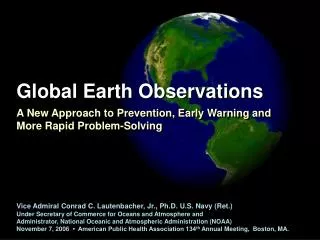
Earth Observations:A Global, National and NOAA PerspectiveA Presentation to the NOAA Science Advisory Board VADM Conrad C. Lautenbacher, Jr., U.S. Navy (Ret.) Under Secretary of Commerce for Oceans & Atmosphere/NOAA March 22, 2005
MENU • Global Earth Observation System of Systems (GEOSS) • U.S. Integrated Earth Observation System • NOAA’s Observation Systems • Challenges Ahead
Growing Interest in GEOSS Frequent Question: Why didn’t the US do more to warn? Answer: The US has been leading an international effort for the past year and a half to provide, among other benefits, a global system to reduce loss of life and property from disasters.
Plan For An Improved U.S.Tsunami Monitoring System • Enable enhanced monitoring, detection, warning & communications • Deploy 32 advanced technology DART buoys • Commit $37.5M over next 2 years • Provide: • Nearly 100% coverage for U.S. coasts • Expanded capability throughout Pacific & Caribbean basins • Part of future global observation & global tsunami warning systems
Building a Global System Our approach can be fragmented… “...it makes sense to develop a global tsunami warning system within the GEOSS framework.” • Koichiro Matsuura, UNESCO Director General (World Conference on Disaster Reduction, Kobe, Japan, January 2005) Tsunami warning system shatters on nationalistic shoals . . . or coordinated.
GEO as Coordination Mechanism • Political will of nearly 60 countries • Participation of organizations like the IOC, WMO and ISDR • These organizations don’t always talk to each other; GEO offers a mechanism to coordinate projects like an all-hazards warning system
Earth Observation Summit IIIBrussels, BelgiumFebruary 16, 2005 • 10 Year Implementation Plan for GEOSS • Resolution Endorsing Plan • Tsunami Communique
The GEO Process Earth Observation Summit I, Washington DC ad hoc GEO I, Washington, DC ad hoc GEO 2, Baveno, Italy ad hoc GEO 3, Cape Town, South Africa ad hoc GEO 4, Tokyo, Japan Earth Observation Summit II, Tokyo, Japan ad hoc GEO special session on governance, Brussels, Belgium ad hoc GEO 5, Ottawa, Canada ad hoc GEO 6, Brussels, Belgium Earth Observation Summit III, Brussels, Belgium
GEO IGeneva, SwitzerlandMay 2-4, 2005 • GEO I (GEO replaces ad hoc GEO) • Hosted by World Meteorological Organization • WMO also hosting Secretariat • “to do list” at GEO I • Establish Executive Committee • Agree to Transition Workplan • Begin Implementation of GEOSS
MENU • Global Earth Observation System of Systems (GEOSS) • U.S. Integrated Earth Observation System • NOAA’s Observation Systems • Challenges Ahead
Hon. Carlos GutierrezUS Secretary of Commerce “The United States is making the commitment to move earth observation to the next level to benefit this next generation.This is one of President Bush’s environmental priorities… …And today, I am pleased to present you with our government’s plan for an Integrated U.S. Earth Observation system.”
Like GEOSS, the US Integrated System will be: • A distributed system of systems • Links all platforms: in situ, aircraft, and satellite networks • Identifies gaps in our global capacity • Facilitates exchange of data and information • Improves decision-makers’ abilities to address pressing policy issues
U.S. Integrated Earth Observation System Health Public – Societal Imperatives Healthy Economy – Economic Imperatives Healthy Planet – Scientific Imperatives
U.S. Integrated Earth Observation System Ecosystems Water Resources Natural & Human Induced Disasters Energy Resources Sustainable Agriculture & Desertification Human Health & Well-Being Oceans Weather Information, Forecasting & Warning Climate Variability & Change
Integration: 4 Perspectives Considered in U.S. Strategic Plan • Policy and Planning Integration • Focus on specific societal benefits • Issue and Problem Focused Integration • Address a particular issue • Scientific Integration • Modeling of Earth processes • Technical Systems Integration • Coordination of observing system technology and data management systems • Account for observing system evolution
The Road Ahead for the U.S. Interagency Effort • Develop Implementation Plans for 6 Near Term Opportunities: • Data Management • Improved Observations for Disaster Warnings • Global Land Observing System • Sea Level Observing System • National Integrated Drought Information System • Air Quality Assessment and Forecast System • Establish Earth Observation Subcommittee of NSTC Committee on Environment & Natural Resources
MENU • Global Earth Observation System of Systems (GEOSS) • U.S. Integrated Earth Observation System • NOAA’s Observation Systems • Challenges Ahead
NOAA’s Role • NOAA: Where Science Creates Value • Earth observations… • Are at the core of NOAA’s mission • Support virtually every activity we perform • NOAA has… • Observing capabilities being advanced through scientific and technological research • A broad scope of domestic and international partnerships • Commitment to transform research into useful, operational information
Ecosystems Weather & Water GIS & NOAA’s Strategic Mission Goals Process developed to convert the current text based forecast product to a GIS based inundation map Geospatially enabled NOAA data combined with data from the MMS, and TX state data
Climate Commerce &Transportation GIS & NOAA’s Strategic Mission Goals NOAA’s NCDC provides surface daily and monthly data, hourly precipitation data, and 15-minute precipitation data Iceberg B-15A in McMurdo Sound, Antarctica, reported to be potentially blocking shipping access to scientific stations in the Sound
NOAA Observing System Council • Principal advisory body to the Under Secretary for NOAA's Earth observation and data management (end-to-end) activities. • Principal coordinating body for NOAA to the White House Committee on Environment and Natural Resources (CENR) Subcommittee on Earth Observations in developing an international, comprehensive, coordinated and sustained Earth observation system
NOAA Observing Systems • Integrated Observations Strategic Plan • Published in 2004 • Documents initial inventory of approximately 100 observing systems measuring 286 unique environmental parameters • Establishes strategic goals for integrated observations and data management • Feeds development of an initial baseline observing architecture, to be followed by a target architecture
MENU • Global Earth Observation System of Systems (GEOSS) • U.S. Integrated Earth Observation System • NOAA’s Observation Systems • Challenges Ahead
Data Management System for Earth Observations • Data Management Needs • New Systems mean 100-fold increase in data • Current systems already challenged • Development of browser and visualization systems • Interoperability through protocols and standards • Geospatial One-Stop initiative has enhanced interoperability among geographic components of government activities (led by Department of the Interior)
Upcoming Activities… • International • Transition workplan in development • Formation/selection of Executive Committee underway • GEO I meeting at World Meteorological Organization, May 2-4 • National • Upcoming rollout of US plan (pre-publication copy out now) • Development of Data Management Plan and Architecture • May 9-10 Public Engagement Workshop, Ronald Reagan International Trade Center
For more information… • Intergovernmental ad hoc Group on Earth Observations • http://earthobservation.org • Interagency Working Group on Earth Observations • http://iwgeo.ssc.nasa.gov • NOAA Observing System Council • http://www.nosc.noaa.gov