Download
1 / 51
520 likes | 867 Views
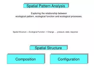
Spatial Analysis . Longley et al., chs. 14 and 15. What is spatial analysis?. Methods for working with spatial data to detect patterns, anomalies to find answers to questions to test or confirm theories deductive reasoning to generate new theories and generalizations

E N D
Spatial Analysis Longley et al., chs. 14 and 15
What is spatial analysis? • Methods for working with spatial data • to detect patterns, anomalies • to find answers to questions • to test or confirm theories • deductive reasoning • to generate new theories and generalizations • inductive reasoning • "a set of methods whose results change when the locations of the objects being analyzed change"
What is spatial analysis (cont.) • Methods for adding value to data • in doing scientific research • in trying to convince others • Turning raw data into useful information • A collaboration between human and machine • Human directs, makes interpretations and inferences • Machine does tedious, complex stuff
Early Spatial Analysis • John Snow, 1854 • Cholera via polluted water, not air • “John Snow’s pump” www.jsi.com X X X X X X X
Video http://vid01.esri.com/winmmedia/avflu.wmv http://www.esri.com/apps/esriclips/clip.cfm?ClipID=165
Categories of Spatial Analysis(Longley et al.) • Hypothesis testing • Queries and reasoning • Map & database/catalog queries, buffer, polygon overlay • Measurements • Aspects of geographic data, length, area, etc.
Categories of Spatial Analysis(Longley et al.) • Transformations • New data, raster to vector, geometric rules • Buffer, polygon overlay • Interpolation, Density Estimation, Terrain Analysis (Lab 6) • Descriptive summaries • Essence of data in 1 or 2 parameters • Spatial statistics (including fragmentation statistics) • Optimization - ideal locations, routes • Network analysis (Lab 5), Routing
Nonlinear Interpolation • When things aren't or shouldn’t be so simple • Basic types:1. Trend surface analysis / Polynomial 2. Minimum Curvature Spline 3. Inverse Distance Weighted 4. Kriging
Fitting ContinuousSurfaces to Data (1) FLAT plane (2) flat but TILTED to fit data better (3) tilted but WARPED to fit data even better
1. Trend Surface/Polynomial • point-based • Fits a polynomial to input points • When calculating function that will describe surface, uses least-square regression fit • approximate interpolater • Resulting surface doesn’t pass through all data points • global trend in data, varying slowly overlain by local but rapid fluctuations
1. Trend Surface cont. • flat but TILTED plane to fit data • surface is approximated by linear equation (polynomial degree 1) • z = a + bx + cy • tilted but WARPED plane to fit data • surface is approximated by quadratic equation (polynomial degree 2) • z = a + bx + cy + dx2 + exy + fy2
Trend Surfaces • Simplifies the surface representation to allow visualization of general trends. • Polynomials of higher order
Windows (not Microsoft’s) • generates estimates based on existing data in the “region” • “region” = “roving window” • moves about study area • summarizes data it encounters • reach (search radius) • number of samples • Direction • WHERE might you find unusual responses? • results extend non-spatial concept of central tendency
2. Minimum Curvature Splines • Fits a minimum-curvature surface through input points • Like bending a sheet of rubber to pass through points • While minimizing curvature of that sheet • repeatedly applies a smoothing equation (piecewise polynomial) to the surface • Resulting surface passes through all points • best for gently varying surfaces, not for rugged ones (can overshoot data values)
3. Inverse Distance Weighted • Each input point has local influence that diminishes with distance • estimates are averages of values at n known points within window • where w is some function of distance
point i known value zi location xi weight widistance di unknown value (to be interpolated) location x The estimate is a weighted average Weights decline with distance
IDW (cont.) • an almost infinite variety of algorithms may be used, variations include: • the nature of the distance function (w) • varying the number of points used • the direction from which they are selected
IDW (cont.) • IDW is popular, easy, but not panacea • interpolated values limited by the range of the data • no interpolated value will be outside the observed range of z values • how many points should be included in the averaging? • what to do about irregularly spaced points?
A potentially undesirable characteristic of IDW interpolation This set of six data points clearly suggests a hill profile. But in areas where there is little or no data the interpolator will move towards the overall mean. Blue line shows the profile interpolated by IDW
IDW Example • ozone concentrations at CA measurement stations 1. estimate a complete field, make a map 2. estimate ozone concentrations at specific locations (e.g., Los Angeles)
Data for IDW Example measuring stations and concentrations (point shapefile) CA cities (point shapefile) CA outline (polygon shapefile) DEM (raster)
Power of distance 4 sectors Further define interpolation
Cross validation • removing one of the n observation points and using the remaining n-1 points to predict its value. • Error = observed - predicted
Results amount of detail where there is no data generally smooth surface highs in LA, S central valley
4. Kriging • Assumes distance or direction betw. sample points shows a spatial correlation that help describe the surface • Fits function to • Specified number of points OR • All points within a window of specified radius • based on an analysis of the data, then an application of the results of this analysis to interpolation • Most appropriate when you already know about spatially correlated distance or directional bias in data
Kriging (cont.) • Involves several steps • Exploratory statistical analysis of data • Variogram modeling • Creating the surface based on variogram
Explore with Trend analysis • You may wish to remove a trend from the dataset before using kriging. The Trend Analysis tool can help identify global trends in the input dataset.
SemiVariogram inKriging how avg. difference between values at points changes with distance between points Range – no more surprises sill A semivariogram. Each cross represents a pair of points. The solid circles are obtained by averaging within the ranges or bins of the distance axis. The solid line represents the best fit to these five points, using one of a small number of standard mathematical functions.
Kriging Results • once the variogram has been developed, it is used to estimate distance weights for interpolation • computationally very intensive w/ lots of data points • estimation of the variogram complex • No one method is absolute best • Results never absolute, assumptions about distance, directional bias
Kriging Example Surface has no constant mean Maybe no underlying trend surface has a constant mean, no underlying trend allows for a trend binary data
Kriging Result • similar pattern to IDW • less detail in remote areas • smooth
IDW vs. Kriging • Kriging appears to give a more “natural” look to the data • Kriging avoids the “bulls eye” effect • Kriging gives us a standard error Kriging IDW
Which Method to Use? • Trend - rarely goes through your original points • Spline - best for surfaces that are already smooth • Elevations, water table heights, etc. • IDW - assumes variable decreases in influence w/distance from sampled location • Interpolating a surface of consumer purchasing power for a retail store • Kriging - if you already know correlated distances or directional bias in data • Geology, soil science
Which to Use? cont. • Kriging - Allows user greater flexibility in defining the model to be used in the interpolation • Tracks changes in spatial dependence across study area (may not be linear) • Produces • a smooth, interpolated surface • variogram (how well pixel value fits overall model) • Diagnostic tool to refine model • Want to get variances close as possible to zero
Interpolation Software • ArcGIS with Geostatistical Analyst • ArcView 3.2 • Surfer (Golden Software) • Surface II package (Kansas Geological Survey) • GEOEAS (EPA) • Spherekit (NCGIA, UCSB) • Matlab
TREND (Grid function) SPLINE (Grid function, minimum curvature spline) IDW (Grid function) KRIGING (Arc command) ArcInfo Workstation Interpolation Methods
MakeTrend(Avenue request) Interpolate Surface(menu choice) or MakeSpline(Avenue request) Interpolate Surface(menu choice) or MakeIDW(Avenue request) MakeSemivariogram and MakeKriging(Avenue requests) Interpolation in ArcView 3.2
Research Issues... • "easy to use" • choose correct technique w/o having a Ph.D. in math or stats • “effective" • techniques should be informative, • highlighting the essential nature of the data and/or surface • meet needs of the study • “natural language” interface • series of questions about the intentions, goals and aims of the user and about the nature of the data • articles on prototypes in the literature
Gateway to the Literature • Lam, N.S.-N., Spatial interpolation methods: A review, Am. Cartogr., 10 (2), 129-149, 1983. • Gold, C.M., Surface interpolation, spatial adjacency, and GIS, in Three Dimensional Applications in Geographic Information Systems, edited by J. Raper, pp. 21-35, Taylor and Francis, Ltd., London, 1989. • Robeson, S.M., Spherical methods for spatial interpolation: Review and evaluation, Cartog. Geog. Inf. Sys., 24 (1), 3-20, 1997. • Mulugeta, G., The elusive nature of expertise in spatial interpolation, Cart. Geog. Inf. Sys., 25 (1), 33-41, 1999. • Wang, F., Towards a natural language user interface: An approach of fuzzy query, Int. J. Geog. Inf. Sys., 8 (2), 143-162, 1994. • Davies, C., and D. Medyckyj-Scott, GIS usability: Recommendations based on the user's view, Int. J. Geographical Info. Sys., 8 (2), 175-189, 1994. • Blaser, A.D., M. Sester, and M.J. Egenhofer, Visualization in an early stage of the problem-solving process in GIS, Comp. Geosci, 26, 57-66, 2000.