Download
1 / 17
170 likes | 331 Views
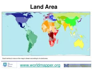
Fuzzy Land Cover/Land Use Ontologies. Ola Ahlqvist, PhD Department of Geography The Ohio State University ahlqvist.1@osu.edu. Land use and land cover data. Importance climate modeling, urban planning, landscape change assessment, hydrological models, and unknown future issues

E N D
Fuzzy Land Cover/Land Use Ontologies Ola Ahlqvist, PhD Department of Geography The Ohio State University ahlqvist.1@osu.edu
Land use and land cover data • Importance • climate modeling, urban planning, landscape change assessment, hydrological models, and unknown future issues • Demand that data can be re-purposed for a variety of end uses • Initiatives • Standards: National Vegetation Classification Standard (Vegetation Subcommittee, 1997), the Nordic Landscape Monitoring Project (Groom, 2005), the CORINE Land Cover (CEC, 1995 and 1999; Bossard et al., 2000), the standard classification for land cover of South Africa (Thompson, 1996), GLC2000 (Bartholomé and Belward, 2005) , UNEP/FAO Land Cover Classification System (LCCS) (Di Gregorio and Jansen, 2000)
A traditional land cover taxonomy • Easily translated to an ontology description language as class-subclass relations and class specific properties • But no agreement on a unified taxonomy • CORINE • GlobCover • MODIS/IGBP • Not even our own USGS system could stay the same from one time to the other • National Land Cover Data (NLCD) used slightly different classes in 1992 and 2001
11 Open Water 21 Developed, Open Space 22 Developed, Low Intensity 23 Developed, Medium Intensity 24 Developed, High Intensity 31 Barren Land (Rock/Sand/Clay) 41 Deciduous Forest 42 Evergreen Forest 43 Mixed Forest 81 Pasture/Hay 82 Cultivated Crops 90 Woody Wetlands 95 Emergent Herbaceous Wetlands National Land Cover Data (NLCD) change example Different classification systems create problems! ? ?
Zimbabwe Sudan Turkey Tanzania United UNESCO States China Jamaica Estonia Same issues around global definitions of “forest” 16 14 12 10 8 Tree height (m) 6 4 2 0 0 20 40 60 80 100 Canopy cover (%) after Lund (2006) and Comber et al. (2006)
Solutions? • The FAO and UNEP Land Cover Classification System (LCCS) • multi-purpose classification system • capable of comparing land cover types across taxonomies • uses diagnostic criteria rather than pre-defined classes • Now at v.3 - Land Cover Meta Language (LCML) • a predefined set of land cover basic objects are enriched on their semantic significance with external qualities and attributes • Use of UML and XML for formal description of an ontology • http://www.glcn.org/ont_2_en.jsp
Parameterization using FAO’s Land Cover Classification System v.2 • Unnecessarily crude where detail is actually available
With v.3 - Land Cover Meta Language (LCML) U.S. NLCD 1992 Low Intensity Residential
Attributes values allow for evaluation of category semantics • Two metrics of semantic relations • Distance • Overlap U.S. NLCD 1992 Low Intensity Residential U.S. NLCD 2001 Developed, Low Intensity
Attributes values allow for evaluation of category semantics • Two metrics of semantic relations • Distance • Overlap • Bivariate color scheme • Different types of change Similar but Disjoint classes Very different classes Overlap-1 Very similar classes Class/ subclass relationship Distance
But land cover/use concepts are rarely clear cut… • Fuzzy set theory and fuzzy numbers allow for vagueness “Closed Tree Cover” “Open Shrub Cover” “Sparse vegetation”
…and they typcially have many attribute dimensions U.S. NLCD 1992 Low Intensity Residential U.S. NLCD 2001 Developed, Low Intensity 1 2 3 4 5 6 7 8 9 10 11 12 13 14 15 16 1 2 3 4 5 6 7 8 9 10 11 12 13 14 15 16 Comparison in 16D can be summarized
1992 Open Water Low intensity residential High intensity residential Commercial/ Industrial/ Transportation Quarries/ Strip Mines/ Gravel Pits Transitional Deciduous Forest Evergreen Forest Mixed Forest Pasture/Hay Row Crops Urban/ Recreational Grasses Woody Wetlands Emergent Herbaceous Wetlands Semantic relations summarized in matrix form Overlap-1 Dissemblance
… with the semantic similarity metrics we can compare within and across conceptual spaces National Land Cover Data MDS of class definitions 1992 2001 Water Developed Barren Vegetated (Forest) Shrub land Non-natural woody Grasslands Herbaceous planted Wetlands
Summarize landscape change from a cognitive perspective An overall, spatially explicit evaluation of land cover change throughout the study area Nuanced assessments of graded changes even for heterogeneous, nominal land cover types Semantic change image
Some references Ahlqvist, O., 2004, A parameterized representation of uncertain conceptual spaces, Transactions in GIS, 8(4), 493-514. Ahlqvist, O., 2008, Extending post classification change detection using semantic similarity metrics to overcome class heterogeneity: a study of 1992 and 2001 National land Cover Database changes, Remote Sensing of Environment, 112(3):1226-1241 Comber, A., Fisher, P., and Wadsworth, R., 2006, What is land cover?, Environment and Planning B, 32: 199-209 Gärdenfors, 2000, Conceptual Spaces: The geometry of thought, MIT press. Kaufman A and Gupta M M, 1985, Introduction to fuzzy arithmetic. New York, Van Nostrand Reinhold Company Lund, H.; Gyde (coord.) 2006. Definitions of Forest, Deforestation, Afforestation, and Reforestation. [Online] Gainesville, VA: Forest Information Services. http://home.comcast.net/~gyde/DEFpaper.htm. Global Land Cover Network (GLCN) - http://www.glcn.org/index_en.jsp - Land cover Ontology - http://www.glcn.org/ont_0_en.jsp - ISO standard - Part 1 & 2http://www.iso.org/iso/iso_catalogue/catalogue_tc/catalogue_detail.htm?csnumber=32562 http://www.iso.org/iso/iso_catalogue/catalogue_tc/catalogue_detail.htm?csnumber=44342 U.S. National Land Cover Database - http://www.mrlc.gov/