Download
1 / 23
240 likes | 242 Views
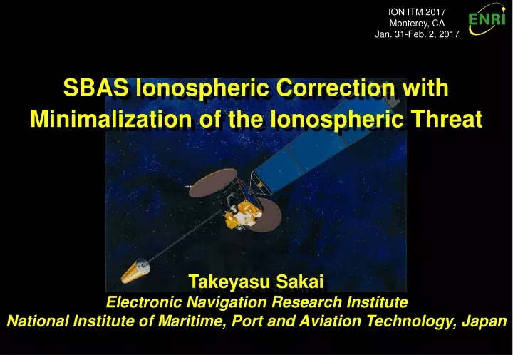
ION ITM 2017 Monterey, CA Jan. 31-Feb. 2, 2017. SBAS Ionospheric Correction with Minimalization of the Ionospheric Threat. Takeyasu Sakai Electronic Navigation Research Institute National Institute of Maritime, Port and Aviation Technology, Japan. Introduction. Japanese MSAS program:

E N D
ION ITM 2017 Monterey, CA Jan. 31-Feb. 2, 2017 SBAS Ionospheric Correction with Minimalization of the Ionospheric Threat Takeyasu Sakai Electronic Navigation Research Institute National Institute of Maritime, Port and Aviation Technology, Japan
Introduction • Japanese MSAS program: • MSAS has been operational since Sept. 2007. • Still serving horizontal navigation only. • Transition to the new system in 2020, as a part of QZSS program; Planning update for vertical guidance in 2023 with two GEOs. • The ionospheric effect is a major error source for Single-Frequency SBAS: • The ionospheric term is the dominant factor of protection levels. • Necessary to develop improved ionosphere algorithms to introduce vertical guidance capability to MSAS. • Problem: Planar model does not perfectly fit to the low-latitude ionosphere: • The storm detector makes a lot of false trips for the low-latitude ionosphere. • Minimalization of the ionospheric spatial threat: • Basic idea: Adjusting fitting radius so that the storm detector does not trip. • Reduces the ionosphere term of protection levels without missed detection.
Current Status • MSAS: Japanese SBAS in operation. • MTSAT Satellite-based Augmentation System. • Operational since Sept. 27, 2007. • Continues operation with 2 signals via 1 GEO. • MTSAT-1R decommissioned in Dec. 2015 (MTSAT-2 also in 2020). • Hawaii and Australia MRS sites decommissioned in Feb. 2015. • Service for Air Navigation • Providing GPS augmentation information. • Available for RNAV, from En-route through NPA (Non Precision Approach), i.e. RNP 0.3. • Within Fukuoka FIR. • Only horizontal navigation due to ionosphere activities. • NOTAM is available to MSAS users. • Alert for service interruption. • Alert for predicted service outage.
Current Configuration MTSAT-2 GPS Satellites Ranging Signals Augmentation Signals 6 GMS in Japan PRN137 Sapporo GMS PRN129 Users Kobe MCS (and GMS) Fukuoka GMS Hitachi-Ota MCS (and GMS) Tokyo GMS Ground Network MSAS Monitor Stations Naha GMS • 1 GEO, 2 MCS (Master Control Station), and 4 GMS (Ground Monitor Station); • MCS also has GMS function; MSAS has 6 domestic monitor stations. • MTSAT-2 is broadcasting 2 signals from 2 MCS (PRN129 and PRN137).
Performance of MSAS GPS only GPS only Horizontal 0.722m RMS Horizontal 0.717m RMS MSAS PRN129 MSAS PRN137 GEONET 940058 (Takayama) 2016/8/8-12 (5 days) PRN129 and PRN137 Broadcast Signal
Continuous Operation • Replacement in 2020: • MSAS continues operation with 1 GEO (MTSAT-2) and 6 GMS until 2020. • In 2020, MSAS will continue operation with a new GEO of the QZSS. • QZSS (Quasi-Zenith Satellite System): Japanese regional satellite navigation system with IGSO and GEO satellites. • The L1Sb signal of QZS-3 (GEO) will be used for MSAS service. • MCS equipment will also be fully replaced at the same time. • 7 GMS will be added: Totally 13 GMS domestic. • The performance will be similar with the current MSAS: Horizontal only. • Supporting vertical guidance in 2023: • Vertical guidance: LPV and LPV-200 operation. • Needs software upgrade: • Adding GMS cannot overcome ionospheric effects. • Needs development of the improved algorithms for ionospheric correction. • Will be supported in accordance with introduction of the 2nd GEO in 2023.
Toward Vertical Guidance • The current MSAS is built on the IOC WAAS: • Achieves 100% availability for Enroute to NPA flight modes, but not for PA modes. • The primary purpose is providing horizontal navigation means to aviation users; Ionospheric corrections may not be used. • As the first satellite navigation system developed in Japan, the design tends to be conservative, especially for ionospheric corrections.. • The major concern for vertical guidance is ionosphere: • The ionospheric term is dominant factor of protection levels; • Necessary to reduce ionospheric terms to provide vertical guidance with reasonable availability.
Components of VPL VPL Ionosphere (5.33 sUIRE) Clock & Orbit (5.33 sflt) MSAS Broadcast 06/10/17 00:00-12:00 GEONET 93011 Tokyo PRN129 (MTSAT-1R) Test Signal • The ionospheric term (GIVE) is dominant component of Vertical Protection Level.
Ionosphere Term: GIVE • Ionospheric component: GIVE: • Uncertainty of estimated vertical ionospheric delay. • Broadcast by 4-bit GIVEI index. • Current algorithm: ‘Planar Fit’: • Vertical delay is estimated as parameters of planar ionosphere model. • GIVE is computed based on the formal variance of the estimation. • The formal variance is inflated by: • Rirreg: • Inflation factor against the worst case that the distribution of true residual errors is not well-sampled. • Based on chi-square statistics. • A function of the number of IPPs; Rirreg = 2.38 for 30 IPPs. • Undersampled threat model: • Margin for threat that the significant structure of ionosphere is not captured by IPP samples. • A function of spatial distribution (relative centroid) of used IPPs.
Vertical Delay Cutoff Radius IPP Fit Plane IGP • GIVE Equation Spatial Threat Model Formal Sigma Spatial Threat Temporal Threat Planar Fit and GIVE • Developed for WAAS; MSAS employs the same algorithm. • Assumes ionospheric vertical delay can be modeled as a plane. • Model parameters are estimated by the least square fit. • GIVE (Grid Ionosphere Vertical Error): Uncertainty of the estimation including spatial and temporal threats unobserved.
Storm Detector • The current storm detector algorithm is ‘Chi-Square Test’: • Chi-square statistics is the sum of squared residuals: • For chi-square smaller than the threshold, GIVE is computed from the formal variance with an inflation factor Rirreg. • If chi-square statistics is larger than the threshold: • The assumption that the distribution of residual errors is the normal (Gaussian) may not be valid. • In such a case, the associate IGP is determined as storm condition: Set the maximum GIVE (Storm Detector ‘trips’). • Chi-square can test only ‘invalidity’: • Small chi-square does not guarantee that the actual error distribution is the normal. ^ ^ c2= ( Iv,IPP-Iv,IPP)T W( Iv,IPP-Iv,IPP)
Example Detector Response • Severe storm condition with the largest Kp index of 9-. • Chi-square metric is chi-square statistics divided by the associate threshold. • Inflation factor Rirreg applied. • Normalized residual means residual error divided by sGIVE; It must be within 5.33 for integrity. • Can observe many false trips; These trips lower the availability of MSAS. False Trips No Trips Storm Detector Trips
Estimation Process • STEP 1: Determination of Rfit • Rfit is set between Rmin (800km) and Rmax (2,100km). • RCM (Relative Centroid Metric) is computed based on the distribution of IPPs. • STEP 2: Estimation of the delay at the IGP • Conduct Planar Fit with IPPs inside Rfit; N is the number of IPPs for fit. • Formal sigma is derived as variance of the least square fitting. • STEP 3: Determination of the uncertainty • Formal sigma: Variance of fitting. • Inflation factor: A function of N, the number of IPPs for fit. • Threat model: A function of Rfit and RCM, i.e., the distribution of IPPs for fit. (1) Set Rfit=Rmin (3) Stop if N=Nmax or Rfit=Rmax (2) Enlarge Rfit while N<Nmax
Possible Situation Anomaly Anomaly N = Nmax Storm Detector trips N < Nmax Storm Detector does not trip • Normally, larger N induces smaller Rirreg and thus smaller GIVE. • Due to curvature of the real ionosphere, large Rfit (means large N) tends to reach an IPP which is not on the planar model. • In such a condition, storm detector trips and sets GIVE to the maximum. • Is it possible to stop increase of N to keep storm detector quiet ?
Adjustment of Fit Radius, Rfit • Introduces some algorithms to adjust Rfit between STEP 1 and STEP 2. • Storm Avoidance Algorithm: • Decrease Rfit until Storm Detector does not trip. • Metric Reduction Algorithm: • Search Rfit which can minimize the metric, c.f., RCM or chi-square. • Keeps spatial threat not reduced. • For conservatism, employs the spatial threat model once computed before these adjustment of Rfit. • This means the adjustment of Rfit affects to fitting and Storm Detector only and does not reduce the spatial threat model. (1) Decrease Rfit while Storm Detector trips (2) Stop if DRfit = DRmax or N = Nmin (1) Decrease Rfit so that the metric becomes the minimum. (2) Stop if DRfit = DRmax or N = Nmin
Simulation • Ionospheric vertical delay at 30 sites: • Current GMS locations (6) • GMS locations after 2020 (13) • Additional sites for oversampling (16) • Severe storm condition periods: • Sampling: 300s interval • At each epoch, each measurement is tested as an IGP. • IPPs are other measurements at GMSs at the same epoch. • Output: sGIVE and residual of fit. 14 locations Note: Applies GIVE Filter and IPP Filter of 15N instead of 25N which is the current MSAS setting.
Result: 6 GMS, DRmax=300km • Showing average results including cases of DN=0. • Storm Avoidance algorithm is the most effective to reduce GIVE. • The estimation accuracy can be slightly improved via reduction of • residual by Metric Reduction for Chi-Square, but need to allow increase of GIVE. Better Worse
Result: 6 GMS, DRmax=600km • Amplified effects due to larger DRmax. • Storm Avoidance algorithm is still the most effective to reduce GIVE. Better Worse
Result: 13 GMS, DRmax=300km • Same trend with 6 GMS results. • Storm Avoidance algorithm is the most effective to reduce GIVE. • The estimation accuracy can be slightly improved via reduction of • residual by Metric Reduction for Chi-Square, but need to allow increase of GIVE. Better Worse
Result: 13 GMS, DRmax=600km • Same trend with 6 GMS results. • Storm Avoidance algorithm can reduce sGIVE of 0.6 m in average. Better Worse
GIVEI Improvement Original Original Proposed Proposed Storm Avoidance Algorithm 6 GMS DRmax=300km Storm Avoidance Algorithm 13 GMS DRmax=600km • Comparing: (Red) Original algorithm; and (Green) Proposed algorithm. • Reduces frequency of the maximum GIVEI=14; Replaced to 11, 12, or 13.
Safety Protection Storm Avoidance Algorithm 6 GMS DRmax=300km Storm Avoidance Algorithm 13 GMS DRmax=600km • Triangle charts show comparison between 5.33 sGIVE and the associate residual of estimation. • In both cases, sGIVE protects users well; Some MIs need to be overbounded by GIVE floor settings.
Conclusion • MSAS will have a new GEO and replaced MCS in 2020. • Alters the current GEO and MCS facilities. • Update for vertical guidance is also planned in 2023 with the 2nd GEO. • Development of ionospheric algorithms for MSAS vertical guidance: • Storm Avoidance and Metric Reduction are proposed and tested. • Storm Avoidance algorithm may reduce GIVEI without safety concerns. • Metric Reduction for Chi-Square can improve estimation accuracy, but the effect is small. • Further activities: • Verification with more historical storm data archives. • Prediction of LPV availability. • Consideration of some other algorithms. • Contact for more information: Dr. Takeyasu Sakai <sakai@mpat.go.jp> Electronic Navigation Research Institute National Institute of Maritime, Port and Aviation Technology, Japan