Download
1 / 17
190 likes | 351 Views
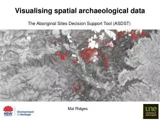
Visualising spatial archaeological data. The Aboriginal Sites Decision Support Tool (ASDST). Mal Ridges. Aboriginal sites decision support tool ASDST:. http://www.environment.nsw.gov.au/licences/AboriginalSitesDecisionSupportTool.htm. AHIMS. All modelled Feature types. GRASP. Pre1750

E N D
Visualising spatial archaeological data The Aboriginal Sites Decision Support Tool (ASDST) Mal Ridges
Aboriginal sites decision support tool ASDST: http://www.environment.nsw.gov.au/licences/AboriginalSitesDecisionSupportTool.htm
AHIMS All modelled Feature types GRASP Pre1750 model Muti-resolution Segmentation ASLUs Feature Data Spatial variables All modelled Feature types SGA algorithm Model reliability Reliability model Land-Use Layer Survey Priority calculator All modelled Feature types Survey priority model Vulnerability parameters Current Condition calculator Current model All modelled Feature types Accum. impact calculator Accum. Impact model KEY: GIS layer Data Tool or algorithm Corp. database
Model testing using withheld data: • Models were built with 2007 site data • Since then ~10,000 sites have been added to the database • Independent data, but also suffers the same inherent recording biases Scarred trees: Stone artefacts:
Comparison with Pardoe / Martin model: Predictive accuracy comparison: NOTE:Measured against current AHIMS data (including RERP data not used to build either model) Predictions for AHIMS sites Low likelihood High likelihood CONCLUSION:Both models perform well, predicting high likelihood for the majority of sites. The ASDST model performs slightly better (fewer sites with low likelihood)
Survey priority Survey priority Survey priority combines: • large data gap • low impact • high current likelihood Mined areas that have been the focus of much assessment are LOW survey priority Data gaps and low impact areas are HIGH survey priority
Scarred tree model pre1750 Scarred tree model current Impacts in the Hunter Valley
http://www.gbif.org/ These tools can be automated Providing users with custom results for defined regions Result: better contextual data for decision making
Accumulated impacts Accumulated impacts • Using the difference between the pre1750 and current version of each model, the level of impact can be mapped • This maps some impacts across all feature types modelled • Highest impacts occur in mined areas, irrigated cropping and urban extent
Segmentation for CMA • Multi-resolution segmentation on current models • 53,386 segments mapped for the CMA • Average area is 190 Ha • Information can be tagged to each segment • The information can be used for property scale planning
Take home message All this is possible just from using site type + location BUT…its focused on generating landscape scale data that supports decision making It also provides simple information that can be used by non-archaeologists in order to trigger appropriate assessment Derived information from the ASDST is easy to deliver through on-line tools: eg regional profiling