Download
1 / 29
290 likes | 298 Views
Alfred Wegener, a great SES scientist! (1880-1930) Thermodynamics of the Atmosphere (1911) The Origin of Continents and Oceans (1915,1929) Climate and Geological Pre-history (1924). quantitative fitting of the shapes of W. Africa and E. South America. The geology matches very closely.

E N D
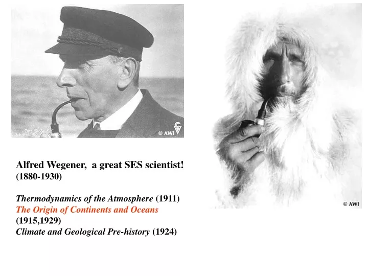
Alfred Wegener, a great SES scientist! (1880-1930) Thermodynamics of the Atmosphere (1911) The Origin of Continents and Oceans (1915,1929) Climate and Geological Pre-history (1924)
quantitative fitting of the shapes of W. Africa and E. South America
The geology matches very closely Proterozoic orogenic belts >2000 Ma cratons
And the southern hemisphere continents Africa Madagascar India Australia Antarctica South America
The evidence for continental drift was compelling and well established during the first half of the 20th Century- but it was not accepted by many geologists (almost all U.S. geologists) until the advent of plate tectonics in the late 1960’s-early 1970’s! Why??
Why?? • Wegener was attacked because of his lack of geological credentials and some of his geophysical theories for the dynamics of continental drift. The dynamics were wrong, but the kinematics - “continental drift” - was right.
Why?? • Wegener was attacked because of his lack of geological credentials and some of his erroneous geophysical theories for the causes of continental drift. The theories were wrong, but the basic idea was right. • The focus of geologists on complex continental geology at local to regional scales
Why?? • Wegener was attacked because of his lack of geological credentials and some of his erroneous geophysical theories for the causes of continental drift. The theories were wrong, but the basic idea was right. • The focus of geologists on complex continental geology at local to regional scales • The obvious importance in continental geology of vertical motions, leading to the "fixest" (versus "mobilist") synthesis that was the reigning theory for much of the first half of the last century.
Why?? • Wegener was attacked because of his lack of geological credentials and some of his erroneous geophysical theories for the causes of continental drift. The theories were wrong, but the basic idea was right. • The focus of geologists on complex continental geology at local to regional scales • The obvious importance in continental geology of vertical motions, leading to the "fixest" (versus "mobilist") synthesis that was the reigning theory for much of the first half of the last century. • the ocean basins: “terra incognita” before WWII
WWII-Cold War explosion of technology and observations • Marine exploration - opening the last geographic frontier (from naval warfare, especially submarine warfare) • mapping ocean bathymetry and crustal structure • ocean ridge system • ocean crust a very uniform in structure: • a single, well defined geological entity • contrasts with thickness, complexity, variability of continental crustal structure • very thin sedimentary cover: ocean floor is a relatively young geological feature • development of marine magnetometers: led to SEAFLOOR SPREADING
WWII-Cold War explosion of technology and observations • Isotope geochemistry (from development of atomic bomb)
WWII-Cold War explosion of technology and observations • Global seismological networks: global earthquake locations and focal mechanisms - (from nuclear test detection and verification for Cold War and post-Cold War test ban treaties)
WWII-Cold War explosion of technology and observations • Digital computers • enabled realistic modeling of processes and observations • ability to process, analyse and visualize dense, comprehensive spatial data sets
WWII-Cold War explosion of technology and observations • Marine exploration • Isotope geochemistry • Global seismological networks • Digital computers Plate tectonics Revolution (1962 – 1972)
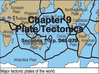
Plate boundary types divergent boundary convergent boundary lithospheric plate asthenosphere
Plate boundary types divergent boundaries Transform fault boundary lithospheric plate asthenosphere
Continental rifting in the Middle East: Red Sea and Gulf of Aden
Convergent boundary: subduction zones South American Andes island arc
seafloor age, Ma Age of ocean floor recorded by Seafloor Spreading
The key breakthroughs: • Paleomagnetism • Seafloor Spreading • Seismicity, plate boundaries, and subduction Plate tectonics Revolution
Geomagnetism: major key to Earth’s history • The key breakthroughs: • Paleomagnetism • Seafloor Spreading • Seismicity of plate boundaries Plate tectonics Revolution