Download
1 / 15
150 likes | 166 Views
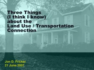
ALBACETE / TRANSPORTATION LAND USE. streetcar. U-bahn. S-bahn. local national rail. national rail. http:// www.ctchouston.org/blogs/christof/2007/05/12/networks-hubs-and-tickets-transit-for-a-multi-centered-city /. frankfurt stuttgart. madrid albacete area. new york philly baltimore.

E N D
streetcar U-bahn S-bahn local national rail national rail http://www.ctchouston.org/blogs/christof/2007/05/12/networks-hubs-and-tickets-transit-for-a-multi-centered-city/
“Greater Golden Horsehoe” Toronto Regional Plan Coordinated by the provincial government Establishment of greenbelt, with some designated greenfield area growth At least 40% of growth should occur on existing development by 2015 Density targets for people and jobs legislation that municipalities will be required to adopt (with flexibility) targets based on where higher-order transit is in place or planned http://www.pir.gov.on.ca/English/growth/index.html
Boston Job Sprawl http://www.mi.vt.edu/uploads/Edgeless%20Cities.pdf
Architecture of Transportation and Urban Form - Curitiba BRT and busways stations, exclusive lanes and feeder system, metropolitan coverage Trinary road system center street with bus lane and service lanes parallel streets for express buses Linear development policies densities diminishing 2 blocks off axis/spine
Albacete Context Opportunities Incredibly compact, walkable core that is the cultural, historic, and commercial heart of the city/region. What is the economic heart of the Albacete? Iberian town planning traditions – plazas, compact housing, outdoor commerce, mixed use A set of satellite towns/suburbs Are they linked culturally, historically, economically? Growth in new global industries – IT, aerospace, education, tourism, finance, creative arts Experiential proof that they rely on agglomeration, vibrant urban areas, and culture Possible Barriers Cars = progress (but owning cars doesn’t fundamentally prevent transit use and density) Space = happiness (but there can be low-density residential neighborhoods that work with transit) Growth in transport-heavy industries – logistics, retail, manufacturing, energy – need for highways Authority – regional planning is non existent
Data Transport-related autonroads.shp, roads.shp – CLM roads and avgspeed.shp for national roads do we have a point file for where on/off points are? totalnetwork.shp – understand most “valuable” lands for economic development using accessibility as a proxy Urban-related lic.shp and zepas.shp – development won’t happen here pgou.shp – “polygon shapefile that describes newly urbanizable land in Albacete” what is this based on? could this be a proxy for a BAU “painting” of the region? abas.shp – use this as an input into a development-friendly index propuestaspgo.shp – proposed extensions of Albacete water supply system could this be used as proxy for BAU “painting”