Download
1 / 50
530 likes | 685 Views
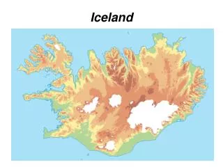
ICELAND 2013 GPS Processing. TU Delft GRS fieldwork . Hans van der Marel, TU Delft. GPS Processing Strategy. Three processing steps are foreseen Data pre-processing ( RINEXing & Q/C) of campaign data IGS/EUREF Standards Ionosphere Free solution Bernese GPS Software (V5.0)

E N D
ICELAND 2013 GPS Processing TU Delft GRS fieldwork Hans van der Marel, TU Delft
GPS Processing Strategy Three processing steps are foreseen • Data pre-processing (RINEXing & Q/C) of campaign data • IGS/EUREF Standards Ionosphere Free solution • Bernese GPS Software (V5.0) • Ionosphere free linear combination • Additional XX IGS stations included (fiducial stations) • IGS08(ITRF2008) Reference Frame • Enabler for absolute Troposphere Delay estimation • Downloaded from IGS Data Centers • Campaign data stored in local (ORX) directory • Analysis of the campaign solutions (time series)
Motivation for Regional Network • Network includes three types of stations • Campaign stations (1-3 days of occupation) • Local permanent stations (continuous operation during campaign, but without good coordinates in ITRF) • IGS/EPN stations with good station coordinates and velocities (!) in ITRF2008 (IGS08). • The main goals of adding regional IGS/EPN stations are • To obtain the best possible site coordinates and position time series in a global reference frame (ITRF2008) • To obtain estimates of the atmospheric delay (Zenith Tropospheric Delay) over the area of interest • To verify the stability of presumed stable reference points (local permanent stations)
Bernese GPS Software 5.0 • Bernese software v5.0 developed by University of Berne • Standard for IGS, EUREF and scientific campaign processing • Semi-autonomous computation using Bernese processing engine • Standard RNX2SNX script for Ionosphere free, Ambiguity Fixed, Double Differenced Network Processing • With some TU Delft additions • Automatic FTP’ing of RINEX data and IGS orbits • Analysis tools (Matlab) • Wide experience (used at TU Delft since 1992) • Latest version 5.0 including all modifications up to Oct 2012
Main Steps involving the BSW5.0 • Install the Bernese GPS software 5.0 (once) • Install ActivePerl • Install BSW5.0 using the TU Delft installer file • Setup the Campaign (once) • Select IGS/EPN station to include in processing • Prepare campaign directories and campaign files • Processing using the Bernese Processing Engine (BPE) • Add campaign data (RINEX observation files) to ORX directory • Update station information file(s) for the new stations (only if there are new stations) • Start the BPE This step must be repeated every time there are new stations or data.
Bernese Software BSW5.0 Desktop icons: • Bernese 5.0 -> Start BSW5.0 GUI • GPSDATA -> Campaign Directories • GPSDATA/ICELAND/STA <- campaign definition files • GPSDATA/ICELAND/ORX <- where to store campaign data • GPSUSER -> User files (scripts, program options, etc) Windows start menu (extra link to documentation)
BSW 5.0 GUI Used later to set session/computation date for the BPE The BSW50 has a very extensive help system Quit the GUI
Add ICELAND Campaign 1 Edit list of campaigns Select active campaign Create new campaign 2 3 ^Run creates the campaign directories (ignore warnings)
ICELAND Campaign Directory • GPSDATA/ICELAND/… • Just created, except SAV… • SAV you should create yourself • Three important subdirectories: • ORX -> RINEX campaign data • STA -> Station definition files • SAV -> Where results are saved • - Others only hold temporary data • Data file locations: • GPSDATA/ICELAND/ORX (campaign data, RINEX observation files, no IGS data, copy yourself) • GPSDATA/CACHE (IGS station, orbit and clock data, automatic download)
Campaign Setup (manual task) • Add new campaign (ICELAND) <- just done • Select IGS/EPN fiducial sites (Network definition) <- next • Data center selection for IGS/EPN data (ICELAND.FTP) • Station Information File (ICELAND.STA) • Station Abbreviations File (ICELAND.ABB) • Plate Definition File (ICELAND.PLD) • A-priori Coordinate Files (IGS08.CRD, IGS08.VEL, IGS08.FIX) • IGS08 (ITRF2008) coordinates and velocities for IGS/EPN stations => used as constraints (min constraint, 3 dof, shift in XYZ) • A-priori coordinates for campaign stations from Precise Point Positioning (PPP) and velocities from Nuvel-1A plate model • Ocean Loading Parameter File (ICELAND.BLQ)
Fiducial site selection (1) • To obtain the best possible site coordinates in ITRF2008 we should add as many as possible nearby IGS/EPN sites • These are called fiducialsites • Conflicting selection criteria • More is better (averaging out of errors in fiducial coordinates and processing errors) • Distances should be with 1000 km (otherwise no simultaneous observations, problems with ambiguity resolution, etc.). If necessary, we could add some other permanent stations to bridge the distance. • Fiducial sites should have good coordinates -> not all permanent stations can be used (must be in ITRF). • Only necessary for tectonic studies or studies which requires a well defined and stable reference frame (in absolute sense)
Fiducial site selection (2) • Useful links http://igscb.jpl.nasa.gov/network/complete.html http://www.epncb.oma.be/_networkdata/stationmaps.php • What to watch out for • Use (at least) the same fiducials as in campaigns of previous years • Check the station quality (using the web-links) • IGS Reference frame sites are top of the line (used for definition of ITRF) • Good tracking statistics • If recent data is available (temporary outages, download problems) • If the station has good coordinates in ITRF (several years of observations, check relevant EPN pages) • Receiver and antenna type (stations with similar receiver and antenna types are a pro, good antenna calibrations are a must)
Fiducial site selection (3) http://www.epncb.oma.be/_networkdata/stationmaps.php
Fiducial site selection for ICELAND Verify these yourself! Used by campaigns in previous year: HOFNhttp://igscb.jpl.nasa.gov/network/site/hofn.html (IGS reference frame site) REYKhttp://igscb.jpl.nasa.gov/network/site/reyk.html (data download problem) Other IGS sites (to be included): QAQ1http://igscb.jpl.nasa.gov/network/site/qaq1.html(IGS reference frame site) SCORhttp://igscb.jpl.nasa.gov/network/site/scor.html (IGS reference frame site) NYA1http://igscb.jpl.nasa.gov/network/site/nya1.html (IGS reference frame site) TRO1http://igscb.jpl.nasa.gov/network/site/tro1.html (IGS reference frame site) MORPhttp://igscb.jpl.nasa.gov/network/site/morp.html(IGS reference frame site) Other EPN sites (candidates): ARGIhttp://www.epncb.oma.be/_networkdata/siteinfo4onestation.php?station=ARGI No coordinates in ITRF2008, no velocities, not a fiducial, but could be used to bridge the distance with MORP
Campaign Setup (manual task) • Add new campaign (ICELAND) <- done • Select IGS/EPN fiducial sites (Network definition) <- just done • Data center selection for IGS/EPN data (ICELAND.FTP) • Station Information File (ICELAND.STA) • Station Abbreviations File (ICELAND.ABB) • Plate Definition File (ICELAND.PLD) • A-priori Coordinate Files (IGS08.CRD, IGS08.VEL, IGS08.FIX) • IGS08 (ITRF2008) coordinates and velocities for IGS/EPN stations => used as constraints (min constraint, 3 dof, shift in XYZ) • A-priori coordinates for campaign stations from Precise Point Positioning (PPP) and velocities from Nuvel-1A plate model • Ocean Loading Parameter File (ICELAND.BLQ) We can now create the initial version of station definition files in the ICELAND/STA directory
Campaign definition files • IGS08.CRD, IGS08.VEL and IGS08.FIX • Download IGB08_R.CRD and IGB08_R.VEL from AIUB (ftp://ftp.unibe.ch/aiub/BSWUSER50/STA), extract required fiducials, and rename fiile to IGS08.CRD and IGS08.VEL • Download ITRF2008.CRD and ITRF2008.VEL from AIUB [ibid], extract REYK coordinates and velocities, add to IGS08.CRD|VEL • Create IGS08.FIX with the list of fiducial stations (REYK is the only non IGS reference frame station -> be alert later!) • ICELAND.STA (Station information file) • Download IGS.STA from AIUB [ibid] and extract only the fiducial stations we actually use • ICELAND.PLD (same as IGS08.VEL, just copy) • ICELAND.FTP • Each line contains first four character of file name (case sensitive) and the data center from where to download the data from
Campaign definition files (cont’) • ICELAND.ABB (Station abbreviation file) • Contains 4 and 2 letter abbreviations for the stations • Can be created automatically by the BSW • But it is also easy to do by hand • ICELAND.BLQ (Ocean loading tables) • Contains parameters to compute corrections for ocean loading • Ocean tide model: FES2004 (NO correction for CMC) • Parameters provided by Chalmers, Onsala(H.-G. Scherneck): http://holt.oso.chalmers.se/loading/ • Instead, we copied FES2004.BLQ from AIUB [ibid], and extracted the required fiducial stations, and renamed to ICELAND.BLQ Now all files are ready for processing the ficucial data. IGS08.[CRD|VEL] and ICELAND.[STA|PLD|BLQ] have to be updated for campaign data
IGS08.CRD, IGS08.VEL, IGS08.FIX You may consider removing REYK from the IGS08.FIX file; this station is the only IGS non reference frame station (but leave it in IGS08.CRD and IGS08.VEL)
ICELAND.STA Renaming of station names Receiver, antenna, antenna height information
IGS Receiver/Antenna types Iceland Station name Receiver type Antenna type Dome AntHgt Location HOFN 10204M002 LEICA GR25 LEIAR25.R4 LEIT 0.0319 Hoefn, Iceland REYK 10202M001 LEICA GR25 LEIAR25.R4 LEIT 0.0570 Reykjavik, Iceland MORP 13299S001 TRIMBLE NETR8 AOAD/M_T NONE 0.0330 Morpeth, United Kingdo NYA1 10317M003 TRIMBLE NETR8 ASH701073.1 SNOW 0.0000 Ny-Alesund, Norway TRO1 10302M006 TRIMBLE NETR8 TRM59800.00 SCIS 0.0000 Tromsoe, Norway QAQ1 43007M001 ASHTECH UZ-12 ASH701945E_M SCIS 0.1206 Qaqortoq / Julianehaab SCOR 43006M002 ASHTECH UZ-12 ASH701941.B SCIS 0.1977 Scoresbysund/Ittoqqoor (From ICELAND.STA) UK / Norway Greenland
ICELAND.FTP • All data is available from BKGI (BKG IGS) data center • In case you want to add for example ARGI (or other EUREF EPN site) use BKGE (BKG EUREF) as data center • Other possibilities are CDDIS, IGN, … • We don’t use this for campaign data => these are just copied into the ICELAND/ORX directory
All these files are available as in a zip file, just unzip this to the STA directory. Now everything is ready for processing fiducial stations This is what we will do next… using the BPE Later we are going to add campaign data, but not yet! ICELAND.BLQ
Two ways of processing with BSW50 • The Bernese software consists of 60+ programs which have to be run in a particular order. • Sometimes the same program has to be run twice, or even more, using different options and input data • There are two ways to accomplish this • Through the GUI and menu system; you run the individual programs. This offers the best flexibility, but it is also very labour intensive and not recommended for fist time users. • You use the Bernese Processing Engine (BPE) using predefined settings and file naming conventions. The BPE runs the programs in a particular order.
Bernese Processing (BPE engine) RNX2SNXA script (modified) • IGS finial (rapid) orbits, clocks and ERP • IGS RINEX data from various data centers • Ionosphere models, Differential Code Biases (DCB) and Satellite information (SATCRUX) files from University of Berne • Absolute antenna calibrations from IGS/EPN; • Elevation Cut-off of 3 degrees • Elevation Dependent Weighting • Ocean loading parameters from Chalmers/TUD Processing time 5-10 minutes/day Let try it on our newly defined ICELAND campaign
Starting the BPE 1 2 Set session/computation date Start BPE process Should be ICELAND Selected session/compute date
Select session/computation date Various date options 1 2 check
Start BPE Process (1) Press ^Next for the next panel
Start BPE Process (2) Press ^Run to start the BPE. That’s all (for now)
Here we go !! The BPE is running one program after the other, you can follow the progress here…
Oeps… ERROR Another learning moment!
Protocol files: look here for errors, especially the last file!! What happened? before after Found! Temporary files (will be deleted when successful) Campaign directory before and after
What happened? • When there is an error, look into the campaign directory • In case of an error, no files are deleted in the campaign directory, so you will find all the program output • In ICELAND/BPE you will also find the protocol files • These are never deleted • These are the first place to look for diagnostic messages • Start with the last log-file: that is where the processing stopped In this case RNXGRA program is complaining about a file it cannot find. This is because we did not update the Process Control File (PCF) for the BPE: we’re using RNX2SNXA.PCF with it’s default settings(probably for the I2GPS example…). We need more education on the BPE and PCF files first …
Process Control Files (PCF) • GPSUSERcontains the following subdirectories GPSUSER/PCF Process Control Files GPSUSER/OPT Directories with pre-set program options GPSUSER/… (others are not relevant for the BPE now) • The Process Control Files can be found in GPSUSER/PCF • The PCF we are using is RNX2SNXA.PCF • Copy RNX2SNXA.PCF to ICELAND.PCF (so we can safely make changes) • Open ICELAND.PCF in an editor
ICELAND.PCF (1) After a lot of comments (explaining what is done) you find the following section linking SCRIPTS to OPT directories with the input parameters: You don’t need to change this part… PID SCRIPT OPT_DIR CAMPAIGN CPU P WAIT FOR.... 3** 8******* 8******* 8******* 8******* 1 3** 3** 3** 3** 3** 3** 3** 3** 3** 3** # # Copy required files and create a priori CRD file # ------------------------------------------------ 001 R2S_FTP R2S_GEN ANY 1 002 COOVEL R2S_GEN ANY 1 001 # # Prepare pole, orbit, and clock information # ------------------------------------------ 101 POLUPD R2S_GEN ANY 1 001 111 PRETAB R2S_GEN ANY 1 101 112 ORBGEN R2S_GEN ANY 1 111 (skipped)
IGS means here final orbits (available after 13 days), may change this later into IGR for rapid orbits (one day delay) ICELAND.PCF (2) # VARIABLE DESCRIPTION DEFAULT 8******* 40************************************** 16************** V_A A priori information APR V_B Orbit/ERP, DCB, ION information IGS V_C Preliminary (ambiguity-float) results P1_ V_E Final (ambiguity-fixed) results F1_ V_F Size-reduced NEQ information R1_ V_MINUS Session range begin (for COMPAR) -6 V_PLUS Session range end +0 V_CLU Maximum number of files per cluster 3 V_STAINF Station information file name I2GPS V_BLQINF Ocean loading correction file name V_ABBINF Station name abbreviation file name I2GPS V_CRDREF A-priori/reference CRD/VEL/FIX filename IGS08 V_PCV Absolute/relative PCV I08 # At the end of the file you find the following section: ICELAND ICELAND Is blank, if you want ocean loading corrections enter ICELAND here as well Why we got the error…
Start BPE Process (again) Press ^Next to see next input panel
Enter name of PCF file here. Use the ICELAND.PCF created in the previous step Press ^Next twice to see the 4th input panel
Here you can make some last minute changes before starting the BPE (these are not saved in the PCF for future runs) IGS->IGR? Press ^Run from any of the BPE menu’s to start the BPE. Leave blank?
Here we go again !! The BPE is running one program after the other, you can follow the progress here… … fingers crossed
Where are the results? Protocol files before after Results saved in ICELAND/SAV directory Temporary files deleted … Campaign directory before and after
What are the results? Estimated Zenith Delays (troposphere) Bernese format [F1|P1]_yyddd0.TRP Troposphere SINEX F1_yyddd0.TRO Protocol / Summary file (R2Syyddd0.PRC) ADDNEQ output ([F1|P1]_yyddd0.OUT) GPSEST output (ESTyyddd0.OUT) SINEX (Solution Independent Exchange) file Normal equations file [R1|F1|P1_yyddd0.NEQ Coordinate files [F1|P1}_yyddd0.CRD F1 Final Solution / P1 Provisional Solution
Where are we now ? • You have now successfully processed one day of data • But only IGS stations were included… … this makes little sense. How do we add campaign data to the processing? This is up next.
Step 1: Conversion to RINEX We use Trimble’s “Convert to Rinex” to convert T01 into RINEX. There are a couple of issues to pay attention to: • Marker name field : change s/n into the 4 letter code • Marker number field: leave/make blank • Receiver type: change “R7” into “TRIMBLE R7”, change “5700” into “TRIMBLE 5700” (if you don’t do this the s/w will not recognize the receiver • Antenna offset: enter the antenna height (to ARP) you measured • Antenna serial number: enter the serial number of the antenna After conversion you have to rename the RINEX files • Change s/n into 4 letter code, e.g. 06681740.13o -> KVIH1740.13O • Use all uppercase letters (not kvih1740.13o but KVIH1740.13O) Copy/move RINEX observation files to GPSDATA/ICELAND/ORX
Step 2: Update campaign files (1) When there are new stations we have to update the campaign definition files IGS08.CRD, IGS08.VEL, ICELAND.STA, ICELAND.ABB and ICELAND.BLQ. We could do this all by hand (using an editor) and results from e.g. a PPP run with NRCAN’s web-service. We can also do this by doing PPP (Precise Point Positioning) run using the BPE in the BSW50: • Open the BPE (after selecting a date) and select in the 2nd panel the PPPA Process Control File • In the 4th panel you leave the STAINFO and BLQ input fields blank. Also check whether to use IGS (final) or IGR (rapid) products. • Press ^Run to start the BPE. The BPE will now process all RINEX observation files (in ORX) for the selected day using the PPPA.PCF.
Step 2: Update campaign files (2) When the BPE/PPPA has finished, it has: • Created IGS08_U.CRD and IGS08_U.VEL in the STA directory • Updated ICELAND.ABB in the STA directory • Create a SINEX file PPP_____.SNX in the SOL directory • Saved other output in the SAV/… directories IGS08_U.CRD is an update of IGS08.CRD whereby coordinates for new stations have been added (only for stations which did not exist previously). IGS08_U.VEL contains the new stations with zero velocities : we will be using zero velocities for all campaign stations, resulting in coordinates at the epoch of measurement! If you are happy with the IGS08_U.[CRD|VEL] updates you use these to replace the IGS08.[CRD|VEL] that is used in the RNX2SNXA processing.
Step 2: Update campaign files (3) The BPE/PPPA script has also updated the abbreviation tables in ICELAND.ABB (STA directory). No action is needed here. Next we have to update the ICELAND.STA information file • We left the STAINFO field blank in the BPE/PPPA, so that the RINEX file was not checked against the station information file • This is not allowed for the BPE/RNX2SNXA script; the STAINFO file is an essential step in checking the RINEX files A easy way to update the ICELAND.STA file is • In the Bernese GUI, select conversion > sinex to station information • Select the SINEX file PPP_____.SNX created by the BPE/PPPA run, select an output file (e.g. UPDATE.STA) and enter a title, then enter ^Run. This will extract information from the SINEX file.
Step 2: Update campaign files (4) Now you can merge the output of UPDATE.STA with ICELAND.STA. When doing this: • Check that the collected information is correct, if necessary correct the information. Doing this now will save you a lot of work later. • Change the start and end times for the stations The final item on the list is to update the Ocean Loading tables in ICELAND.BLQ. • Open ICELAND.BLQ in an editor, copy the a block for one of the campaign stations, and rename the station name • The ocean loading effect is the same for all campaign stations (You could also decide to do without ocean loading corrections in the BPE/RNX2SNXA by leaving the entry for BLQ files blank)
Step 3: Run the BPE/RNX2SNXA Now you restart the network processing including the campaign data. A few point to pay attention to: • Check that you are using the ICELAND.PCF (which is our tailored version of RNX2SNXA.PCF) • Decide if you will be using final IGS products (IGS) or rapid products (IGR). Final products are only available after 13 days; rapid products will only remains available for a few days after finals. • If you have a BLQ file no not leave the BLQ field blank (you won’t have ocean loading corrections then…) • Check the protocol files that the stations have actually been included and that the processing results are ok. • Don’t loose your patience, things may not go directly your way… Good luck!
Further reading • README.TXT that came with the Windows installer Has some good hints on setting up a new campaign, and the steps needed to include new stations • The on-line help system available from the GUI This is an excellent source of information (one mouse click away) • The Bernese manual (pdf) Has lots and lots of information, available from BERN50 directory. Contains also very good information on GPS (and Glonass) in general.