Download
1 / 40
400 likes | 406 Views
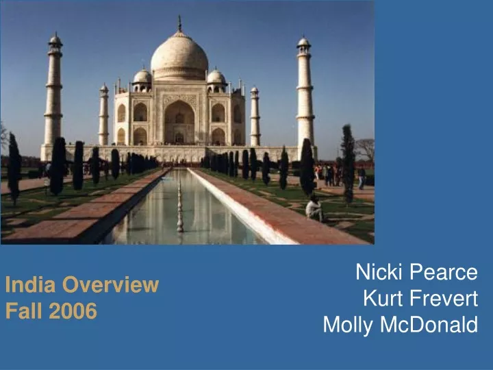
Nicki Pearce Kurt Frevert Molly McDonald. India Overview Fall 2006. Geography. Area: 1,270,000 squ. miles Approx the 1/3 the size of the US Border: 8800 miles total; 2100 miles with China; 1800 miles with Pakistan Coastline: 4350 miles. Demographics: Population. 2006 (est.)

E N D
Nicki Pearce Kurt Frevert Molly McDonald India Overview Fall 2006
Geography • Area: 1,270,000 squ. miles • Approx the 1/3 the size of the US • Border: 8800 miles total; 2100 miles with China; 1800 miles with Pakistan • Coastline: 4350 miles
Demographics: Population 2006 (est.) • Population: 1,095,352,000 • 17% of the world’s population (2nd most populous) • 5% of county’s population is within 10 urban areas with 2000+ persons/squ mi. • 28% population is urban
Demographics: Population cont. 2006 cont. • Growth: 1.38% per year • Birth Rate: 22.01 births/1000 • Death Rate: 8.18 deaths/1000 • Migration: -.07/1000 • Median age: 24.9 years • Population: 1.06 males/female
History • Indus Valley civilization is 5000 years old - one of the oldest in the world • Aryan tribes enter in 1500 BC and merge with early Dravidian inhabitants to create classic Indian culture • Incursions by other cultures: • Arabian – 8th century • Turkish – 12th century • European – 15th century • Independence in 1947 from UK • Country split into 3 at independence – Pakistan, India, and East Pakistan • 3rd war with Pakistan in 1971 results in East Pakistan becoming Bangladesh
Government: Central Government • Federal Republic with legislative, executive & judicial branches • Executive Branch: subordinate to the legislature • President: head-of-state, largely ceremonial, Commander-in-Chief of armed forces, interprets Constitution, signs laws • Prime Minister: elected by majority of Parliament, head of government, retains most executive powers • Judicial Branch: • Supreme Court: jurisdiction of disputes between states and the Central Gov; appellate jurisdiction over each state’s High Court and subsequent lower courts
Government: Central Government cont. • Legislative Branch: • Rajya Sabha/Council of States (Upper House): 245 members; chosen through the electoral college • Lok Sabha/Council of People (Lower House): 552 members, chosen through direct elections • All Indian citizens above the age of 18 are eligible to vote • The Indian National Congress Party has controlled the national government for most of India’s independent history, although opposition parties have intermittently controlled the national government since 1977 and the 2004 elections required the Congress to form a coalition with Communist and Progressive parties to secure control.
Government: State Governments • 28 states, 6 territories & the National Capital Territory of Delhi • States elect their own governments • Territories are governed by administrators appointed by the union government
Culture: Languages • 22 official languages • 33 unofficial languages • 2000 dialects • Hindi (180 million speakers) is the national language and primary tongue • English is an associate language but very important for national, political and commercial communication • Sanskrit is the classical language (& literature) of India
Culture: Religion/Ethnicity Religions of the population • Hindu: 80.5% • Muslim: 13.4% • Christian: 2.3% • Sikh: 1.9% • Jain: 0.4% • Other: 1.5% Ethnicity of the population • Indo-Aryan: 72% • Dravidian: 25% • Mongoloid and other: 3% • Significant differences exist within the 80% Hindu majority, arising not only out of divisions of caste, but also out of differing religious beliefs. One difference is between the devotees of the god Vishnu and the devotees of the god Shiva
Culture: The Hindu Caste System • The caste system is pervasive in India. Although it is entwined in Hindu beliefs, it encompasses non-Hindus as well. A caste is a social class to which a person belongs at birth and which is ranked against other castes, typically on a continuum of perceived purity and pollution. People generally marry within their own caste. In rural areas, caste may also govern where people live or what occupations they engage in. The particular features of the caste system vary considerably from community to community and across regions. • Since 1947 the importance of caste has declined somewhat in India.Many people have also been influenced by the nationalist movement’s ideological commitment to the equality of men and women, and lower castes have increasingly used the power of their numbers or their right to vote to gain social status in their local community. However, castes are not disappearing, mainly because of the system of marriage. Almost all Hindu marriages in India are arranged, and almost all arranged marriages occur between people of the same caste, thus providing continuity to the caste system.
Culture: Education • India has some of the best Universities in the world, but struggles with literacy • Enrollment (2001-2002) • Primary (ages 6-11): 113.9 million • Middle/High (ages 11-18): 44.8 million • Higher Education (college): 30.5 million • Higher Education: • Must be accredited by the government and indirectly controlled by the government • Literacy: 59.5%; defined as 15 years+ that can read and write • Male: 70.2% vs. Female: 48.3%
Economics: Currency • Basis of exchange: Rupee (INR) • Formerly used by Pakistan, Qatar, UAE, Malaysia as basis of currency • Most often distributed as 100 & 500 Rupee denominations from ATMs • Current exchange rate: 1 USD = 44.42 INR (12/8/06) • Pegged by the Bhutanese ngultrum • Accepted in Nepal, near India – Nepal border
Economics: National metrics • GDP: $3.6 trillion using purchase power parity-PPP & 785.5 billion measured in USD exchange rate (2005) • 4th largest in the world when measured using PPP & 12th in the world when measured in USD exchange rate • PPP: a method of equalizing currencies for comparison by comparing a given basket of good within each country • GDP growth: 7.6% (2005) – among the fastest in the world • GDP per capita: $3300 using PPP (2005) • 122nd in the world • GDP composition by sector: • Agricultural: 18.6% • Industry: 27.6% • Services: 53.8%
Economics: Workforce • Labor force: 496.4 million • Labor by occupation and percentage of population: • Agricultural: 60% • Industry: 17% • Services: 23% (accounts for over 50% of India’s total output) • Unemployment rate: 8.9%
Economics: Liberalization • Economic liberalization: • Pre-1991: India focused on self-sufficiency & government control. Allowed trade was primarily with Soviet Union & eastern block. Foreign countries were viewed as economic threats, not opportunities. • Liberalization occurred in 1991, catalyzed by the collapse of the Soviet Union and the economic shocks resulting from the Gulf War. Results include a reduction of government influence, privatization of many government enterprises, relaxing of Foreign Direct Investment (FDI) restrictions, incentives for Trade (import of foreign goods) and revision of labor laws. • Recent activity (2005): High tariffs (20% on non-Agricultural) and FDI limits remain in place. Liberalization of civil aviation, telecom and construction sectors continue. Privatization of government-owned industry slowed/halted.
Economics: Infrastructure • 1.5 million miles of paved roads (US–2.6 million) • 39,300 miles of railroad, one of the most extensive in the world (US-140,035) • 3550 miles of navigable waterways/canals (US-12,000) • 243 airports with paved runways (US–5200) • Pipelines: • Oil: 4040 miles (US-152,000) • Gas: 3221 miles (US-341,000)
Economics: Resources • 4th largest reserve of coal in world, natural gas, petroleum • Iron ore, manganese, mica, bauxite, titanium ore, chromite, natural gas • Diamonds, limestone • Forests: oak, pine, teak
Economics: Industry • Agriculture: • Ranks 2nd worldwide in farm output • Gross land use: 49% arable, 3% permanent crops, 216,000 squ miles irrigated land • In the Gangetic Plain and in the peninsular deltas, groundwater is plentiful and close to the surface, making year-round irrigation possible. These regions may produce two or three harvests a year. • Industry: manufacturing, mining and construction • Ranks 14th worldwide in factory output • Information Technology: • A large quantity well-educated, English speaking people result in India as a major exporter of software services and software
Economics: Population Wealth • Household income by percentage share of wealth: • Lowest 10% of population with 3.5% of national spending/consumption • Highest 10% of population with 35% of national spending/consumption • 25% of population is below the poverty line • Inflation rate: 4.5%
Economics: Imports/Exports Exports • Total Exports: $76.3 f.o.b. billion • Textiles • Gems/Jewelry • Engineering goods • Leather products • Export Partners: • US: 16.7% • UAE: 8.5% • China: 6.6% • Singapore: 5.3% • UK: 4.9 Imports • Total Imports: $113.1 f.o.b. billion • Electricity: 1.4 billion kWh from Nepal & Bhutan (from hydropower) • Oil: 2.09 million bbl/day • Other: machinery, gems, fertilizer, chemicals • Import Partners: • China: 7.3% • US: 5.6% • Switzerland: 4.7%
Economics: Technology Metrics • Telephone: • Land line users: 49.75 million users (2005) • Cell phone users: 69.2 million (2006) • Radio: • 253 broadcast stations (1998) • 116 million radios (1997) • Television: • 562 broadcast stations (1997) • 63 million televisions (1997) • Internet • 43 Internet providers (2000) • 60 million internet users (2005)
Cities: India for Visitors • Local Currency: Rupee • Time Zone: GMT + 5hr 30min • Electricity: 220 volt, 50 hz • Climate (January only): • New Delhi: 45 - 70 deg F daily, heavy fog • Mumbai: 55 – 83 deg F daily • Bangalore: 55 - 77 def F daily • Little rain during January • Business Hours: Public & private offices: 9:30am – 5:30pm M-F
Cities: New Delhi • Location: Within the capital Territory of Delhi. Geographics: 16.5 squ miles (Delhi: ~900 squ miles) • Capital of the Republic of India and the seat of the Government of India • Population: 320,000 (Delhi:13.8 million) • Government: Municipal Council of 11 members • Includes: 1 Chairperson, 3 members of New Delhi Legislative Assembly, 2 members nominated by the Chief Minister of New Delhi and 5 members nominated by the central government
Cities: New Delhi • History: Delhi has been the historic capital of much of the sub-continent. The British moved the capital to Delhi, from Calcutta, in 1911. • Economics (of the Delhi): • A large scale English speaking work force and high literacy (81.7%) attract multinational companies • A large consumer market and readily available skilled labor force • As the Federal capital, the government employs 212,000 federal workers • Manufacturing employs 731,000 workers • Other industries important to Delhi: tourism, construction, banking, telecommunications, defense • Delhi is projected to be the 3rd largest metro-area in the world by 2025, trailing Tokyo and Mumbai
Cities: New Delhi Parliament House Rashtrapati Bhawan
Cities: New Delhi Red Fort Humanyun Tomb
Cities: Mumbai (Bombay) • Renamed Mumbai in 1995 • Location: Central-western coast of India • Geographics: 170 squ miles, multiple lakes and rivers within metro area • State capital of Maharashtra • Population: 13 million, the most populous city in India and the 6th largest in the world • Government: Municipal Council (corporation) of 277 direct elect Councilors representing 24 wards • History • Area was governed by different Buddhist and Hindu rulers until 15th century, by the Portuguese in the 16th century and finally the British in the 17th century • The American Civil War resulted in Mumbai (Bombay) becoming the world’s chief cotton trading market (foundation for textile industry). The opening of the Suez Canal in 1869 transformed it into a large seaport.
Cities: Mumbai (Bombay) • Economics: • Commercial capital of India: • Home of Reserve Bank of India, Bombay Stock Exchange, the National Stock Exchange of India and many corporate headquarters • Entertainment capital of India: Bollywood • Deep natural harbor with a port that handles half of India’s passenger traffic and significant cargo • Contributes 10% of all factory employment in India, 40% of all income tax collection in India, 60% of all custom duties in India and 40% of all India’s foreign trade. • Pre-1980s prosperity was due to textile mills and the sea port • Post-1980s properity is due to engineering, healthcare, information technology, etc
Cities: Mumbai (Bombay) Gateway of India Marine Drive
Cities: Mumbai (Bombay) SiddhiVinayak Temple
Cities: Bangalore (Bengaluru) • Renamed Bengaluru in December 2005 • Location: South-central India • Geographics: 183 squ miles • State capital of Karnataka • Population: 6.2 million • Government: Municipal Council (corporation) of 100 direct elect Councilors representing 100 wards • History • Many different ethic rulers until the British in 1799. British rule through 1947 integrated technology into Bangalore such as telegraphs (1846), rail connections (1846), telephone lines (1898) and hydro-electic power (1906 – the 1st city in India to use hydro power) • Became a manufacturing base following independence (1947) and experienced a software boom in 1990s.
Cities: Bangalore (Bengaluru) • Economics: • India’s 4th largest and fastest growing market • Evolved as a manufacturing hub for public sector heavy industries (defense, aero-space) during post-Indian independence • Accounts for 35% of India’s software exports • Included: Software Technology Park of India, Bengaluru Int’l Technology Park & Electronic City • Daily Life: • Rapid growth has resulted in traffic congestion and infrastructure obsolescence
Cities: Bangalore (Bengaluru) Bull Temple Glass House
Cities: Bangalore (Bengaluru) Utilities Building Bangalore High Court
Additional information about India on the Web • en.wikipedia.org/wiki/India (A good source for any depth of information. Look for “See also” links at the bottom of the page. Search for cities from this site for city specific information) • www.cia.gov/cia/publications/factbook/geos/in.html • Current information: timesofindia.indiatimes.com/? • Maps:www.mapsofindia.com/ • Indian Embassy: www.indianembassy.org/newsite/default.asp • Tourism: www.tourindia.com/htm/homepage.htm