Download

1 / 21
210 likes | 398 Views
Weather Briefing for The 2013 Presidential Inauguration. NOAA/ National Weather Service Baltimore/Washington Weather Forecast Office January 12, 2013 2000 UTC/3:00 PM EST James E. Lee Meteorologist-in-Charge. Outline. Weather Hazards Forecast Overview Forecast Tables and Graphs

E N D
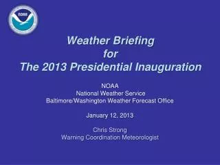
Weather BriefingforThe 2013 Presidential Inauguration NOAA/ National Weather Service Baltimore/Washington Weather Forecast Office January 12, 2013 2000 UTC/3:00 PM EST James E. Lee Meteorologist-in-Charge
Outline • Weather Hazards • Forecast Overview • Forecast Tables and Graphs • Reagan National Airport METAR & TAF • Illumination Data • Space Weather • Plume Modeling • Web Page • Summary of Weather Hazards • Briefing Schedule NWS Baltimore/Washington Weather Forecast Office
Weather Hazards00UTC 13 Jan – 00UTC 20 Jan 2013for Washington, D.C. • Fog developing overnight • Temperatures much above normal Sunday • Gusty winds Monday • Wind gusts 20-30 mph • Small Craft Advisory may be required: • 12Z Mon – 00Z Tue • Rain Likely Tuesday in DC • Up to 1 inch rainfall possible • Possibly frozen/freezing precipitation northwest of DC Metro NWS Baltimore/Washington Weather Forecast Office
Today’s Surface Analysis1500 UTC Sat 12 Jan 2013 NWS Baltimore/Washington Weather Forecast Office
Forecast Pressure/FrontsValid 1200 UTC Sun 20 Jan 2013 NWS Baltimore/Washington Weather Forecast Office
WFO SterlingModel of ChoiceFor Sun 20 Jan 2013 • Heavily weighted GFS NWS Baltimore/Washington Weather Forecast Office
Forecast Overviewfor Washington, D.C. • Now – 12Z Sun (remainder of aft through tonight) • High confidence • Partly sunny sky through this evening, fog developing around midnight • High temperature this afternoon 54F • Low temperature Sunday morning 49F • 12Z Sun – 00Z Mon • Moderate confidence • Fog clearing by late morning • Max temperature much above normal, 65F NWS Baltimore/Washington Weather Forecast Office
Weather Element Forecastfor Washington, D.C. NWS Baltimore/Washington Weather Forecast Office
Weather Element Forecastfor Washington, D.C. NWS Baltimore/Washington Weather Forecast Office
Weather Element Forecastfor Washington, D.C. NWS Baltimore/Washington Weather Forecast Office
KDCA METAR & TAFRonald Reagan National Airport KDCA 121752Z 17008KT 4SM HZ FEW009 BKN250 09/07 A3015 RMK AO2 SLP209 T00940067 10094 20061 58012 KDCA 121736Z 1218/1318 15003KT 4SM HZ SCT009 BKN250 FM121900 00000KT P6SM FEW010 SCT050 FM122300 14004KT P6SM BKN110 FM130200 00000KT 3SM BR BKN090 FM130400 14004KT 1SM BR OVC010 FM130700 15004KT 1/2SM FG OVC003 FM131500 17005KT 3SM BR BKN020 NWS Baltimore/Washington Weather Forecast Office
Illumination Data Washington, D.C.
Illumination Data Washington, D.C.
Space Weather Summary/Forecast 1640 1644 1638 1641 • Summary/Forecast Details: • Currently quiet across S and G scales • Region 1654 harbors the potential to produce R1 (minor) radio blackouts • Threat of significant space weather activity remains low 1642 Geomagnetic Storms Solar Flare Radio Blackouts Joint NOAA/USAF Space Weather Briefing Jan. 3rd, 2013 - 1900 UTC
Phenomena Reference/Impacts • Solar Flare Radio Blackout (R Scale): • No advance warning • Effects lasts for 10’s of minutes to several hours • Impacts High Frequency (HF) communication on the sunlit side of the Earth • First indication significant S and G scale activity may be possible • Solar Radiation Storm (S Scale): • Warnings possible on the minutes to hours time scale • Elevated levels can persist for several days • Impacts to the health and operation of satellites and International Space Station operations and crew • Impacts High Frequency communication in the polar regions, affecting commercial airline • Geomagnetic Storm (G Scale): • Advance notice possible given coronal mass ejection (CME) transit times from Sun to Earth range from just under a day to several days (CMEs being the main driver of significant storms) • In extreme storms, impacts to power grid operations and stability • Impacts to Global Positioning System (GPS) accuracy and availability • Driver of aurora; severe to extreme storms may cause aurora to be visible over most of the lower 48 Joint NOAA/USAF Space Weather Briefing Jan. 2013 - 1900 UTC Complete NOAA Space Weather Scale information available online at: http://www.swpc.noaa.gov/NOAAscales/
NOAA/NWSBaltimore/Washington http://www.erh.noaa.gov/washington Always Up-to-date NWS Baltimore/Washington Weather Forecast Office
Summary • Fog developing overnight • Much-above normal temperatures for Sunday after fog breaks late morning • Cold front passage Monday morning • Gusty winds Mon (12Z Mon – 00Z Tue)/Small Craft may be required • Cold rain for DC likely on Tue (12Z Mon – 00Z Tue) NWS Baltimore/Washington Weather Forecast Office
Briefing Schedule • T-7 days: Tue Jan 15 1500 EST • T-4 days: Thu Jan 17 1500 EST • T-3 days: Fri Jan 18 1500 EST • T-2 days: Sat Jan 19 1500 EST • T-1.5 Day: Sat Jan 19 2200 EST • T-1 Day: Sun Jan 20 1500 EST • T-14 hours: Sun Jan 20 2200 EST • T-12 hours: Mon Jan 21 0000 EST • T-9 hours: Mon Jan 21 0300 EST • T-6 hours: Mon Jan 21 0600 EST • T-3 hours: Mon Jan 21 0900 EST • T-1 hour: Mon Jan 21 1100 EST • T+2 hour: Mon Jan 21 1400 EST • T+5 hour: Mon Jan 21 1700 EST • Other times / dates as needed or requested NWS Baltimore/Washington Weather Forecast Office
Next Scheduled Briefing 2000 UTC/3:00 PM EST Tue 15 Jan 2013 Thank you for your participation! NWS Baltimore/Washington Weather Forecast Office