Download
1 / 17
190 likes | 375 Views
Aviation Forecasting. Darin Figurskey, Meteorologist-in-Charge NOAA’s National Weather Service, Raleigh 27 January 2009. Why the Department of Commerce?. The National Weather Service (then the Weather Bureau) left the Department of Agriculture and joined the Department of Commerce in 1940.

E N D
Aviation Forecasting Darin Figurskey, Meteorologist-in-Charge NOAA’s National Weather Service, Raleigh 27 January 2009
Why the Department of Commerce? • The National Weather Service (then the Weather Bureau) left the Department of Agriculture and joined the Department of Commerce in 1940. • The growth of the airline industry and its relationship to the commerce of America was a key reason for the shift.
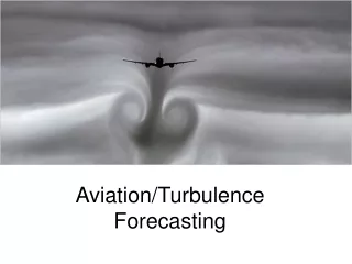
What Does Aviation Forecasting Consist Of? • National Weather Service Forecast Offices • Terminal Aerodrome Forecasts (TAFs) • Center Weather Service Units • Liaison with the FAA at its centers, Center Weather Advisories (CWAs) and Meteorological Impact Statements (MISs) • The Aviation Weather Center • In-flight advisories (AIRMETs, SIGMETs) • The Hydrometeorological Prediction Center • Winds and temperature aloft forecasts
WFO Raleigh forecasts for five airports in central North Carolina: • KINT • KGSO • KRDU • KFAY • KRWI
What Goes Into a TAF? • KGSO 132320Z 1400/1424 31008G15KT P6SM FEW070 • FM140700 32008G15KT P6SM SKC • TEMPO 1408/1412 1/2SM FG BKN005 • FM141300 35007KT P6SM SKC WS015/22030KT • FM142000 20010KT P6SM SKC= • TAFs are issued every six hours, and updated as needed. • Scheduled TAFs are issued between 20 and 40 minutes before due. • Elements of the TAF include: • WIND (31008G15KT) • VISIBILITY (P6SM, 1/2SM) • WEATHER (FG for fog, RA for rain, TS for thunder, SN for snow) • SKY (FEW070, BKN005) • LOW-LEVEL WIND SHEAR (WS015/22030KT) • TEMPORARY AND CHANCE CONDITIONS (TEMPO, PROB30)
Another Example • KORD 162320Z 1700/1806 18007KT P6SM SCT100 SCT250 • FM170700 19013KT P6SM BKN040 BKN080 • FM171400 20015G26KT 6SM -SN SCT025 OVC040 • TEMPO 1714/1717 3SM -SN BKN025 • FM171800 22014G23KT 5SM BR BKN015 OVC025 • TEMPO 1718/1722 3SM -SN • FM172300 25013KT P6SM SCT012 OVC020 • TEMPO 1723/1802 3SM –SHSN • FM180200 30012KT P6SM SCT015 BKN025 • PROB30 1802/1804 5SM -SHSN= • In this case, the TAF for Chicago’s O’Hare Airport is 30 hours in length. Several large airports now have 30-hour TAF service at the request of customers.
Aviation Forecast Discussion • .AVIATION /03Z SATURDAY THROUGH WEDNESDAY/... • AS OF 730 PM FRIDAY... VFR CONDITIONS EXPECTED THROUGH THE 24-HOUR TAF PERIOD... AS ARCTIC HIGH PRESSURE CONTINUES TO BUILD EASTWARD TO THE MID ATLANTIC COAST THROUGH SATURDAY. EXTENSIVE MID AND HIGH CLOUDS -- ASSOCIATED WITH A SHORTWAVE TROUGH ALOFT (MID/UPPER LEVEL DISTURBANCE) CENTERED NEAR ATLANTA AT THE MOMENT -- WILL CLEAR CENTRAL NC BY ABOUT MIDNIGHT... WITH CLEAR SKIES EXPECTED THEREAFTER. NEAR SURFACE WINDS WILL REMAIN GENERALLY LIGHT NORTHERLY OVERNIGHT... BECOMING VARIABLE AND EVENTUALLY SOUTHEASTERLY OR SOUTHERLY LATE SATURDAY AS THE ARCTIC RIDGE MOVES EAST. • The aviation discussions, new within the last couple of years, are meant to help aviation interests understand the impacts to aviation in and near the terminal sites. Especially helpful are discussions of alternatives not included in the TAF. Customer feedback has been positive.
Measures of Success Thunderstorm climatology Crosswind and low-level wind shear climatology Outreach to internal partners and external customers Includes forecasts for INT, GSO, RDU, FAY, & RWI
The CWSUs serving the nation. • Central NC is served mostly by the Washington CWSU, with a small portion served by Atlanta.
A CWSU Product - MIS • ICING- NONE SIG EXPECTED.TURB- LGT-MOD TURB IS PSBL ALONG ERN ZNY AND WRN ZNY. OCEANIC AIRSPACE...TURB IS MOST LIKELY BETWEEN FL200 AND FL300..TRACON AREA FORECAST- VFR COND WILL CONT THRU THE PERIOD. WINDS WILL START OFF FM 290-31 AT 10-14KT WITH OCNL GUSTS TO 20KT AT LGA/JFK...AFT 19-20Z GUSTS WILL DIMINISH...AFT 01-03Z WINDS WILL BEC 8KT OR LESS EVERYWHERE..ZNY OCEANIC AIRSPACE- LGT-MOD TURB PSBL IN NWRN PARTS OF THE AIRSPACE...TURB IS MOST LIKELY BETWEEN FL200 AND FL300.
The Aviation Weather Center • Located in the National Weather Service Training Center just north of Kansas City, MO • In-flight advisories for turbulence, icing, wind, IFR, mountain obscuration. LLWS, volcanic ash • (SIGMETs and AIRMETs) • SIGMET – Significant Meteorological Information • AIRMET – Airmen’s Meteorological Information (conditions less significant but still a concern) • Collaborative Convective Forecast Product (CCFP)
AIRMET TANGO FOR TURB VALID UNTIL 170900 AIRMET TURB...NC SC GA FL AND CSTL WTRS FROM 160SE SIE TO 190ESE ECG TO 130SSE ILM TO 180E PBI TO 70SW SRQ TO 130ESE LEV TO 40W CEW TO 50SW PZD TO GQO TO HMV TO 20NE ECG TO 160SE SIE MOD TURB BTN FL180 AND FL400. CONDS CONTG BYD 09Z THRU 15Z.
Thank you for all of the great reports from the recent snow event! The reports were great, and were collected and passed along to many through public information statements.
Thanks for Listening! The NWS on the web: http://weather.gov/rah Your home on the Internet for forecasts and warnings, direct from the NWS.