Download
1 / 14
140 likes | 324 Views
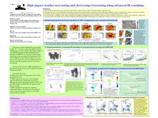
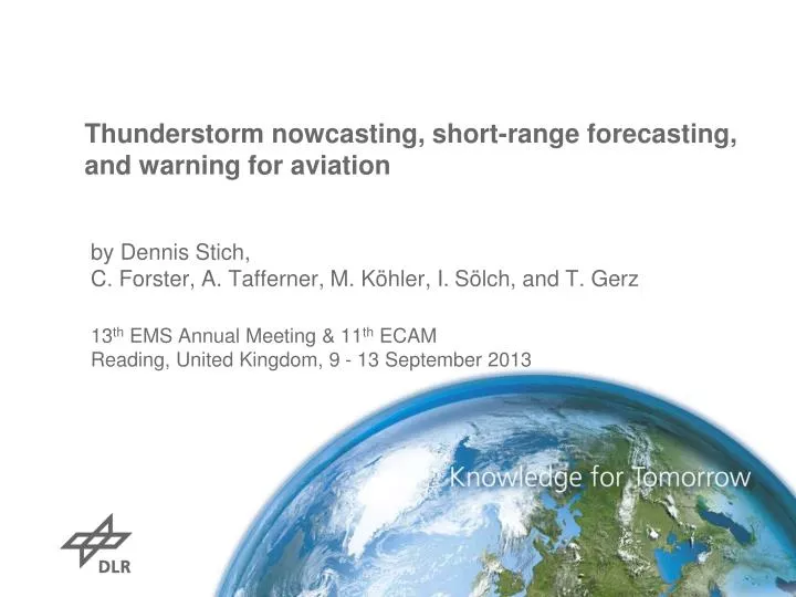
Thunderstorm nowcasting , short-range forecasting, and warning for aviation . by Dennis Stich, C. Forster, A. Tafferner, M. Köhler, I. Sölch , and T. Gerz 13 th EMS Annual Meeting & 11 th ECAM Reading, United Kingdom, 9 - 13 September 2013.

E N D
Thunderstorm nowcasting, short-range forecasting, and warning for aviation byDennis Stich, C. Forster, A. Tafferner, M. Köhler, I. Sölch, and T. Gerz 13th EMS Annual Meeting & 11th ECAM Reading, United Kingdom, 9 - 13 September 2013
> EMS & ECAM 2013 > Dennis Stich > September 2013 Thunderstormsasweatherobjectswith multiple objectattributes Cb top: conv. turbulence, lightning activity, etc. detected by satellite (Cb-TRAM) Cb bottom: hail, icing, lightning, heavy rain, turbulence, etc. detected by radar (Rad-TRAM) Picture byMartin Köhler, DLR Vortrag > Autor > Dokumentname > Datum
Weather Forecast User-oriented System Including Object Nowcasting > EMS & ECAM 2013 > Dennis Stich > September 2013 Surface Analysis Lightning Radar tracker POLDIRAD Cloud tracker Combination of datasourcesthroughfuzzylogic: Decisionfindingtechniqueallowingforparameterranges instead of fixedthresholds Takes intoaccountthemeteorologicalexperienceandconcepts aswellaslocaleffects weather object specification oriented at user requirements Initiation Track Nowcast Forecast forecast validation forecast validation Object Comparison Object Comparison SYNSAT COSMO-DE & Ensemble Local forecasting SYNRAD
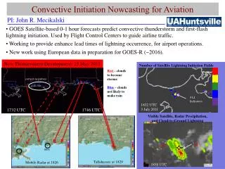
> EMS & ECAM 2013 > Dennis Stich > September 2013 Cb-TRAM -CumulonimbusTRackingAndMonitoring Used MSG (rapidscan) data: WV 6.2 IR 10.8 IR 12.0 HRV Detection stages: 1: Convection Initiation (CI) development in HRV IR 10.8 cooling 2: Rapid development WV 6.2 rapid cooling (> 1K/15min) 3: Mature storms T 6.2 - T 10.8 HRV texture Extrapolation up to 60 min (here 30 minute nowcast plotted) Description: Zinner et al., 2008,09 & 13 Detection stages: 1: Convection Initiation (CI) development in HRV IR 10.8 cooling 2: Rapid development WV 6.2 rapid cooling (> 1K/15min) 3: Mature storms T 6.2 - T 10.8 HRV texture Lightning (LINET) Extrapolation up to 60 min (here 30 minute nowcast plotted) Description: Zinner et al., 2008,09 & 13
> EMS & ECAM 2013 > Dennis Stich > September 2013 CI postprocessing with additional data LINET data & ingredients describing moisture, instability, and lift: equivalent potential temperature θe KO-Index vertical motion ωin 500 hPA Generation of a CI forcing value for each CI detection with fuzzy logic CI forcing values can be translated into a statistical probability of further development Lowest probabilities can be filtered Theprobability of further development is an additional information which can be treated as a kind of confidence level assigned to the CI detection
> EMS & ECAM 2013 > Dennis Stich > September 2013 Cb-TRAM: area of application
> EMS & ECAM 2013 > Dennis Stich > September 2013 Rad-TRAM - Radar Tracking and Monitoring Based on DWD radardata: RX and EURADCOM Black contours: areas > 37 dBZ Dottedcontours: 60 min nowcast Tracking andnowcasting based on pyramidal matchinglike in Cb-TRAM Availableevery 5th minute
> EMS & ECAM 2013 > Dennis Stich > September 2013 Rad-TRAM: area of application Rad-TRAM EURADCOM forFABEC (FunctionalAirspace Block European Central) Rad-TRAM RX for Germany Rad-TRAM EURADCOM for TMA MUC
> EMS & ECAM 2013 > Dennis Stich > September 2013 Automatedthunderstormwarnings (AutoAlert) Aims: Raisesituationalawareness Presentationofthe same informationtodescribethecurrent situationto all stakeholdersat an airporttosupport CDM Automated generation oftextwithattachmentofthecurrent Rad-TRAM-image fortheTMA – 24/7 availability ~ 120 usersat Airport MUC at DFS, FMG, Lufthansa, DWD, TUIfly, AirBerlin, All Nippon Airways… Applicable not onlyat MUC, but foreachairportwhereRad-TRAM andlightningmeasurementdataareavailable
> EMS & ECAM 2013 > Dennis Stich > September 2013 AutoAlertexamplewith additional informationinteractivelyedited (in red) DLR Oberpfaffenhofen, 20 June 2012, Gewitterwarnhinweis um 14:40 UTC ********************************************************* Es wurden Gewittertops bis ca. 14 km Höhe und länger anhaltender Hagel beobachtet. Gewitterzelle Nr. 281 etwa 31 km von MUC entfernt wird laut Prognose in 50 Min. den Flughafen MUC treffen. Weitere Gewitterzellen weniger als 100 km von MUC entfernt. Betroffene Bereiche: NW, SW, SE Mittlere Zugrichtung aller Zellen: nord-oestlich Zur Erläuterung: Gewitterzellen sind schwarz umrandet (Bereich mit Starkniederschlag). Die Verlagerung nach 60 Minuten ist mit einem Pfeil und einer schwarz-weiß gestrichelten Linie markiert. Blitze (LINET) sind mit blauen Kreuzen markiert. Weitere Informationen: Siehe Anhang, MetFROG und http://www.pa.op.dlr.de/nowcasting/ (User: nowcasting, Passwd: drizzle) Mit freundlichen Grüßen, das Gewitterteam des DLR Instituts für Physik der Atmosphäre Feedback, Fragen und Anregungen bitte an cb-team@dlr.de Tel.: 08153 28 3174 oder 01853 28 1218
> EMS & ECAM 2013 > Dennis Stich > September 2013 Cbindicatorforecastsupto 6 hrs (Cblike) Fuzzylogiccombinationof CAPE, 500 hPaverticalvelocity, syntheticsatelliteandradardatafromthe DWD COSMO-DE model Cbobservation 21 June 2012 18:00 UTC Cblike6 hrsforecastfor 21 June 2012 18:00 UTC White contours: Cblikeindicatorexceeding a certainthreshold Pink contours: Rad-TRAM cells Blue crosses: Lightningdata (LINET)
> EMS & ECAM 2013 > Dennis Stich > September 2013 Short-range limited area NWP (COSMO-MUC) Forseemlesspredictionofairtraffic relevant phenomena Forecast skill (60 min) (30 min - 4h) (3h +) Theory Forecast lead time Nowcast NWP
Experience in theframeworkof Wetter & Fliegen > EMS & ECAM 2013 > Dennis Stich > September 2013 COSMO-EU COSMO-MUC MUC Glidepath ~360 km P2P Height [m] Glide path positions (GPP)
Thankyouforyourattention! contact: dennis.stich@dlr.de > EMS & ECAM 2013 > Dennis Stich > September 2013 Decreaseofinformationdetailoverforecast time (Tafferner et al., 2012) Best possibleCbdescription through 3D-polarimetric radar, lightning, satellite, LLWAS; Fuzzylogic: convective initiation, intensity, lifecycle Output: Cbobject 3D with attributes. Extrapolation includingtrend in 3 dimensionsbyfuzzylogic Combination. Output: Cbobject 3D with attributes. Extrapolation 2-D only, noverticalextent, notrend, indicationofseverity. Output:Cbobject 2 D with attributes Calculationofprobabilityof occurrenceofCbwithcertain intensitybyfuzzylogiccombination ofextrapolationandmodelforecast 75% 50% 25%