Download
1 / 19
190 likes | 312 Views
Study of bound water in the surface layer of Mars. Alexander T. Basilevsky. Vernadsky Institute of Geochemistry and Analytical Chemistry Russian Acedemy of Science Moscow 119991 Russia atbas@geokhi.ru. Workshop HEND-2002 “The First year of HEND operations

E N D
Study of bound water in the surface layer of Mars Alexander T. Basilevsky Vernadsky Institute of Geochemistry and Analytical Chemistry Russian Acedemy of Science Moscow 119991 Russia atbas@geokhi.ru Workshop HEND-2002 “The First year of HEND operations on the NASA Odyssey Mars Orbiter” May 20-22, 2002 Institute for Space Research Moscow, Russia
Bound water - water incorporated into minerals and rocks which can not be removed without changing structure or composition of these materials. Minerals H2O content Gypsum - CaSO4 2H2O 21% Goethite - FeO (OH) 10% Nontronite - Na0.33Fe23+(Al0.33Si3.67)O10 (OH)2 nH2O 5-15% Chlorite - (Mg,Fe2+,Fe3+)6AlSi3O10(OH)8 5-14% Serpentine - (MgFe)3Si2O5(OH)4 10-13% Hornblende - (Ca,Na)2-3 (Mg,Fe2+,Fe3+,Al)5 (Al,Si)8 (OH)2 2-3% Rocks Basalt - volcanic rock with 44-50% SiO20.1 to 2% Andesite - volcanic rock with 53-63% SiO21-4% Rhyolite - volcanic rock with >68% SiO23-7% ----------------------------- Clays of platforms of Earth 4-6% ---------------------------- Martian soil (Viking GS-MS estimate) up to 1%
Bound water in tholeitic basalts of intra-plate hot spots, Earth
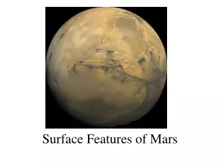
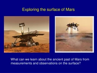
Water on Mars: Noachian Period -Warm and wet or cold and dry? Viking image of cratered terrain with valley network If it was water, it should be chemically incorporated into weathering products and sediments and its hydrogen may potentially be seen in HEND data
Water on Mars: Hesperian Period - Outflow channels - water or liquid CO2 Viking image of Mars Pathfinder site at the mouth of Ares Vallis If it was water, their deposits may contain H2O-OH-bearing minerals and their hydrogen may potentially be seen in HEND data
Water on Mars: Hesperian Period - Did aqueous ocean exist on Mars? Mola topography map of Mars. Courtesy of Mola Team If yes, its sediments should contain H2O-OH-bearing minerals and their hydrogen may potentially be seen in HEND data
Water on Mars: Amazonian Period Was liquid water on and near the surface? MOC image of gullies on the walls of crater Kaiser (46.5S, 341.4W). If yes, surface deposits may contain H2O-OH-bearing minerals and their hydrogen may potentially be seen in HEND data
Impact-induced and magmatic hydrothermal activity Amount of impact-induced and magmatic hydrothermal mineralization decreases with depth (Masaitis & Naumov, 1993). Should be most prominent on the surface. Possible (magmatic) analog: Hydrothermal deposits of Yellowstone National Park Mammoth Terrace Norris Geiser Courtesy of Elizabeth Tritthart, West Yellowstone Web Works Bedrock: Rhyolite(Bauer, 1948; Browny, 1978) Hydrothermal deposits: Travertine CaCO3, Geiserite SiO2 High-silica zeolites, Clays…
How to search for bound water? - To study areas where seasonal/perrenial ices/frosts are not expected: Equatorial zone for all seasons and mid-latitudes at summer Mola shaded relief map of Mars. Courtesy of MOLA Team
General approach: - To correlate HEND data with a) bedrock geology b) topography and c) surface roughness a) Geologic map of Mars. Tanaka et al., 1978
General approach: - To correlate HEND data with a) bedrock geology b) topography and c) surface roughness b) Mola topography map of Mars. Courtesy of MOLA Team
General approach: - To correlate HEND data with a) bedrock geology b) topography and c) surface roughness c) Map of kilometer roughness of Mars. Kreslavsky and Head, 2000
Discussion and conclusions • Some correlation of HEND measured neutron flux • with geologic structures of Mars is seen: • Syrtis Major Planitia (more H, hyps. higher) • v.s Isidis Planitia (less H, hyps. lower) • Hellas basin floor (more H, hyps. lower) • v.s. Argyre basin floor (less H, hyps higher) • Noachian-Hesperian cratered terrain within 0-40W, 30N-15S • has highest contents of H among all equatorial zone, • being usual in hypsometry and surface roughness • Medusa Fossae: increase in H content comparing to • surrounding areas • Elysium Fossae: increase in H content comparing to Elysium • Mons and its other surroundings • Olympus, Arsia, Pavonis, Ascreus volcanic constructs show • low H contents, same as materials of close vicinities More analysis needed to reach meaningful conclusions
HEND data: (0.4 eV-100 keV) HEND data: (1-7 MeV)
Needs for future studies • To understand meaning of neutron flux of different • energies in the geological context (likbez) • To have HEND results maps in cylindical projection • To work on different gradations of the flux intensity • categories on the maps • To play with degree of smoothening on the maps • Calibration of the results in percent of H2O • Possibility of improvement of spatial resolution due to • multiple overlapping of the measuring orbits?