Download
1 / 41
410 likes | 519 Views
Mobile and Distributed GIS and LBS. Geog 176B Lecture 9. The network is the computer. Computer Network Software Localizer. Wired Networks. “Last Mile to the house” 300 baud dial-up early ‘80s 56 kbps dial-up (since mid 1990s) ISDN 64-128 kbps (digital)

E N D
Mobile and Distributed GIS and LBS Geog 176B Lecture 9
The network is the computer Computer Network Software Localizer
Wired Networks • “Last Mile to the house” • 300 baud dial-up early ‘80s • 56 kbps dial-up (since mid 1990s) • ISDN 64-128 kbps (digital) • DSL: 1.5Mb down/64Kb up (6Mb/640K in future) • cable modem: 2 Mbps (load dependent) • LANs (local area network) within building or campus • 300 baud RS232 (1970s) • 10MB Ethernet (1980s) • 100MB Ethernet (mid 1990s) • 1GB Ethernet (late 1990s) • WANs (wide area network) connects LANs • shared, public facilities (Internet) • Dedicated Telco leased lines (fixed bandwidth) • T1 (24 x 64 Kbps channels: 1.54MBps) • T3 (28 T1 circuits: 45MBps; requires fiber) • Dedicated fiber (usually SONET protocol) • OC1 (base rate) 50 mbps OC12 = 600 Mbps • OC3 = 150 Mbps OC48 = 2.4Gbps • ‘virtual circuit’ protocols (max. guaranteed bandwidth)
Twisted pair wire: (now up to 1Gbps) distance/speed trade-off 150m. max. for highest speed high speed: closet to desktop (using Level 5 cable) low speed: home to Telco office Maximum leased line over copper is T1 (1.4Mbps) Coaxial cable (up to 200Mbps): longer distances (up to 20 miles) was fading but cable TV and Internet brought revival for “last mile” applications Fiber optic (exceeds 100Gbps & doubling every 9 months--twice Moore’s Law) single mode for distances over 1 or 2 miles Multi mode within buildings More “wires”
Wireless • infrared (1 mile) • microwave (35 miles line of site) • satellite geostationary (22,000 miles up)--’group’ links • satellite low orbit --individual links • radio--mobile data networks (police) • Wireless LANs (WiFi 802.11b/g) • Cellular data: 3G services • Satellite telephone link
Closer to the Wire Types of Protocols • WAN transmission protocols: • T1/T3 (old faithful for copper/fiber dedicated lines) • SONET(Synchronous Optical Network) • Virtual circuits: Frame Relay, SMDS (Switched Mutimegabit Data Service), ATM (Asynchronous Transfer Mode) All are fading! • LAN Transmission Protocols: • Ethernet 10MB/100MB/1GB (the standard) (IEEE 802.3) • Wireless: replaces wires over short distances • 802.11b (WiFi): 11Mbps on 2.4GHz band (crowded spectrum)-300 feet coverage • 802.11g: faster (54 Mbps) version of 802.11a • Bluetooth: small, cheap (eventually) but doesn’t run tcp/ip • Data Communication Protocols • tcp/ip (transmission control program/internet protocol) the standard • Tcp/ip has replaced • WAN: SNA( old IBM proprietary), X.25 (old open) • LAN: XNS (Xerox), IPX (Novell), Ethertalk(Apple), NetBIOS • Internet: interconnected LANs and WANs running tcp/ip • Internet2/NGI: Next Generation Internet univ/vendor coop. research Closer to the User
Characteristics of Circuits and Networks • circuit switched v. packet switched • end-to-end connection established (e.g voice call) • or, electronic packet traverses the network (like parcel via UPS) • typology: star, hierarchy, bus, ring • baseband v. broadband • one service/channel/protocol per cable v. Multiple (e.g. cable TV is broadband) • switched v. dedicated lines • compete for circuit when needed • or, have your own all the time • public v. private • share with all others (e.g. Internet) • or, have your own (e.g. Intranet)
Networked GIS • Configured within an organization or lab • Collaboration across organizations • Tools relatively undeveloped “Virtual Organization” original vision of web • Web portals offer GIS “services” • Wireless access can be “on-the-spot” • New industry-LBS
Ubiquitous Computing • Computing any time, anywhere • Always on, trackers • Monitoring activity • Sensor networks • Localizers, Actuators • The GRID • Sensitive to multiple inputs
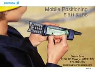
Emergence of LBS • Convergent technologies • Cell phone • GPS • GIS • Wireless networking • Impact has been on the “where” of computing
Wearable computing http://www.itmedia.co.jp/broadband/0309/18
Time-space Geography Source: Jonathan Raper, City University, London
A new role for GIS: highly integrated spatial problem solving • Need a theory of human mobility and access • Need real time multi-source data fusion • GIS continues to play the major role • Tools for 4D GIS only now getting started • Major constraint remains the human computer interface
What is GPS? • GPS is a Satellite-based Navigation System • Generic term: Location Determination Technology • Funded by and controlled by the U. S. Department of Defense (DOD). Originally NAVSTAR • Designed for military tasks: Dual Use • Civil uses now far exceed military
One of three such systems • GLONASS • Galileo • GPS Blocks I and II • Block III and beyond • Many new LDTs, some using GPS • Pseudolites
The GPS System has the following components • Space Segment • Ground/Control Segment • User segment
What the Satellite Does Radio signal transmission Onboard atomic clock Metadata in ephemeris Carrier signal
The constellation 24 satellites 6 orbital tracks 4 satellites/track 12 hour orbits
Control Segment • The Control Segment consists of a system of tracking stations located around the world. • GPS Master Control and Monitor Network located at Schriever Air Force Base in Colorado • These monitor stations measure signals from theSVs which are incorporated into orbital models for each satellite • The models compute precise orbital data (ephemeris) and SV clock corrections for each satellite • The Master Control station uploads ephemeris and clock data to the SVs as they pass over • The SVs then send subsets of the orbital ephemeris data to GPS receivers over radio signals
The User Segment: The Signal • Signals Specified In The Federal Radionavigation Plan • PPS: Precise Positioning Service • Military/encrypted • 22 m hor. 27.7 m vert. 200 ns accuracy • SPS: Standard Positioning Service • Civil users • Subject to SA, but turned off May 1st, 2000 • 100m hor. 156m vert. 340 ns accuracy
GPS Satellite Signals • The SVs transmit two microwave carrier signals. • The L1 frequency (1575.42 MHz) carries the navigation message and the SPS code signals. • The L2 frequency (1227.60 MHz) is used to measure the ionospheric delay by PPS equipped receivers. • Can process carrier phase delay for extra accuracy
Digital signal processing • Three binary clock-tied codes shift the L1 and/or L2 carrier phase. • The C/A code • The P-code • The Y-code • Plus the navigation message
Received Signal distance (m) = time (s) * c (m s-1) 4+ distance, three unknowns In GPS
Dilution of Precision Ionospheric Effect GDOP-PDOP
WAAS network • ~25 precisely measured WRS (Wide Area Reference Stations) • Receive signal from GPS satellites, check for error, then broadcast the correction
Accuracy Usually about, 4-8m With correction (WAAS), 1-3m $150-300 gets you a new GPS Garmin eTrex Vista $60-150 Garmin Quest $599 WAAS Magellan Meridian Gold GPS$250 WAAS Garmin Forerunner 201 $100-150 Casio Protrek GPS Watch
Precision Agriculture GPS enabled innovation
MEMS and WINS • Microelectromechanical systems • Using semiconductor manufacturing techniques to make analog devices • Also called localizers • Wireless Integrated Network Sensors (WINS) provide distributed network and Internet access to sensors, controls, and processors that are deeply embedded in equipment, facilities, and the environment.
Smart Dust Applications: Sensor webs • Personal location • Object location (geosensors) • Autonomous bots (geoprobes) • Inventory control • Localized intelligence for IVHS • Machine control • Infrastructure inspection • Smart homes • Biosensors • Agrisensors!