Download
1 / 42
430 likes | 598 Views
Down in the Trenches. Automating Label Placement in Dense Utility Maps Jill Phelps Kern. The Map Label Placement Problem. Definition Literature review Research problem Approach and timeline. Problem Definition. The Map Label Placement Problem Placing map feature labels legibly

E N D
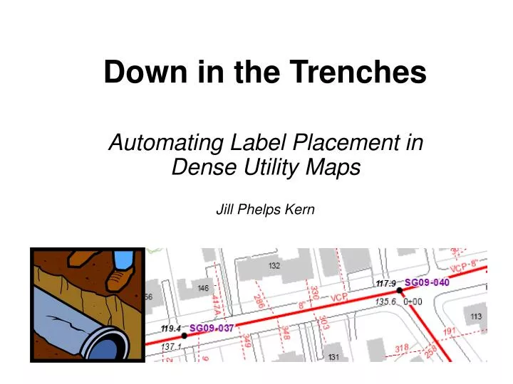
Down in the Trenches Automating Label Placement in Dense Utility Maps Jill Phelps Kern
The Map Label Placement Problem • Definition • Literature review • Research problem • Approach and timeline
Problem Definition The Map Label Placement Problem Placing map feature labels • legibly • without overlap (features / other labels) • maintaining visual association of labels with their features
Literature Review Themes Label Placement • rules • quality metrics • algorithms
Label Placement Rules • Area features • Point features • Line features Label placement most difficult Label placement least constrained
Label Placement Rules Menemsha W i s s o t a R. W i s s o t a R. Lakeview Lakeview L a k e W i n n i p e s a u k e Lake Winnipesauke Franklin County Davis County Potomo Potomo Sources: Imhof (1962, 1975); Wood (2000)
Label Placement Quality Metrics • Aesthetics • Label visibility • Feature visibility • Association i River R v e r City City Peak Peak Peak BTown ATown BTown ATown Based on Van Dijk et al. (1999)
Label Placement Quality Metrics • Aesthetics 5 of 20 papers reviewed • Label visibility 20 • Feature visibility 10 • Association 11
Automating Label Placement • Area features • Point features • Line features Label placement most difficult Frequent research target for label placement automation Label placement least constrained
Automating Label Placement • Area features • Point feature label placement • Line features models algorithms
Automated Point Feature Label PlacementModels Discrete label position priorities: Yoeli (1972) 7 2 1 6 5 4 3 8 Slider model: Van Kreveld et al. (1999) Continuous circumferential movement: Hirsch (1982), Kameda & Imai (2003)
Automated Point Feature Label PlacementAlgorithms Local Search Global Optimization
Automated Point Feature Label PlacementAlgorithms Local Search • Rule-based exhaustive search • Gradient descent Global Optimization • Force-directed • Simulated annealing
Local Search Algorithms Exhaustive Search Rule Rule Rule … x • Place labels according to rules until violation • Backtrack and adjust to maximize number of labels placed
Local Search Algorithms Gradient Descent • Develop initial label placement • Compute overlap vectors to guide • next movement • Iterate From Hirsch (1982), p. 13
Local Search Algorithms Gradient Descent • Develop initial label placement • Compute overlap vectors to guide • next movement • Iterate • Can cycle between • local minima (a) and (b) • without finding • preferred placement (c) From Hirsch (1982), p. 13 (b) (a) (c) From Christensen et al. (1995), p. 213
Automated Point Feature Label PlacementAlgorithms Local Search • Rule-based exhaustive search • Gradient descent Global Optimization • Force-directed • Simulated annealing
Global OptimizationAlgorithms Force-Directed From Stadler et al. (2006), p. 211
Global OptimizationAlgorithms Simulated Annealing Based on Zoraster (1997) and Christensen et al. (1995)
Automated Label PlacementSoftware Imhof (and others’) labeling rules Iteration and backtracking Optimization Yoeli priorities Association 9.2 Label / feature visibility Aesthetics Slider models Force-directed methods Simulated annealing
Project Objectives Evaluate the automated labeling capabilities of current GIS software when applied to dense maps Identify factors which necessitate manual label placement
Project Context Town of Concord Sewer Map Book
Sewer Infrastructure Features Point feature: Sewer manhole Attributes: Facility ID, station number, rim elevation, invert elevation
Sewer Infrastructure Features Line feature: Sewer main Attributes: Size, material (VCP = vitreous clay pipe)
Sewer Infrastructure Features Line feature: Sewer main Attributes: Slope and slope direction
Sewer Infrastructure Features Line feature: Sewer tie Attribute: Service number
Sewer Labeling Quality Metrics Importance: Critical – Major – Minor • Number of Labels Placed • Total and % of ideal • Minimal leader length • B. Labels in Preferred Position • Point (manhole) • Line (sewer mains & ties) • Area (streets) • C. No Overlap • Label-label • Label-sewer tie
Sewer Labeling Quality Metrics Importance: Critical – Major – Minor • Number of Labels Placed • Total and % of ideal • Minimal leader length • B. Labels in Preferred Position • Point (manhole) • Line (sewer mains & ties) • Area (streets) • C. No Overlap • Label-label • Label-sewer tie
Sewer Labeling Quality Metrics Importance: Critical – Major – Minor • Number of Labels Placed • Total and % of ideal • Minimal leader length • B. Labels in Preferred Position • Point (manhole) • Line (sewer mains & ties) • Area (streets) • C. No Overlap • Label-label • Label-sewer tie
Approach and Timeline 1. Prepare for research (Dec – Feb) 2. Conduct research (Mar – May) 3. Develop conclusions (Jun – Jul) 4. Present findings (Aug – Oct)
1. Prepare for Research • Conduct literature review - COMPLETE • Select case study maps - COMPLETE • Design label classes, styles and hierarchy / weighting • - COMPLETE • Develop label placement quality metrics - COMPLETE
2. Conduct Research • Automated Labeling • Apply automated ESRI labeling tools to case study maps • Standard labeling engine • Maplex • Measure quality of automated results • Iterate to improve quality using automated tools • Select highest quality result (standard vs. Maplex) for remaining steps
2. Conduct Research • B. Manual labeling • Complete manual adjustments • Measure quality of manual results • Compare quality of final automated vs manual
3. Develop Conclusions • Strengths and limitations of current automated • labeling tools • Conditions under which manual placement • becomes preferable • Research limitations and potential for future study
4. Present Findings • Prepare for conference presentation • Present at NACIS 2007 conference
Preliminary Findings Standard Labeling Engine Maplex Poor Acceptable Ideal
References Christensen, Jon, Joe Marks, and Stuart Shieber. 1994. Placing text labels on maps and diagrams. Graphics Gems IV, Cambridge MA: Academic Press, 497-504. Christensen, Jon, Joe Marks, and Stuart Shieber. 1995. An empirical study of algorithms for point-feature label placement. ACM Transactions on Graphics (14)3: 203-232. Cook, Anthony C. and Christopher B. Jones. 1990. A Prolog interface to a cartographic database for name placement. In Proceedings of the International Symposium on Spatial Data Handling, International Geographical Union and International Cartographic Association, pp. 701-710. Doerschler, Jeffrey S. and Herbert Freeman. 1992. A rule-based system for dense-map name placement. Communications of the ACM (35)1: 68-79. Ebner, Dietmar, Gunner W. Klau and Rene Weiskirscher. 2003. Force-based label number maximization. Technical Report TR 186-1-03-02, Vienna: Vienna University of Technology. Edmondson, Shawn, Jon Christensen, Joe Marks, and Stuart M. Shieber. 1996. A general cartographic labeling algorithm. Cartographica (33)4: 13-23. Freeman, Herbert and John Ahn. 1984. AUTONAP – an expert system for automatic name placement. Proceedings of the International Symposium on Spatial Data Handling, International Geographical Union and International Cartographic Association, pp. 544-569. Freeman, Herbert and John Ahn. 1987. On the problem of placing names in a geographic map. International Journal of Pattern Recognition and Artificial Intelligence 1(1): 121-140. Hirsch, Steven A. 1982. An algorithm for automatic name placement around point data. The American Cartographer 9(1): 5-17. Imhof, Eduard. 1962. Die Anordnung der Namen in der Karte [Positioning names on maps]. Internationales Jahrbuch fur Kartographie, vol. 2, Verlagsgruppe Bertelsmann GmbH/Kartographisches Institut Bertelsman, pp. 93-129. Imhof, Eduard. 1975. Positioning names on maps. The American Cartographer 2(2): 128-144. Jones, Christopher B. 1989. Cartographic name placement with Prolog. IEEE Computer Graphics and Applications 9(5): 36-47. Kameda, Takayuki, and Keiko Imai. 2003. Map label placement for points and curves. IEICE Transaction Fundamentals E86-A(4): 835-840. Stadler, Georg, Tibor Steiner and Jurgen Beiglbock. 2006. A practical map labeling algorithm utilizing morphological image processing and force-directed methods. Cartography and Geographic Information Science 33(3): 207-215. Van Dijk, S., M. Van Krefeld, Tycho Strijk, and Alecander Wolff. 1999. Towards an evaluation of quality for label placement methods. Proceedings of the 19th International Cartographic Conference and 11th General Assembly, ed. by C. P. Keller, Ottawa, Ontario, pp. 57-64. Van Kreveld, M., Tycho Trijk and Alexander Wolff. 1999. Point labeling with sliding labels. Computational Geometry 13: pp. 21-47. Wood, Clifford H. 2000. Descriptive and illustrated guide for type placement in small scale maps. The Cartographic Journal 37(1): 5-18. Yoeli, P. 1972. The logic of automated map lettering. The Cartographic Journal 9(2): 99-108. Zoraster, Steven. 1997. Practical results using simulated annealing for point feature label placement. Cartography and Geographic Information Science 24(4): 228-238.