Download
1 / 24
240 likes | 382 Views
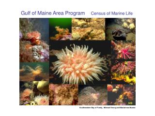
US GLOBEC: Progress of the Gulf of Maine Integrated Model System. The UMASSD Team: C. Chen, Q. Xu, S. Hu, Q. Xu, D. Stuebe, P. Xue and G. Cowles. The WHOI Team: R. C. Beardsley, C. Davis, R. Ji and D. Limeburner. The MIT Team: P. Rizzolli and J. Wei.

E N D
US GLOBEC: Progress of the Gulf of Maine Integrated Model System The UMASSD Team: C. Chen, Q. Xu, S. Hu, Q. Xu, D. Stuebe, P. Xue and G. Cowles The WHOI Team: R. C. Beardsley, C. Davis, R. Ji and D. Limeburner The MIT Team: P. Rizzolli and J. Wei Website: http://fvcom.smast.umassd.edu
Outline 3-D assimilation experiments (OI and Kalman Filter) Improvement of the model salinity field Northeast Ocean Forecast System (NECOFS) Preparation for transition to Pan-Regional GLOBEC projects Recent FVCOM developments Summary
Data Assimilation Experiments Optimal Interpolation (OI) assimilated all T/S and current data into the model. T/S was added as the monthly base, and currents were implemented as hourly input. The OI experiment has been run for years 1995-2006. Ensemble Kalman Filter was focused on twin experiments in the Northeast Channel area, and now is being extended to cover the entire Gulf of Maine domain.
Major Results of OI Assimilation Experiments Improves the deep circulation and water exchange between GOM and outer ocean Improves the simulation of water salinity in both interior and coastal regions Examples are shown for an example of 1998. Results from other years are being processed.
Jan Feb Mar Apr Aug May June July Spt Oct Nov Dec The hydrographic data sites: January-December, 1998
Near-surface, April 1998 With No OI Assimilation With OI Assimilation OI reduced the intensity of the Maine coastal currents which probably were overestimated by the model run without assimilation
Velocity (OI)-Velocity (No-OI); Temperature (OI)-Temperature (No-OI)
Near-surface, August 1998 With OI No OI OI showed a well-defined cyclonic gyre in Jordan Basin in summer
Velocity (OI)-Velocity (No-OI); Temperature (OI)-Temperature (No-OI)
At 150-m, August 1998 No-OI With-OI OI shows a cyclonic gyre in Jordan Basin but it is too weak in the case with No OI.
Observing System Simulation Experiment (OSSE) Objective: A series of twin experiments were made to examine the effectiveness of the Ensemble Kalman Filter data assimilation to restore the true ocean state after initial perturbation. Location: Northeast Channel Twin experiments: Case 1: with an initial perturbation in surface wind forcing Case 2: with an initial perturbation in surface heat flux Case 3: with an initial perturbation in the T/S field InOSSE: The true ocean: the forward model results; The false ocean: the forward model results with perturbed initial field without the assimilation; The assimilation analysis: the assimilated results with inclusion of observation;
Major results of OSSEs The twin assimilation experiments indicate that the effectiveness of a data assimilation method depends on initial perturbation. For the imperfect initial condition case in which the T/S fields are perturbed, the EnKF works efficiently in restoring the true ocean state (RMS errors reduce by 75% over a time scale of ~10 days). For imperfect model configuration case in which the wind and heat flux fields are perturbed, the EnKF is constrained more by wind field than heat flux. In winter, the wind dominates the effectiveness,while in summer, both wind and heat flux seem equally important. Since the data assimilation works only under small values, it is more important to improve the accuracy of the forcing driving the model before the data assimilation is used.
Improvement of salinity simulation The model observation: By comparing with GoMOOS salinity measurement data, the USGS river discharge data seems to underestimate the freshwater loading to the coastal region. The value of the underestimation varies with time. For this reason, the model underestimates the salt content in the coastal region and thus causes an inaccurate simulation of the low-salinity plume.
5 4 3 2 1 Correlation between river discharge and GOMOOS measured salinity for 2005 • 1: Merrimack - Station A • 2: Saco - Station B • 3: Andro/Kennebec - Station C • 4: Penobscot - Station F • 5: St Croix - Station J
Action to improve the salinity simulation Test 2005 by adjusting the freshwater discharge from rivers using the linear regression determined by the correlation coefficient between the USGS river discharge data and GoMOOS coastal salinity measurements. Turn on OI assimilation after the river discharge adjustment. Re-run all years from 1995 to 2008 using the same approach. The results for 2005 are completed, which show a significant improvement.
Regional Domain: 9km Domain 2 Domain 1 Domain 3 Domain 2 Large domain: 27km Domain 3 Hindcast Local domain: 3 km
Preparation for Pan-Regional GLOBEC Studies Pan-Arctic Ocean FVCOM In the region where the mean water is deeper or equal to 100 m, 10 same thickness layers in the upper 30 m (with a layer thickness from 2 to 5 m) and 5 same thickness layers in the lower 25 m above the bottom. Driven by the OMIP-Forcing-the sixth version and the model starts run at January 1 with the wintertime fields of water temperature and salinity. The water temperature and salinity data were from polar science center Hydrographic Climatology (PHC) version 3.0. The region north of 65oN is covered by the ice with a thickness of 2.5 m everywhere at initial
Recent Developments of FVCOM UG-SWAN: Unstructured grid version of surface wave model. This module is being coupled into FVCOM Non-hydrostatic version of FVCOM. This version has been validated for typical coastal wave benchmark test problems, and is now being applied to the Gulf of Maine with focus on Stellwagen Bank Semi-implicit version of FVCOM with K-stage advection approach-make the FVCOM run more efficient with kth order accuracy for advection terms Coupling of UG-SWAN and FVCOM-WRF
Summary The FVCOM hindcast field provides an accurate simulation of water currents and temperature. The inaccurate simulation of salinity is mainly caused by underestimation of river discharge; this has been improved by the adjustment of river output through the linear regression approach. 2. The products of the US GLOBEC physical modeling projects have been converted to build the Northeast Coastal Ocean Forecast System (NECOFS). NECOFS is now in operation 24/7 for forecast application. 3. The FVCOM has been extended to cover the Arctic Ocean in preparation for Pan-Regional GLOBEC projects. 4. Recent developments of FVCOM provide us an opportunity to examine detailed non-hydrostatic dynamics in the Gulf of Maine.
Updated Publication List (only physical component) • Chen, C. R. C. Beardsley, Q. Xu, G. Cowlesand R. Lime burner, 2007. Tidal dynamics in the Gulf of Maine and New England Shelf: An application of FVCOM. Journal of Geophysical Research, in revision • Chen, C., H. Huang, R. C. Beardsley, H. Liu, Q. Xu, and G. Cowles, 2007. A finite-volume numerical approach for coastal ocean circulation studies: comparisons with finite-difference models. Journal of Geophysical Research, 112, C03018, doi:10.1029/2006JC003485. • Chen, C., Q. Xu, R. Houghton and R. C. Beardsley, 2007. A Model-Dye Comparison Experiment in the Tidal Mixing Front Zone on the Southern Flank of Georges Bank. Journal of Geophysical Research,113, C02005, doi: 10.1029/2007jc004106 • Chen, C., P.Malanotte-Rizzoli, J. Wei, R. C. Beardsely, Z. Lai, P. Xue, S. Lyu, Q. Xu, J. Qi and G. Cowles, 2008 Validation of Kalman filters for coastal ocean problems: an experiment with FVCOM. Journal of Geophysical Research, accepted with minor revision. • Cowles, G., Chen, C., Lentz, S.L., Beardsley, R.C., and Xu, Q., 2008. Validation of Model-Computed Low Frequency Currents on the New England Shelf. Journal of Geophysical Research, in press. • Huang, H. C. Chen, G. Cowles, C. D. Winant, R. C. Beardsley, K. S. Hedstrom, and D. B. Haidvogel, 2008. FVCOM validation experiments: comparisons with ROMS for three idealized test problems. Journal of Geophysical Research, in press. • Lai, Z, C. Chen, G. Cowles and R. C. Beardsley, A non-hydrostatic version of FVCOM-validation experiment I: surface standing and solitary waves, Submitted • Lai, Z., C. Chen, G. Cowles and R. C. Beardsley, A non-hydrostatic version of FVCOM-valiation experiment II: lock exchange flow and internal solitary waves. Submitted • Wei, J, P. Malanotte-Rizzoli, C. Chen, and R. C. Beardsley, Validation of An Ensemble Kalman Filter in the Northeast Channel of the Gulf of Maine: An OSSE Study, Journal of Geophysical Research, to be submitted.