Download
1 / 40
400 likes | 536 Views
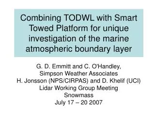
Investigation of the representation of OLEs and terrain effects within the coastal zone in the EDMF parameterization scheme using an airborne Doppler wind lidar. G. D. Emmitt Simpson Weather Associates May 24, 2011. Outline. Research goals Research plans (brief) Background

E N D
Investigation of the representation of OLEs and terrain effects within the coastal zone in the EDMF parameterization scheme using an airborne Doppler wind lidar G. D. Emmitt Simpson Weather Associates May 24, 2011
Outline • Research goals • Research plans (brief) • Background • The instruments and platform • Prior airborne missions • TODWL • P3DWL • Collaboration • Stephan de Wekker (UVa) • Ralph Foster(UWash) • Qing Wang(NPS)
Research goal Contribute to the evaluation and development of the Eddy Diffusivity Mass Flux (EDMF) parameterization by using both existing and new data from the Navy Postgraduate School’s Twin Otter Doppler Wind Lidar (TODWL) in an investigation of lower tropospheric dynamics within the interaction zone of complex terrain and the coastal waters, especially in the presence of Organized Large Eddies (OLEs)and Low Level Jets (LLJs).
Research plan • We will use both the WRF model and COAMPS (in collaboration with J. Doyle) to compare EDMF predicted fluxes and spatial/temporal development of the Planetary Boundary layer (PBL) including aerosol and cloud distributions with those measured by instrumentation on the Twin Otter including the Controlled Towed Vehicle (CTV) funded under a separate grant (Wang and Khelif). • We will conduct flights and ground-based observations under synoptic conditions that favor high (> 5 m/s at 10 meters) wind speeds and shear that are associated with organized large eddies and low level jets over both coastal waters and the adjacent valleys and mountains near Monterey, CA. • During non-flight periods we will operate the TODWL system as a ground based DWL to collect long time series of 3D wind profiles as well as profiles of aerosol features and derive quantities such as Total Kinetic Energy (TKE) and cloud cover fractions. The DWL will also be programmed to obtain low elevation angle volume scans to study the sea breeze front as it interacts with the coastline, the Salinas Valley and the surrounding topographically driven circulations.
Legacy (partial) of airborne DWL research in USA • Early 1980’s • Convair 990 • DC-8 (MACAWS) • Since 2000 • CIRPAS TODWL • NRL P3DWL • Potential in next 12 months • NASA DC-8 • NOAA P3DWL (Dynamo)
P3DWL for TPARC/TCS-08 1.6 um coherent WTX (ARL/LMCT) 10 cm bi-axis scanner (NASA) P3 and other parts (NRL) Analyses software (SWA/CIRPAS)
Comparison with 4km MM5 Working Group on Space-Based Lidar Winds
Instrument investigations • Water surface returns • Implications for space-based mission • LAS returns • Implications for airborne and space-based missions • Cloud effects • Sampling based errors • Inhomogeneities in aerosol/wind structures
Science investigations • Energy flux modes (OLEs, LLJ, effects of spray, etc • Shear instabilities and their role in turbulence bursts • TC life cycles with a focus upon deep layer shear • Model validation and sub-grid scale parameterization
Coastal studies (land) • Ridge and valley circulations • Model validation • Nocturnal boundary layers • Low-level-jets (LLJ) • Organized Large Eddies
Coastal Studies (water) • River currents • Lakes • Monterey Bay • Waves • OLEs • LLJs • Pacific ocean coast
Open ocean MBL and LAS • OLEs • Waves • Typhoon life cycle
Sounding comparisons • Microwave sounders • Radiosondes • Dropsondes • Bouys
CIRPAS Twin Otter with CTV below
Comparison with 4km MM5 Working Group on Space-Based Lidar Winds
TODWL underflight 18 April 6:07 pm PST Monterey Bay, California Buoy Coastline Near Marina Speed m/s)
Salinas Valley Centerline
Collaboration • Steve Greco (SWA) • Sid Wood (SWA) • Kevin Godwin(SWA) • Ralph Foster (UWash) • Stephan de Wekker (UVa) • Zhaoxia PU (Utah) • Dave Bowdle (UAH) • Yansen Wang (ARL) • Jim Doyle(NRL) • Wendell Nuss(NPS)