Download
1 / 19
190 likes | 272 Views
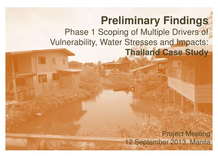
Preliminary Findings Phase 1 Scoping of Multiple Drivers of Vulnerability, Water Stresses and Impacts: Thailand Case Study. Project Meeting 12 September 2013, Manila. Study Area. Bangkok Metropolitan Region. Pathumthani Province. BMR

E N D
Preliminary FindingsPhase 1 Scoping of Multiple Drivers of Vulnerability, Water Stresses and Impacts: Thailand Case Study Project Meeting 12 September 2013, Manila
Study Area Bangkok Metropolitan Region Pathumthani Province • BMR • 7,700 sq.km. area in central Thailand including Bangkok and five adjacent provinces • 10 million pop (2010), 55% of GDP • NOT an administrative territory • Study Area: Krachang Villages • Sited in a low-lying land of Chao Phraya Delta • Having dynamics on land uses, social and economic activities + vulnerable to climate-related water stresses Samkhok District, Pathumthani Study area: Krachang Communities
Climate Changes and Peri-UrbanHow they Induce Vulnerability of Water Stresses in the Study Area • Climate Change Effects in Thailand • Rainfall increase across all regions by 10-20% • Max. and min. temp increases by 2 C. • Natural disasters become common -- increasing damage records over years • Recent critical years: • 2005 drought affected 71 provinces – including Rayong industrial area • 2006 46 provinces were flooded. 47 people killed and more than 2.4 million were affected. • 2011 (the wettest year in the 61-years record), 65 provinces were flooded. More than 880 people killed and millions were homeless or displaced.
Pathumthani Province • Geography:low-lying areas of Chao Phraya Plain, around 2 meters above sea level. The river rises 50 cm. in rainy season causing floods. • Water resources: Chao Phraya River + irrigation and natural canals of 1,060 kms. + underground water (not in good quality) • Prone to flood, high vulnerability zone to flood is on the western side • (include the study area) Krachang Villages Low land River/canal Ponds
Average Rainfalls: around 1,200-1,500 mm./ year. Concentrating in May-Sep • In the past 15 years, major floods occurred in Y 1995, 2006, 2010 and 2011 BUT these years were not the top highest amounts of rainfalls • Other factors intensifying floods: • water mgt in the upstream • Changingslopes • Obstacles of waterways • Absorbing capacity of soil • …. Peri-urban characteristics
Effects of Peri-urban Characteristics on Water Stresses in the Study Area PERI-URBAN CHARACTERISTICS • Rapid populationincrease + weak planning & regulations Inadequate water and WW infrastructure Increase pollution sources WATER STRESSES • Land conversion from single to mixed land uses Elimination of water ways • Unclear jurisdictions and inability of water mgt institutions Ineffective water and WW mgt
Socio-Economic Profile and Affects of Water Stresses in the Study Area • Two Villages in Krachang sub-district, Pathumthani Province • 2.4 sq.km. on the western side of the Chao Phraya • Three canals connecting to the river • The main street (Bang Na-Bang Tei) constructed in 1996 and has been repeatedly increased of height. It now also functions as a dyke. • Land-use is diverse. Factories along highway, local residents along the canals and rivers/ Gov. offices/ commercial houses along the streets/ real estate projects with new residents over 2,000 HHs/ few agricultural plots and a number of vacant lands
Population and sampling: • Total number of local residents is 305 HHs. All Buddhists, mostly Mon ethnic. Many have resided in the area for few generations. • Random survey conducted with 108 HHs. Most respondents were in the working age (30s-60s). Men and Women respondents were equal. • Socio-Economic Profile: • HHs size: average 4-5 persons. Few have large numbers around 7-11 persons • Registered heads of households • Education: half graduated from local primary schools. 35% obtained high school and 15% obtained vocational education
Occupations and income: Motorbike/ taxi-drivers, construction workers, cleaning workers, wage laborers in farms Elders, housewives, students, jobless • 15% in low income (<5,000 THB (160 USD)/ month/ HH), 35% have 300-600 USD, 50% in middle income having 800 USD. • Different occupations different economic resources different level of vulnerability • Full-time employments have regular income and job security even during the crisis (Gov officials have more benefits) WHILE general laborers, part-time factory workers and small-business owners lost all income. Unemployed became more dependence.
Perceptions of Climate Change: Temp. tends to rise every year rainy season is shorter but the rainfalls is higher increasing unseasonal rainfalls • Both men and women’ opinions were similar in perception of forms but women reported to have more effects from the climate-induced impacts.
Water Stresses in Krachang Communities Seasonal flooding October-early Dec annually Rise of Chao Phraya Average flood level 20-50 cm High river level water gate closed/ Dry spell no dissolved water pollution High health risk, esp. the poor HHs. Low water quality in canal Extreme flood Events in the past 30 yrs – 1995 flood 1 m. around 2 months Considered (by the local) a moderate stress 2011 accumulation of rainfalls by 5 cyclones + release of overloaded dams. Pathumthani (and other peri-urban Bangkok) was used for diverting floodwater to protect BKK Flood 2-3 meters for 3-4 months
Impacts of Water Stresses to Local Livelihoods: High impact: the residents are unable to cope with it Low impact: the residents perceive the risk, but they can mitigate some impacts No impact: the residents perceive the risk and they can prevent themselves from the impact
High impact area Low impact area No impact area ** Level of water stress severity – a combined result of locational vulnerability and political and socio-economic conditions of the HHs. Annual Flood:
Very high impact area High impact area Extreme Flood:
High impact area Low impact area Main pollution source Water pollution:
Gender Analysis on Impacts of Water Stresses • Overload of work for the care givers during water stress situations • During floods, the care giving tasks become very tough and tiring – preparing food with out kitchen, keeping good sanitation without toilets and waste collection • Esp. for poor families with sick members • Poor Female-headed HH: the most vulnerable group • To cope with stresses would require physical strengths (as lifting up belongings) or technical skills (as fixing electricity) which they are lacking. • Gender differences in intra-household power relations over financial resources and flooding compensation • Limited access and control over financial resources in the HHs among the female members. • Not the registered owners of the houses and thus cannot access compensation. • Gender differences in political power and accessing to government assistance • Men often contact formal agencies. Men reported for HH losses overlooking concerns of women. • Political space is also male dominated. Gender specific needs are not considered.
PERI-URBAN CHARACTERISTIC Inadequate water and WW infrastructure WATER STRESSES CLIMATE CHANGE • Rapid pop increase Thailand • Increasing rainfall 10-20% • Increasing temperature • More frequent natural disasters Krachang Communities (Residents‘perceptions) • Less numbers of rainy days but increasing amount of rainfalls • Increasing temperature • More frequent unseasonal rainfall Increase pollution sources • Land conversion to mixed land uses Poor water quality Annual and extreme floods Elimination of water ways • Unclear jurisdictions and inability of water mgt institutions Ineffective water and WW mgt IMPACTS OF WATER STRESSES • Damage to houses, appliances/ vehicles • Loss of aqua products • Loss of income • Stresses/ sickness • Local conflicts • Serious water-borne disease/ skin infection • Stresses/ sickness • Local conflicts OTHER DRIVERS OF VULNERABILITY • Geographical vulnerability -- low-lying, flood-prone areas • Poor water management in the upstream reservoirs Different levels of impacts and vulnerabilities among communities’ members due to: • Different economic statuses • Different genders • Different power relations and political influences DRIVERS OF VULNERABILITY at the Community Level SUMMARY:
Your feedbacks are welcome. Thank you.