Download
1 / 39
390 likes | 399 Views
BHUNAKSHA is an integrated solution for the computerization of land records in India. It includes features such as digitized parcel maps, division line creation, distance measurement, and map printing.

E N D
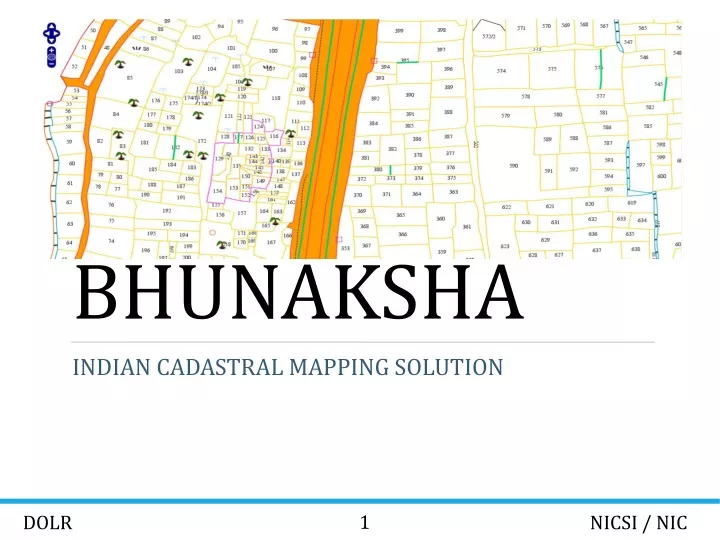
BHUNAKSHA INDIAN CADASTRAL MAPPING SOLUTION 1 DOLR NICSI / NIC
INTRODUCTION • Land plays a crucial role in our social and economic life, particularly in rural areas. • The scheme of computerization of land records was started in 1988-89 with the aim of removing inherent flaws in the existing land records system. Basic work converting the Record of Rights (ROR) into digital form is complete in majority of States with computerized ROR being distributed to citizens from Tehsil computer centre. • The scheme has been revamped and many new and related components have been included such as computerization of registration and its integration with Land Records, capacity building, survey, cadastral maps, modern record room. The new scheme is called National Land Records Modernization Programme (NLRMP) launched in 2008. • The integrated programme would modernize management of land records, minimize scope of land/property disputes, enhance transparency in the land records maintenance system. 2 DOLR NICSI / NIC
BHUNAKSHA • BHU-NAKSHA is a tool developed in-house by NIC using Open source JAVA library ‘GeoTools’ to facilitate management of Digitized Parcel maps. • BHU-NAKSHA is suitable for the states where Cadastral maps are in use. • With proper customization BHU-NAKSHA can be integrated with existing Land Records application of any such State. 3 DOLR NICSI / NIC
FEATURES • Developed using Free and Open source software. • Works in Windows and Linux • Centralized architecture. • Operable in browser and desktop client. • Plugin architecture to facilitate integration with any state ROR database. • A plot can be divided into multiple subdivisions in a single mutation • Multiple methods for creating division lines. • History and Audit trail of division is maintained in the software. • Distance measurement and calculation takes into consideration initial scale and local units 4 DOLR NICSI / NIC
FEATURES • Distance measurement and calculation takes into consideration initial scale and local unitsMap can be displayed and printed to any scale. • Vector printing of map reports. • SLD based styling of maps • Layers on Plot map can be displayed and printed • Query based thematic maps can be defined by user. • Bulk import of Shape files. • Maps can be generated from ETS data and FMB • Validation reports for comparing data in ROR database and digitized map files • Helps to correct geometry errors in Shape file. • Adapts to the authentication and authorization features of ROR database users. Process flow can be maintained as in ROR software 5 DOLR NICSI / NIC
BHUNAKSHA ARCHITECTURE 6 DOLR NICSI / NIC
VILLAGE MAP VIEW Village map view is the default view of Bhunaksha when invoked through web url by public, after logging in as user in web or desktop application. 7 DOLR NICSI / NIC
PLOT REPORT Plot Report is a printable report which will have map of an area containing the plot. It will have location and owner information along with the map. It is possible to generate the map to any scale and overlaying layers. 8 DOLR NICSI / NIC
VILLAGE MAP PRINTING Bhunaksha has a module for generating map of a village or sheet in printable form. The report can be generated in best fit scale or to a specified scale. It is possible to overlay plot number and other layers on the village map. The report can be generated for A4, A1 or A0 size paper and can be printed using plotter. 9 DOLR NICSI / NIC
SPLITTING PLOT A plot can be split into any number of subdivisions. Splitting is done by creating division line. There are a number of methods for creating division line. A background grid can be used to help in creating division line. The angle and length of the division line will be displayed on the fly. 10 DOLR NICSI / NIC
DISTANCE ANGLE METHOD This method can be used to create a division line by specifying distance and angle of each point on the line with respect to some known reference points. The line can either start and end on any border of the plot or it can be inside the plot. Distance has to be mentioned with respect to ground measurements. 11 DOLR NICSI / NIC
ARC METHOD (ADJACENT SIDE) This method can be used for creating division line at a corner of a plot. Two end points of the line can be identified by specifying distance from the corner point. This method will also allow us to specify a third point on the line as intersection of two arcs of specific radius from the end points. 12 DOLR NICSI / NIC
ARC METHOD (OPPOSITE SIDE) This method can be used for creating division line between two sides of a plot. Two end points of the line can be identified by specifying distance from two known points. This method will also allow us to specify a third point on the line as intersection of two arcs of specific radius from the end points. 13 DOLR NICSI / NIC
POINT MEASUREMENT METHOD This method can be used for creating complex division lines accurately. Each point of the division line can be identified by measuring it from two known points. This is a more complex version of the arc method where more than one points can be created by intersecting arcs. 14 DOLR NICSI / NIC
CREATING MAP FROM FMB/TIPPON DATA Maps can be created interactively from FMB (Field Measurement Book) data and tippon sketch. Once the map is created it will be similar to any other map in Bhunaksha. 15 DOLR NICSI / NIC
REAL TIME BASE LINE / OFFSET POINTS Base line and offset points will be drawn in the map area on real time while entering data in ladder table. It is also possible to create hanging baseline by specifying distance from 2 offset points 16 DOLR NICSI / NIC
SUBDIVISION AND LAYERS It is possible to interactively create subdivision and place any kind of layers in the map area. 17 DOLR NICSI / NIC
MERGING PLOT Bhunaksha has a module for merging one or more plots in a village. A user can merge upto 12 khasra’s through this module and assign a new khasra number to the newly created plot. 18 DOLR NICSI / NIC
GEOREFERENCING VILLAGE MAPS It is possible to georeference a village map with the help of village boundary layers from NIC Maps (http://nicmaps.rsgis.nic.in/) and other online services offered by Bing, Google, Bhuvan etc. Onscreen georeferencing is possible my correlating some known coordinates of digitized map with the coordinates of georeferenced maps. Identifying a minimum of four such points will facilitate transforming the coordinate system to world coordinate system. Accuracy will depend on the accuracy and number of the known coordinates. 19 DOLR NICSI / NIC
BHUNAKSHA MOBILE APP Bhunaksha mobile app is available for android mobiles. It supports viewing village map and plot details online, viewing plot report online, saving village map and plot report for offline operation, updating comments of any selected plot. Home Screen 20 DOLR NICSI / NIC
From home screen we can navigate to the available modules in the application. A swipeable context menu is also available for navigating to the modules from any screen. Menu can be opened by touching the context icon ( ). Settings Settings option can be opened from the context menu. It is possible to save server URL of bhunaksha in settings menu. When the server URL is setup correctly, you will be able to view maps from that server in the mobile application. If server is available then the Online Switch in the menu will be on. You can go offline any time by switching off it from the menu. 21 DOLR NICSI / NIC
Viewing Village Map Bhunaksha mobile application can display online village map when connection to server is available. Village can be selected from the select box on left context menu. In online mode it is possible to select a plot either by touching it on the map or by searching ( ) the plot on the top bar of the app screen. When the plot is selected it will popup the owner and area details of the plot. It is possible to view a detailed map report of the selected plot by touching report icon ( ) from the popup. It is also possible to update a comment ( ) about the plot and save it to the server. Village map data can be downloaded( ) for offline purpose from this screen. Village map data stored offline will use storage space of the mobile. 22 DOLR NICSI / NIC
23 DOLR NICSI / NIC
Offline village maps can be viewed from the saved village map list or when the Online Switch is off. In offline mode it is possible to select a plot, search a plot, view owner and area details, and save a comment about the selected plot. The comment can be updated to server on going online. 24 DOLR NICSI / NIC
Plot Report Detailed plot report can be viewed online by touching report icon ( ) from village map screen. It is possible save a report for offline purpose by touching download ( ) icon. 25 DOLR NICSI / NIC
Saved Village List List of villages for which offline maps are available can be viewed from the respective options in menu and home screen. Map of a village can be viewed by selecting the respective row from the list. Data of a saved village can be deleted by touching delete ( ) button . 26 DOLR NICSI / NIC
Saved Plot Report ListList of offline plot reports can be viewed by invoking the respective options in menu or home screen. Report can be viewed by selecting the respective row from the list. A saved report can be deleted by touching the delete( ) icon. It is also possible to view a report of a plot online from this screen if connection is available to bhunaksha server. 27 DOLR NICSI / NIC
Saved Comments List List of comments stored offline can be viewed by invoking the respective options in menu or home screen. It is possible to delete a comment and update the comments to server from this screen. 28 DOLR NICSI / NIC
PLOTS COMPARISON REPORTS Bhunaksha has reports for comparing plot numbers present in map and ROR (Textual) data. It is possible to generate report of plots present in map and missing in ROR, present in ROR and missing in map and duplicate plots in map.Plots Present in map missing in ROR 29 DOLR NICSI / NIC
PLOTS PRESENT IN ROR MISSING IN MAP 30 DOLR NICSI / NIC
DUPLICATE PLOT NUMBERS IN MAP 31 DOLR NICSI / NIC
MUTATION REPORT Bhunaksha has report for displaying all the divisions/Mutations done in a village. It is possible to generate report for all the mutations done in a village. Options for filtering report data is also there. User can filter the data according to UserName and date. User can also view the image of the actual plot and divided plot in the report. 32 DOLR NICSI / NIC
BULK IMPORT Bulk import option can be used for importing a set of files in a single go. For using this module login into Desktop application as user and invoke the option from File -> Bulk Import. 33 DOLR NICSI / NIC
EMBEDDING PLOT MAP IN ROR REPORT. It is possible to request map of a plot to any specified scale by providing parameters. The resulting map image output can be used to embed in ROR reports 34 DOLR NICSI / NIC
PLOT INFO Bhunaksha Plot info module can be used for viewing all the details of the plots in addition to the owner and area details vertices distance details is also available in this module. 35 DOLR NICSI / NIC
IMPORTED VILLAGES REPORT Bhunaksha has a report for displaying all the imported villages in the bhunaksha database. In the report all the details of imported sheet numbers and total no of plots in the village is displayed. 36 DOLR NICSI / NIC
UNIMPORTED VILLAGES REPORT In addition to Imported villages report Bhunaksha has a report for displaying all the unimported villages. In this report all the villages whose data is present in ROR but not in bhunaksha database are displayed. 37 DOLR NICSI / NIC
VALIDATE SHAPE FILE Shape files which are initial output of digitisation can be validated for required fields and correctness of geometry in Bhunaksha. Shape file validation checking module can be opened from menu File -> Validate Shape file in Desktop client. This module will check whether the set of shape files pertain to certain pre defined conditions so as to import in Bhunaksha. Result of validation will be displayed in a grid format which can be printed or exported as excel file. 38 DOLR NICSI / NIC
AUDIT TRAIL Audit trail is available as activity log in Bhunaksha. The activity log gets an entry when a user logs in, starts a division and put up for approval, when a higher user approves the division etc. The log report has listing of time, user who performed the operation and description of operation. 39 DOLR NICSI / NIC