Download
1 / 22
220 likes | 360 Views
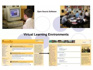
Mapping Pacific Resources using Open Source GeoSpatial Software. A Pacific Solution for Geospatial Data Sharing?. Sachindra Singh Systems Developer Data Management Section SOPAC/SPC. 28th November, 2012 Pacific GIS/RS Conference. Just Pretty Pictures?. 3D Digital Terrain Model of Ba, Fiji

E N D
Mapping Pacific Resources using Open Source GeoSpatial Software A Pacific Solution for Geospatial Data Sharing? Sachindra Singh Systems Developer Data Management Section SOPAC/SPC 28th November, 2012 Pacific GIS/RS Conference
Just Pretty Pictures? 3D Digital Terrain Model of Ba, Fiji Rendered from 3 million points LiDAR Survey
Or Analysed and Visualised Data? Core GIS Fields Cartography Statistical Analysis Data Technology This presentation only focuses on data technologies
Brief History of Internet andOpen Source Systems in SOPAC • 1994 – SOPAC adopted cc:Mail and SunOS – one of the first regional organization to have an electronic communication system in the Pacific region • 1994 – SOPAC was one of the founding members of PICISOC (Internet Society Charter for Pacific Islands) • 1996 - USP [The University of the South Pacific] and SOPAC were the first to connect to the Internet in the South Pacific. SOPAC also offered subsidized internet access to government organisations during this period. • 2000 – 2004 – SOPAC migrated fully to open source services such email systems, GNU/Linux file shares, BIND, etc. • 2002– SOPAC adopted open source tiki-wiki as a web presence and collaboration platform • 2006 – SOPAC adopted open source online library systems (Koha) and e-learning platforms (Moodle)
History (GeoSpatial Platforms) Mapserver 2005– SOPAC deployed and trained users in 14 Pacific Island Countries on UNM Mapserver as part of EU/EDF Pacific Islands Vulnerability project. Geonetwork 2007- Geonetwork deployed within SOPAC by Ocean and Islands programme . Singular GeoSpatial Data Repository 2010- SOPAC ICT unified and catalogued SOPAC's and member countries diverse spatial data collection under a standardised, secure and user-friendly system Geonode 2011– Adoption of Geonode Web Mapping Platform (primarily for World Bank/ADB Pacific Risk Exposure Database Project)
Spatial Data Infrastructure “[Spatial Data Infrastructure] provides a basis for spatial data discovery, evaluation, and application for users and providers within all levels of government, the commercial sector, the non-profit sector, academia and by citizens in general.” – SDI Cookbook A generic and inter-connected set of systems that enables easy management and publication of geospatial data.
SOPAC’s SDI Vision Unified Approach to Cataloguing, Archiving and Exposing Diverse GIS/Spatial Datasets Different projects, different data, different requirements, different access levels; One Platform – GeonodeSDI Zero IT Expertise required to expose, share and geospatial data.
Current and Future Implementations geonode.sopac.org paris.sopac.org
Workflow Entirely Open Source Stack; from Desktop to Processing to Server. Vector Conversion and Re-projection Batch Conversion Direct integration with Geonode Raster Conversion and Re-projection Eg: IMG
Lessons Learnt SDI enables us to quickly implement smart technical solutions to legitimateorganizational data sharing concerns
Federation (Long Term Vision) Multiple agencies in Pacific host their own SDI instances and manage own datasets. Instances are interconnected and are able to search and consume each others datasets transparently. Example: Correlation between car accidents, road fatalities/injuries, and rainfall. Example: Satellite Imagery hosted in SOPAC, overlayed with Forestry Coverage data in Govt.
Federation (Long Term Vision) Multiple agencies in Pacific host their own SDI instances and manage own datasets. Instances are interconnected and are able to search and consume each others datasets transparently. Example: Correlation between car accidents, road fatalities/injuries, and rainfall. Example: Satellite Imagery hosted in SOPAC, overlayed with Forestry Coverage data in Govt.
Barriers to entry What are common barriers to entry in the Pacific, and how do we lower these? • SetupComplexity • Software Support • How-to Guides and Help Resources • Pre-existing Investments (in Commercial GIS Software) • Incompatible ICT Policies • Bandwidth limitations in serving maps
Solutions? What can an organization like SPC/SOPAC do to promote and provide advocacy OSS for GIS in the region? • Provide customized, simple and easy to use GIS tools (Desktop and Server) • Provide a medium for support and problem solving • Provide online help and training modules • Develop customised modules and plugins to suit Pacific datasets • http://github.com/sopac (all tuned to requirements of Pacific GIS Units)
Countering Bandwidth Limitation Local Editions Data and System should be scalable enough to be hosted independently on removable media
sopac-gis-os GIS-oriented Linux (Operating System) Distribution based on Free and Open Source Components built and supported by SOPAC. http://ict.sopac.org/gisos
Open Source Community github.com/sopac datarequest@sopac.org