Download
1 / 10
100 likes | 243 Views
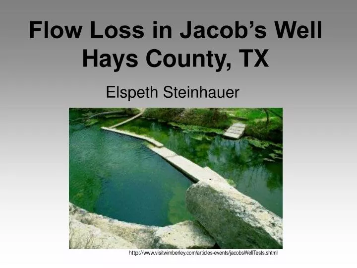
Flow Loss in Jacob’s Well Hays County, TX. Elspeth Steinhauer. http:// www.visitwimberley.com/articles-events/jacobsWellTests.shtml. Jacob’s Well. Located in Wimberley, TX Extends at least 2,900 ft Fractured limestone bedrock Stopped flowing July 2000 Not sure of recharge source.

E N D
Flow Loss in Jacob’s WellHays County, TX Elspeth Steinhauer http://www.visitwimberley.com/articles-events/jacobsWellTests.shtml
Jacob’s Well • Located in Wimberley, TX • Extends at least 2,900 ft • Fractured limestone bedrock • Stopped flowing July 2000 • Not sure of recharge source
Possible Reasons for drop in flow • Population increase from 65,614 in 1990 to 97,589 in 2000 (nearly 50% increase) • Drought (http://synergyx.tacc.utexas.edu/Spotlight/Texas_drought/drought_playa.html) July 5, 1999 January 13, 2000
Potentiometric Surface Maps 2000 1986 2006 1996
Implications • Population increase from 97,589 in 2000 to124,432 in 2005, Cypress Creek continues to flow • Flow from Cypress Creek appears to be linked to rainfall • Conservation important, but maybe not the key factor here
Future Research • Data from USGS gage of Jacob’s Well flow soon available • Explore possibility of other recharge sources (Blanco River?) • Use time series in ArcGIS to link rainfall data to discharge data spatially and temporally