Download
1 / 30
310 likes | 402 Views
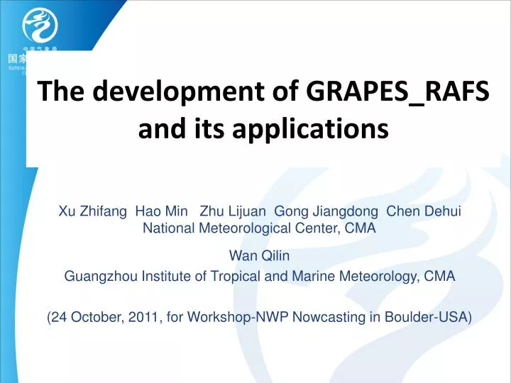
The development of GRAPES_RAFS and its applications. Xu Zhifang Hao Min Zhu Lijuan Gong Jiangdong Chen Dehui National Meteorological Center, CMA Wan Qilin Guangzhou Institute of Tropical and Marine Meteorology, CMA (24 October, 2011, for Workshop-NWP Nowcasting in Boulder-USA).

E N D
The development of GRAPES_RAFS and its applications Xu Zhifang Hao Min Zhu Lijuan Gong Jiangdong Chen Dehui National Meteorological Center, CMA Wan Qilin Guangzhou Institute of Tropical and Marine Meteorology, CMA (24 October, 2011, for Workshop-NWP Nowcasting in Boulder-USA)
Outline • 1 Introduction • 2 RAFS Based on GRAPES_Meso • 3 Results of some experiments • 4 Plans for future work
1 Introduction Sever thunderstorm in He-nan (河南) on June, 2009 The requirements are increasing in short-term forecasts of thesevere high impact weather which occurred more frequently in recent years in China. Mud-rock flow on August 07, 2010 in Zhou-qu (舟曲)
1 Introduction (cont.) • Many data sets from different obs. systems (AWS, aircraft, GPS, radars, satellites) have been frequently (hourly or shorter) are available in real time. (Meng Zhaolin, 2011)
Forecast GRAPES-Model GRAPES-3DVar GRAPES_ MODEL GRAPES_ 3DVAR Flow Chart of Grapes_RAFS Observation DATA background Assimilation Cycle Data processing Cloud Analysis Digital Filter initialization DFI nudging Firstguess
Data Assimilation Data can be used in GRAPES_3DVAR : • Radio sonde data (wind, temperature, humidity, pressure) • AWS data (pressure) • VAD winds (Doppler Radar) • GPS/PW • Ship reports (pressure) • Aircraft (wind, temperature) • FY-2C/2D cloud-drift winds • Cloud Analysis (Radar , Satellite data, surface observation et al.)
3.1 Design of the experiments • GRAPES_Meso: 15km L31 • GRAPES_3DVAR (model grid space) • 1-hourly cycle rapid analysis • 12 hour forecast at 03,06,09,15,18,21UTC • 24 hour forecast at 00,12UTC • Data used: GTS, local radiosonde, Doppler radar VAD, AWS, Aircraft
AIREP SYNOP Radiosonde VAD Horizontal distribution of one case
left:observation (radar reflectivity) right:model forecasting (Initial time:0300GMT 3 June, 2009) The position prediction of strong convective system is very close to the observation.
left:observation (radar composite reflectivity) right:model forecasting (Initial time:0600GMT 3 June, 2009) The moving direction of the system is close to observation
TS-Verification of 6h accumulated precipitation over whole Chinafor the period of June-August 2009 (TS score) (TS score) Initial Time: 0000GMT Initial Time:1200 GMT Inter-comparison between GRAPES_RAFS (RUC) with operational GRAPES_Meso (OPT): TS of RAFS is better than that of OPT for all thresholds: 0.5mm, 5mm, 10mm, above 15mm.
TS-Verification of 24h accumulated precipitation over whole Chinafor the period of June-August 2009 1mm 10mm 25mm 50mm (TS score) Inter-comparison between GRAPES_RAFS (RUC) with operational GRAPES_Meso (OPT): TS of RAFS is better than that of OPT for all thresholds: 1mm, 10mm, 25mm, above 50mm.
1North-Eastern 2 Xinjiang 3 East of West-Northern 4 North of China 5 Tibetan Plateau 6 East of West-Southern R. 7 M. & D. basins of Yangtz River 8 South of China (Wang Yu ,2007) Sub-domains for verifications
Bias Threat Score 1 2 3 4 5 6 7 8 1 2 3 4 5 6 7 8 Threat Score Bias 1 2 3 4 5 6 7 8 1 2 3 4 5 6 7 8 TS-Verification of 6h accumulated precipitation forecasts over whole China for the period of June-August 2011: RAFS vs OPT.
Pressure Old vertical correlation: too big from bottom to top V. Potential S. function Humidity
new vertical correlation: reduced significantly Pressure S. function Humidity V. potential
TS-Verification of 6h accumulated precipitation over whole China Period: 072009 I. Time: 06Z Period: 072009 I. Time: 18Z 0.1 10 25 50 100 (mm) 0.1 10 25 50 100 (mm) Period: 082009 I. Time: 06Z Period: 082009 I. Time: 18Z 0.1 10 25 50 100 (mm) 0.1 10 25 50 100 (mm) Red: with old background covariance ; Grey: with new background covariance
TS-Verification of 24h accumulated precipitation over whole China for August (left), July (right) 2009 0.1 10 25 50 100 (mm) 0.1 10 25 50 100 (mm) Red: with old background covariance ; Grey: with new back-ground covariance
Configurations • GRAPES_Meso 3.0 • 15km L31 with m-top at 10 hPa • Radiation: no-change • Cumulus: Betts-Miller-Janjic • Microphy.: WSM-6 (soon by 2-momment (Liu, 2010)) • Cloud: no-change • Land surface: NOAH • PBL: no-change • q-adv.: PRM(Xiao, 2002) • GRAPES_Meso 2.5 • 15km L31 with m-top at 10 hPa • Radiation: RRTM LW & Dudhia SW • Cumulus: SAS • Microphy.: WSM-6 • Cloud: Xu & Randall diagnostic cloud • Land surface: SLAB • PBL: MRF PBL • q-adv.: QMSL
TS-Verification of 6h accumulated precipitation over whole China Period: 072009 I. Time: 06Z Period: 072009 I. Time: 18Z 0.1 10 25 50 100 (mm) 0.1 10 25 50 100 (mm) Period: 082009 I. Time: 06Z Period: 082009 I. Time: 18Z 0.1 10 25 50 100 (mm) 0.1 10 25 50 100 (mm) Grey: with GRAPES_V2.5; Pink: with GRAPES_V3.0
TS-Verification of 24h accumulated precipitation over whole China for July (left), August (right) 2009 0.1 10 25 50 100 (mm) 0.1 10 25 50 100 (mm) Grey: with GRAPES_V2.5; Pink: with GRAPES _V3.0
4 Plans for future work • To Improve QC scheme and assimilation approach of local intensified observation. • To make better use of satellite data. • To perform the cloud analysis. • To improve boundary layer and cloud microphysical process in GRAPES model. • To add 1DVAR assimilation of precipitations