Download
1 / 34
340 likes | 465 Views
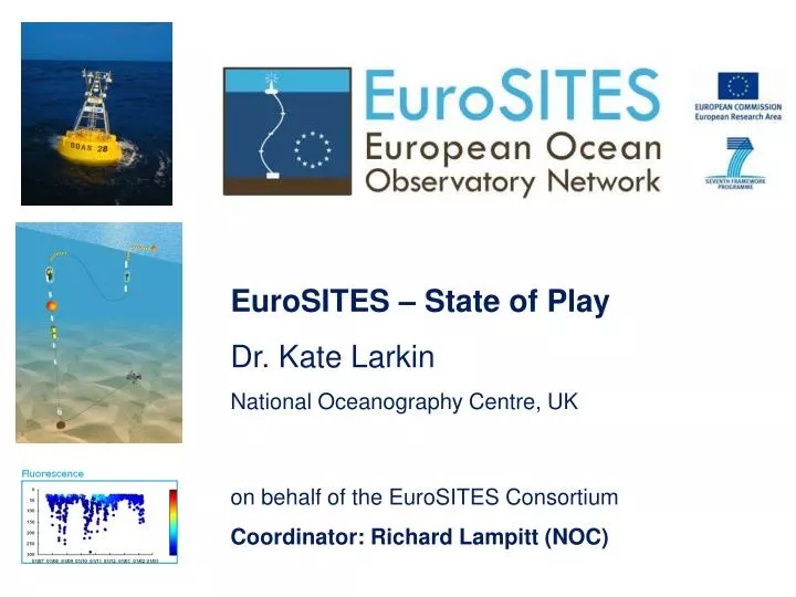
EuroSITES – State of Play Dr. Kate Larkin National Oceanography Centre, UK on behalf of the EuroSITES Consortium Coordinator: Richard Lampitt (NOC). FP7 Collaborative Project (Small-Medium): 3.5 Million Euros 3 years: 1 April 2008 - 31 March 2011

E N D
EuroSITES – State of Play Dr. Kate Larkin National Oceanography Centre, UK on behalf of the EuroSITES Consortium Coordinator: Richard Lampitt (NOC)
FP7 Collaborative Project (Small-Medium): 3.5 Million Euros 3 years: 1 April 2008 - 31 March 2011 EuroSITES is integrating and enhancing Europe’s existingfixed-point open ocean observation capability
EuroSITES is integrated in GOOS as the European component of the international OceanSITES network of deep water reference stations.
The EuroSITES open ocean observatory network: A platform for multidisciplinary time-series • Atmospheric • Temperature • Salinity • Currents • Nutrients • Chl-a • CO2 • O2 • Particle flux • Benthic components • (biology, geohazards) • *Real-Time Telemetry
The EuroSITES open ocean observatory network: A platform for multidisciplinary science • Atmosphere-ocean (physics) • Carbon cycle (biogeochemistry, fluxes) • Marine ecosystems (biodiversity, functioning, impacts) • Geohazard early warning • Observations for ocean/climate models • Habitats, budgets, fluxes
The EuroSITES open ocean observatory network: Open Access to in situ ocean data in near real-time • Raw data in near real-time at www.eurosites.info • Daily delivery to MyOcean and GTS (physical data) • Common data policy • Common format • QC data on OceanSITES ftp (CORIOLIS GDAC) • Archived data in National Data Centre’s available through SeaDataNet • Links with ESONET data portal
NB. Other biogeochemical variables supported and trialled within the EuroSITES Project include pH, particle flux, mesozooplankton abundance and O₂ consumption
In situ atmospheric data e.g. PAP (NOC, UK) PAP UK Met Office ODAS buoy at PAP-SO since June 2010 Near real-time data: www.eurosites.info Daily delivery to GTS
In situ ocean data e.g. CIS, Central Irminger Sea (IFM-GEOMAR) Daily delivery of physical data to MyOcean and GTS Raw data in near real-time at www.eurosites.info Quality Controlled data available from OceanSITES ftp ftp://ftp.ifremer.fr/ifremer/oceansites/
In situ integrated ocean and seafloor data e.g. Poseidon-Pylos (HCMR) Time series of high resolution (15 sec) pressure data from the seabed platform. Poseidon-II project (Greek National funding) -Water column components since 2007. -EuroSITES has funded an autonomous deep sea platform (2000m depth) for tsunami detection installed in October-November 2008 in the Souteast Ionian Sea -The EuroSITES time-series is now a candidate OceanSITES time-series
EuroSITES is the “up-stream” in situ ocean data provider to a range of European Data Management and Modelling Initiatives
EuroSITES is an observation network already providing integrated, in situ datasets in near real-time to GMES (marine core service). EuroSITES/ OceanSITES
EuroSITES data contribute to MyOcean services and products: e.g. Daily delivery of OceanSITES physical datasets to MyOcean and upload to GTS http://catalogue.myocean.eu.org/
EuroSITES delayed mode data for services and products:e.g. Marine Resources. Cape Verde physical variables Slide from Pierre Bahurel
EuroSITES is a key data provider for GMES through MCS (MyOcean) and the network is a key stakeholder in the GISC project (led by EEA) June 2010: EuroSITES presented a position paper of contribution to GMES and current Capability. Jan 31 2011: EuroSITES contributed to the first GISC Stakeholder Consultation (now closed) Ongoing/future: Contribution to prioritisation of in-situ ocean observation towards an integrated ocean observing system?
EuroSITES is a named data contributor (underlying infrastructure) for EMODNET pilot portals e.g. Physical portal. EuroSITES Data (delayed mode) EuroSITES Data (near real-time) EuroSITES data management coordinators NOC are a partner (through BODC, UK)
Links and common regions with other FP7 initiatives • EuroSITES has existing ocean observing infrastructure in many climate sensitive regions common to e.g. ESONET, EMSOand HERMIONE-Collaborations include joint science demonstration missions, sharing of expertise and data management, joint outreach/dissemination activities, joint meetings and planning for future integrated programmes • - Identify gaps: Spatial, vertical or temporal and link with international e.g. initiatives e.g. NSF Ocean Observatories Initiative (OOI), NEPTUNE etc Moorings
Relevance to coastal and shelf sea initiatives e.g. JERICO, EMECO, MARS-MarBEF EuroSITES open ocean data can be used as ‘early warning’ to assess longer-term oceanic trends and provide rare multi- -disciplinary in situ ocean data as openocean reference points EuroSITES PAP EuroSITES locations mapped with European EEZ’s http://westernshelfobservatory.org/about
Relevance to Society and Maritime Policy
EuroSITES: Platforms for monitoring ‘good environmental status of our seas’ updated list of GCOS and the UNFCCC list of Atmospheric and Oceanic ECV’s EuroSITES observatories already produce datasets for many ECVs (in red) EuroSITES also monitors additional variables e.g. oxygen, particle flux and are trialling e.g. irradiance, pH
EuroSITES: Towards an operational network Contributing to maritime policy EuroSITES in situ atmospheric and ocean datasets can contribute to European maritime policy through the Marine Strategy Framework Directive (MSFD) and OSPAR EuroSITES ECVs and other variables can be used as key in situ datasets for the MSFD targets and 11 ‘descriptors’ e.g. Biodiversity, fisheries, eutrophication (open ocean = productivity; chl-a, nutrients), seafloor integrity, contaminants, marine litter, underwater noise, marine food webs EuroSITES results already inform National policy in Europe: e.g. UK EuroSITES PAP time-series results contributed to the Charting Progress II report
Towards an integrated ocean observing system EuroSITES time-series are essential reference stations e.g. calibration for Argo floats in the Irminger Basin, North Atlantic, using EuroSITES CIS mooring as a reference station http://www.euro-argo.eu/
Innovation Moorings
EuroSITES has funded R&D to enhance the capability for biogeochemical and Ecosystem variables on fixed-point moorings e.g. oxygen consumption, pH and mesozooplankton McLane ZPS At PAP and DYFAMED Partner: NOC O2 consumption: IODA6000 At DYFAMED, ANTARES and PAP. Partner: CNRS (LMGEM) pH spectrophotometer At ESTOC Partner: ULPGC Moorings
Future enhancements to sensors/samplers can be driven by both science and policy • As testbed platforms for scientific advancement • As operational platforms for monitoring e.g. Hydrocarbon detection and Chemical speciation using Mass Spectrometry • e.g. Aerosols • Aerosol Fe • other trace elements e.g. Molecular/Genetic Environmental Sample Processor (MBARI) Applications: Ecology and biogeochemistry of the oceans, biodiversity and molecular / genetic information for species detection e.g. HABs, pollution/oil spills
Future integration from the atmosphere to seafloor • seafloor platforms • acoustic telemetry • Integrating with other platforms e.g. gliders, as ‘virtual moorings’ • Linking existing infrastructure with cables (where appropriate) BOBO lander and conceptual design of MODOO ESONET demo mission (PAP) conceptual design of cabled ocean observatory (ESONET, EMSO) Moorings
EuroSITES is a mature, existing infrastructure contributing to ESFRII through EMSO. Future: develop and enhance EuroSITES, moving towards a European Multidisciplinary Sea Observatory Network integrating the science objectives, infrastructure and technology of e.g. EuroSITES, ESONET Also key infrastructures for marine component of ICOS (RICCO)
In Summary • EuroSITES is a marine research infrastructure already delivering key in situ atmsopheric and ocean data and linking science with user needs….. • -Essential Climate Variables (atmospheric and ocean ECVs) • -Open access in near real-time to in situ multidisciplinarydatasets • -Key data contributor/stakeholder for: • GOOS through OceanSITES • GMES-GISC through MCS - MyOcean • EMDONET – data are used in pilot portals e.g. physical data • SeaDataNet – data are archived through National Data Centres • -Policy: Key observations for scientific knowledge,contributing to National maritime policy, MSFD for the sustainable management of ocean resources • -Modelling applications: Through MyOcean/Mercator-Ocean, projects e.g. SESAME and MEECE and National Initiatives(validation, reanalysis) • Contributions to GEO through GOOS task, SBAs climate, ecosystems etc • Reference for other platforms: EuroSITESfixed-point data are used as a • reference for other platforms e.g. ARGO
In the future, EuroSITES can build on existing • Infrastructure and expertise to increase scientific and economic impact of ocean observations by developing even stronger links with users, policy and industry • -Socio-economics: Increaselinks with socio-economic users and policy • building on existing expertise e.g. HERMIONE • Innovation: Build on the EuroSITES R&D for emerging sensor technology • (linking with SME’s, public-private partnerships and international initiatives • e.g. OOI, NEPTUNE) • Datasets: Expand datasets, availability and users: • - New ocean variables in near real-time, greater depth and time resolution • - Establish better metadata for all datasets • wider use in modelling activities – towards ‘forecasting applications’ • Continue to develop EuroSITES contribution to data management initiatives • e.g. SeaDataNet, EMODNET, GEO Data Core
ERIC Time-line for some leading FP7 European ocean observation initiatives and future plans
An Integrated Ocean Observing System: A key European Priority • OceanObs’09: • ‘The need for a global ocean information system for society’ • 2nd ESF Marine Board meeting, Brussels (September 2010) • -Towards a European Network of Marine Observatories for Monitoring and Research. • EurOCEAN 2010 (12-13 October), Ostend • European Ocean Observing System, a key priority in the Ostend declaration • GEO ‘Observe, Share and Inform’ • Long-term continuity is a major challenge. • EuroSITES and other platforms now need to establish a mechanism for sustained support from both National and European funding to secure these observations/datasets for the long-term.. • The cost may be high, but is it higher than the cost of losing these valuable observation datasets?
Coordinator: Richard Lampitt (rsl@noc.soton.ac.uk) Project manager: Kate Larkin (kel1@noc.soton.ac.uk) Data coordinator: Maureen Pagnani (mred@noc.soton.ac.uk) Diagram produced by EuroSITES, HERMIONE, ESONET, EMSO projects for a joint exhibition at the GEO Ministerial Summit, Beijing, November 2010