Download
1 / 9

E N D
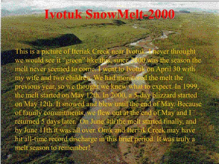
Ivotuk SnowMelt-2000 This is a picture of Iteriak Creek near Ivotuk. I never throught we would see it “green” like this, since 2000 was the season the melt never seemed to come. I went to Ivotuk on April 30 with my wife and two children. We had monitored the melt the previous year, so we thought we knew what to expect. In 1999, the melt started on May 12th. In 2000, a 5-day blizzard started on May 12th. It snowed and blew until the end of May. Because of family commitments, we flew out at the end of May and I returned 5 days later. On June 4th the melt started finally, and by June 11th it was all over. Otuk and Iteriak Creek may have hit all-time record discharge in this brief period. It was truly a melt season to remember!
Ivotuk, AlaskaSnowMelt 2000 Snow melt at Ivotuk was monitored in several ways: 1. Snow depths at stakes between the outhouse to Otuk Creek were read frequently. 2. Snow depth was probed using a Magnaprobe (Patent 5 ) along three traverse lines ranging from 1.5 to 7 km in length (Outhouse-Otuk, Outhouse-Iteriak, and SE Lake). Position on the line was determined using differential GPS. 3. A 1 by 1 km grid (CALM grid) was probed for end of winter snow depth in thousands of locations. 4. In-situ snow temperatures were measured hourly near the Ivotuk cabin, and local weather recorded. 5. SWE was measured using a Federal sampler and a regression of SWE vs. depth establihed. 6. Daily snow pits were measured and location of the water in the snow etc. determined. 7. The people who did the work were Matthew Sturm, Betsy Sturm, Eli Sturm, Skye Sturm, and Jerry Johnson. Thanks also to all our fine pilots and Mike Kunz.
Scenes from Ivotuk, April-June 2000
View of Study Area from nearby Otuk PeakJune 5, 2000 Otuk Creek
View of Study Area from nearby Otuk PeakJune 8, 2000 Otuk Creek
The Sturms,Cold Regions Research and Engineering Laboratory,US Army Funding for this research was provided by the National Science Foundation Arctic Systems Science Program (Grant Nos. OPP-9732077 and OPP-9818066)