Download
1 / 24
240 likes | 368 Views
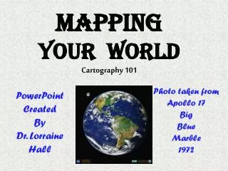
Mapping Your World. North Olympic Peninsula Skills Center Natural Resources. Mapping Your World Unit Overview.

E N D
Mapping Your World North Olympic Peninsula Skills Center Natural Resources
Mapping Your World Unit Overview Maps help us understand the world around us. Maps and mapping are also a key component of any career related to natural resources. In this unit we will learn from and create a variety of maps, starting simple and moving to complex. We will work in the field with orienteering tools such as maps, compasses, and GPS units. We will also learn about Geographic Information Systems (GIS) and create our own GIS-type maps.
Mapping Your World Goals + Objectives • Show understanding of cartography (maps and mapping) • Identify the parts of a map. • Recognize and give best-use examples of the standard map scales and projections. • Explain the difference between precision and accuracy. • Compare and contrast different coordinate systems. • Demonstrate cartographic and orienteering skills • Locate Natural Resources objects using map, compass, and GPS. • Complete an orienteering course. • Employ geographic information systems technology • Define GPS, GIS and other cartographic terms. • Employ GPS to inventory Natural Resources features. • Design and construct a basic GIS to display on the class website.
What is a Map? • A map is a visual representation of the ‘real-world’ • A map can be used for orientation and navigation • A map gives us information about the ‘real-world’
What have you used a Map for? • To find a place (or thing) you were looking for?
What have you used a Map for? • To find a place (or thing) you were looking for? • To show someone the location of something?
What have you used a Map for? • To find a place (or thing) you were looking for? • To show someone the location of something? • To reflect on field days in Natural Resources Class?
What have you used a Map for? • To find a place (or thing) you were looking for? • To show someone the location of something? • To reflect on field days in Natural Resources Class? • What else have you used a map for?
What types of Maps are you familiar with? • Road Maps?
What types of Maps are you familiar with? • Road Maps? • Political Maps?
What types of Maps are you familiar with? • Road Maps? • Political Maps? • Historical Maps?
What types of Maps are you familiar with? • Road Maps? • Political Maps? • Historical Maps? • Weather Maps?
What types of Maps are you familiar with? • Road Maps? • Political Maps? • Historical Maps? • Weather Maps? • Physical Maps?
What types of Maps are you familiar with? • Road Maps? • Political Maps? • Historical Maps? • Weather Maps? • Physical Maps? • Topographic Maps?
What types of Maps are you familiar with? • Road Maps? • Political Maps? • Historical Maps? • Weather Maps? • Physical Maps? • Topographic Maps? • What other types of Maps?
Road Maps • Road maps show where roads, highways, routes, etc. are. The more a user zooms in on a map the more detailed the map is as to local roads, routes, etc.. • The United States Interstate Highways(http://www.mcwdn.org/MAPS%26GLOBES/RoadMaps.html)
Political Maps • Political maps show where the boundaries and locations of countries, states, cities, towns and counties are. These boundaries and locations are generally determined by people rather than nature. • The United States(http://www.mcwdn.org/MAPS%26GLOBES/PoliticalMaps.html)
Historical Maps • Historical maps are maps from the past that are valuable for learning how events unfolded many years ago relative to a place's geography. They allow us to compare the changes in an area over time. • The United States in 1783(http://www.mcwdn.org/MAPS%26GLOBES/HistoricalMaps.html)
Weather Maps • Weather maps are maps that show predictions of coming weather or report on weather that is actually happening. Weather is how hot or cold or how wet or dry it is in a location over a short period of time. • United States Weather, 8/9/98(http://www.mcwdn.org/MAPS%26GLOBES/WeatherMaps.html)
Physical Maps • Physical/Elevation/Topographic/Relief Maps show how high or low places are, generally in relation to sea level. They are of value not only for this, but also to help determine the climate of an area. • United States Relief Map(http://www.mcwdn.org/MAPS%26GLOBES/PhysicalMaps.html)
Topographic Maps • Topographic maps use contour lines to portray the shape and elevation of the land. Topographic maps render the three-dimensional ups and downs of the terrain on a two-dimensional surface. (http://egsc.usgs.gov/isb/pubs/booklets/topo/topo.html#Map) • Rialto Beach Area Topographic Map (www.kaleberg.com/portangeles/rialto/topo-big.jpg)
Mapping Our World Throughout this unit, we will be spending time with these types of maps and many more. Happy Mapping!!!